Derbyshire WalksWalking Routes & Hiking Trails
Find Derbyshire walks from the list below which features the best walking routes in the area. Most of routes are circular walks although there are a few linear hikes. The walks are listed from the shortest and easiest to the longest more challenging routes. The walks are divided into sub areas so you can find specific walks.
Much of the walking in Derbyshire is contained within the boundaries of the Peak District National Park. Both the White Peak and limestone dales and the moors and gritstone edges of the Dark Peak are available within this county. Elsewhere there are many interesting walks featuring countryside, historic houses and industrial heritage. All walks are free to download and print. All routes have GPS files.
White Peak - Manifold Valley & Dovedale Walks
Peak District National Park
Walking highlights - Dramatic Dovedale and its sister dales are typical of the White Peak with limestone outcrops a character of the landscape. The Manifold Valley, lying to the west of Dovedale, also has much to offer walkers including Thor's Cave perched high on the valley side. Between the Dove and Manifold valleys lies high ground, including Ecton Hill and the villages of Alstonefield and Wetton which provide a good base for Peak District walks in this area.
Where to stay - Hartington, Alstonefield, Wetton, Grindon and Ashbourne are all convenient for this area.
| Walk | Description | Grade | Miles |
|---|---|---|---|
| 1021★ | Milldale & Hall Dale | easy/mod | 5.00 |
| 1594★ | Biggin, Wolfscote & Beresford Dales from Hartington | easy | 5.50 |
| 2682★ | River Dove & Reynard's Lane from Hartington | easy/mod | 5.60 |
| 1593★ | Beresford, Wolfscote & Biggin Dales from Hartington | easy/mod | 6.20 |
| 1595★ | Dove Valley & Biggin Dale from Hartington | easy/mod | 6.80 |
| 2079★ | Beresford & Wolfescote Dales from Hartington | easy/mod | 7.20 |
| 1195★ | High-level Dovedale | moderate | 9.50 |
White Peak - Upper Dove Valley & Chrome Hill Walks
Peak District National Park
Walking highlights - Chrome Hill and Parkhouse Hill (the Dragon's Back) are the main attractions in this area. As you head up towards the source of the River Dove the scenery gets wilder and more dramatic.
Where to stay - Hartington and Longnor are convenient for this area.
| Walk | Description | Grade | Miles |
|---|---|---|---|
| 1861★ | Chrome and Parkhouse Hills from Earl Sterndale | easy/mod | 5.00 |
| 1042★ | Pilsbury Castle | easy/mod | 5.50 |
| 3709★ | Sparklow, Crowdicote & Pilsbury Circular | easy/mod | 9.00 |
White Peak - High Peak & Lathkill Dale Walks
Peak District National Park
Walking highlights - Lathkill Dale is popular with walkers. Its varied scenery adds to its appeal. Elsewhere in the High Peak you can explore the remains of the once flourishing lead mining industry, marvel at the dry-stone walls that stretch for miles or enjoy an easy walk along a disused railway.
Where to stay - Hartington, Monyash, Youlgreave and Bakewell are convenient for this area.
| Walk | Description | Grade | Miles |
|---|---|---|---|
| 3046★ | Lathkill Dale & Monyash | easy | 4.00 |
| 1369★ | Tissington Trail - Hartington to Parsley Hey | easy | 4.00 |
| 1410★ | Minninglow Hill, Roystone Grange and Cardlemere Lane from Gotham | easy/mod | 5.50 |
| 1945★ | Lathkill Dale & Over Haddon circular | easy/mod | 5.70 |
| 1892★ | Minninglow & Roystone Rocks | easy/mod | 5.80 |
| 1206★ | Chelmorton & Flagg from Taddington | easy/mod | 6.00 |
| 1589★ | Lathkill & Bradford Dales (short version) | easy/mod | 6.00 |
| 1827★ | Ashford-in-the Water,Magpie Mine & Over Haddon | easy/mod | 7.10 |
| 1590★ | Monyash & Lathkill Dale | easy/mod | 8.20 |
| 1569★ | Lathkill Dale & Bradford Dale | easy/mod | 8.20 |
| 2301★ | Biggin & Parsley Hay from Hartington | easy/mod | 9.50 |
| 1146★ | Bradford & Lathkill Dales | moderate | 11.25 |
White Peak - Stanton Moor & Winster Walks
Peak District National Park
Walking highlights - Stanton Moor with its Nine Ladies stone circle offers great views and many interesting things to explore. The villages of Birchover and Winster are worth exploring too.
Where to stay - Bakewell, Winster, Stanton and Matlock are convenient for this area.
| Walk | Description | Grade | Miles |
|---|---|---|---|
| 2136★ | Wensley & Brightgate | easy/mod | 6.20 |
| 3196★ | Stanton Moor and Robin Hood's Stride from Winster | easy/mod | 7.00 |
| 2559★ | Stanton Moor & The Nine Ladies Stones from Winster | moderate | 9.00 |
| 2503★ | Robin Hood's Stride & Stanton Moor | moderate | 11.00 |
White Peak - Miller's Dale, Bakewell & Monsal Trail Walks
Peak District National Park
Walking highlights - The Monsal Trail follows an old railway and takes you from Bakewell through a number of scenic dales including Miller's Dale. Monsal Head is a great place to visit to savour the view into the dale far below.
Where to stay - Bakewell, Tideswell, Taddington and Ashford in the Water are convenient for this area.
| Walk | Description | Grade | Miles |
|---|---|---|---|
| 3018★ | Cracknowl and the Monsal Trail | easy | 3.50 |
| 1650★ | Miller's Dale & Cressbrook Dale from Tideswell Dale | easy/mod | 5.50 |
| 1896★ | Horseshoe Dale & Deep Dale from Wye Dale | easy/mod | 6.40 |
| 3341★ | Brushfield, Miller's Dale & Monsal Head from Lees Bottom | easy/mod | 6.50 |
| 2573★ | Tideswell, Miller's & Cressbrook Dales from Litton | easy | 7.00 |
| 1859★ | Chee Dale & Monk's Dale from Miller's Dale | moderate | 7.30 |
| 1043★ | Chelmorton & the Monsal Trail | easy/mod | 8.10 |
| 1651★ | Monsal Trail & Ashford-in-the-Water from Lees Bottom | easy/mod | 8.75 |
| 2627★ | Cromford to Bakewell | moderate | 11.50 |
| 2798★ | Bakewell to Edale | mod/hard | 18.00 |
Dark Peak South - Edale & Kinder Scout Walks
Peak District National Park
Walking highlights - the Kinder Scout Plateau, especially the edges which circle this moor, including Ringing Roger, Grindsbrook, Ashop Head, Fairbrook Naze and Kinder Downfall. In addition the western fringes of this area including South Head.
Where to stay - Edale, Castleton and Hayfield are convenient for this area.
| Walk | Description | Grade | Miles |
|---|---|---|---|
| 1852★ | Eldon Hill from Peak Forest | easy/mod | 5.00 |
| 1113★ | Ringing Roger & Grindslow Knoll | moderate | 5.50 |
| 1923★ | Cown Edge & Whiteley Nab from Chunal | easy/mod | 6.50 |
| 1489★ | Blackden Brook, Kinder & Upper Ashop | moderate | 6.75 |
| 2637★ | Coombs Ridge, Cown Edge from Broadbottom | easy/mod | 7.00 |
| 1686★ | Cown Edge | easy/mod | 7.30 |
| 1159★☩ | Grindsbrook & Edale Head | moderate | 7.50 |
| 2635★ | The edges of Combs Moss near Chapel-en-le-Frith | easy/mod | 7.50 |
| 2534★ | Chinley Churn & South Head | easy/mod | 7.50 |
| 1174★ | Kinder Low & Mount Famine | moderate | 7.50 |
| 2546★☩ | Lantern Pike & Cown Edge from Rowarth | easy/mod | 8.00 |
| 2507★☩ | South Head & Edale Cross from Hayfield | moderate | 8.00 |
| 2514★☩ | Fair Brook & Kinder Downfall | moderate | 8.00 |
| 1182★☩ | Kinder Downfall | moderate | 8.00 |
| 1300★☩ | Hope Cross & Ringing Roger | moderate | 8.00 |
| 3350★☩ | Kinder Scout Summit | moderate | 8.50 |
| 1227★☩ | Fair Brook & Kinder Northern Edges | moderate | 8.50 |
| 3407★☩ | Chinley to Edale without a car | moderate | 9.25 |
| 3238★☩ | Fairbrook Naze & Ashop Head from Birchen Clough | moderate | 9.30 |
| 1264★☩ | Rushup Edge & Crowden Tower | moderate | 10.00 |
| 1295★☩ | Ringing Roger & Edale Cross | moderate | 10.00 |
| 2622★☩ | Sett Valley & Kinder from New Mills | moderate | 10.00 |
| 2378★☩ | Rushup Edge & Mam Tor | moderate | 10.00 |
| 3298★☩ | Oyster Clough & Blackden Edge from Birchen Clough | moderate | 11.40 |
| 2599★☩ | Kinder Scout and Castleton Ridge from Hope | mod/hard | 13.50 |
| 2615★☩ | The Kinder Edges | mod/hard | 18.00 |
Dark Peak South - Castleton Great Ridge & Mam Tor Walks
Peak District National Park
Walking highlights - the Great Ridge at Castleton linking Mam Tor with Lose Hill is one the great walks of the Peak District. Other attractions include Winnats Pass, Peveril Castle and Rushup Edge. An excellent for Peak District walks and very popular in good weather.
Where to stay - Castleton, Hope, and Edale are convenient for this area.
| Walk | Description | Grade | Miles |
|---|---|---|---|
| 1831★ | Mam Tor & Hollins Cross from Mam Nick | easy | 3.00 |
| 1519★ | Catleton & Speedwell Cavern Circular | easy | 4.25 |
| 1521★ | Cave Dale and Winnats Pass | easy | 4.50 |
| 3426★ | Lose Hill & Hollins Cross | easy/mod | 5.00 |
| 1665★ | Hollins Cross & Lose Hill | easy/mod | 6.00 |
| 1087★☩ | Mam Tor & Cave Dale | moderate | 6.50 |
| 1706★☩ | Win Hill from Hope | easy/mod | 6.50 |
| 2522★ | Rushup Edge & Edale from Mam Nick | moderate | 7.00 |
| 1368★☩ | Mam Tor, Upper Booth & Rushup Edge | moderate | 7.00 |
| 2591★ | Crook Hill & Ladybower Reservoir | easy/mod | 7.50 |
| 2588★☩ | Win Hill & Hope Cross | moderate | 7.50 |
| 2595★☩ | Castleton Great Ridge from Edale | moderate | 8.50 |
| 1286★☩ | Castleton Great Ridge & Mam Tor | moderate | 8.50 |
| 1688★☩ | Old Dam & Sparrowpit from Mam Nick | moderate | 9.00 |
Dark Peak South - Longendale & Bleaklow Walks
Peak District National Park
Walking highlights - Bleaklow is wild and can be challenging but it does have its rewards. Grains-in-the-Water provides solitude and stunning moorland landscapes. Circular walks using sections of the Pennine Way are also a feature of this area.
Where to stay - Glossop and Crowden are convenient for this area.
| Walk | Description | Grade | Miles |
|---|---|---|---|
| 2625★ | Torside Clough from Longdendale | moderate | 4.50 |
| 3607★ | Reservoirs Walk from Tintwistle | easy/mod | 5.50 |
| 1759★ | Torside Clough & Longendale from Old Glossop | moderate | 7.40 |
| 3027★ | Bleaklow Head from Longdendale | moderate | 8.00 |
| 1213★ | Alport Castles | moderate | 8.50 |
| 2982★ | Bleaklow & Higher Shelf Stones from the Snake Pass | mod/hard | 9.50 |
| 1168★☩ | Old Glossop & Bleaklow | moderate | 9.50 |
| 1756★ | Bleaklow & The Longendale Trail from Woodhead | mod/hard | 10.00 |
| 1486★ | Harry Hut, Mill Hill & Doctor's Gate from Glossop | moderate | 11.30 |
| 2375★☩ | The Longendale Edges | mod/hard | 11.80 |
| 3049★ | Bleaklow Stones from Derwent Valley | mod/hard | 12.00 |
| 1116★ | Grains in the Water & Alport Castles | mod/hard | 12.00 |
Dark Peak North - Black Hill & Dovestone Reservoir Walks
Peak District National Park
Walking highlights - circular walks based on the Pennine Way, the wild moorland around Black Hill, Laddow Rocks, the gritstone edges of Saddleworth Moor above Dovestone Reservoir and the wide open spaces of Wessenden Moor.
Where to stay - Holmfirth, Hadfield, Mossley and Marsden are convenient for this area.
| Walk | Description | Grade | Miles |
|---|---|---|---|
| 3174★ | Saltersbrook and Lady Cross from Woodhead | easy/mod | 6.00 |
| 1179★ | Lad's Leap & Laddow Rocks from Crowden | moderate | 6.50 |
| 2621★ | Black Hill & Laddow Rocks | moderate | 9.00 |
| 3022★ | Black Hill | moderate | 9.00 |
| 1703★ | Longdendale from Hadfield Station | easy/mod | 9.00 |
Eastern Moors - Sheffield area & Derwent Edge Walks
Peak District National Park
Walking highlights - Derwent Edge above the Derwent valley offers great walking with many interesting rock formations to discover, the many reservoirs on the western fringes of Sheffield and their surrounding countryside, and the wild moors that dominate this area.
Where to stay - Hathersage, Bamford, Grindleford and Sheffield are convenient for this area.
| Walk | Description | Grade | Miles |
|---|---|---|---|
| 1539★ | Flask Edge and Bar Brook Moor from Shillito Wood | moderate | 9.40 |
| 1479★ | Burbage Moor & Redmires from near Ringinglow | easy/mod | 9.75 |
| 1219★ | Back Tor & the Wheel Stones | moderate | 10.25 |
| 1098★ | Howden Edge & Derwent Valley | mod/hard | 14.00 |
Eastern Moors - Gritstone Edges, Higger Tor & Longshaw Estate Walks
Peak District National Park
Walking highlights - the gritstone edges offer level walking and superb views and include Stanage Edge, Burbage Rocks, and Froggatt Edge. The area around the Longshaw Estate including Higger Tor and Padley Gorge also offers some excellent Peak District walks.
Where to stay - Hathersage, Bamford, and Grindleford are convenient for this area.
| Walk | Description | Grade | Miles |
|---|---|---|---|
| 1169★ | Baslow Edge & Wellington's Monument | easy | 3.50 |
| 1093★ | Higger Tor & Burbage Rocks | easy/mod | 5.30 |
| 1090★ | Stanage Edge | moderate | 7.00 |
| 2515★ | The River Derwent, Curbar, Baslow & Froggatt Edges | easy/mod | 7.50 |
| 1240★ | Curbar, Froggatt & White Edges | easy/mod | 8.00 |
| 2548★ | Stanage Edge from Hathersage | moderate | 8.50 |
| 2520★ | Higger Tor & the Longshaw Estate | moderate | 9.00 |
| 3540★ | The Derwent Edge from Cutthroat Bridge | moderate | 10.00 |
| 1273★ | Burbage Rocks & Padley Gorge from Hay Wood | moderate | 11.00 |
Eastern Moors - Abney Moor & Chatsworth Walks
Peak District National Park
Walking highlights - Abney Moor offers some great walks and is less busy than adjacent areas. The extensive Chatsworth Estate also offers great walking with Chatsworth House and the estate villages providing plenty of interest along the route.
Where to stay - Hope, Bradwell, Grindleford and Eyam are convenient for this area.
| Walk | Description | Grade | Miles |
|---|---|---|---|
| 3620★ | Bretton Clough & Abney Moor | easy/mod | 6.00 |
| 3557★ | Chatsworth Park from Calton Lees | easy/mod | 6.50 |
| 1270★ | Abney Circular | easy/mod | 7.20 |
| 1986★ | Chatsworth Park from Rowsley | easy/mod | 7.30 |
| 1080★ | Shatton Moor and Offerton | easy/mod | 7.50 |
| 1100★☩ | Abney Moor & Bretton Clough | moderate | 8.50 |
| 1014★ | Coombs Dale, Longstone Edge & Pilsley from Calver | moderate | 10.00 |
Western Moors - Lyme Park, Shining Tor & Goyt Valley Walks
Peak District National Park
Walking highlights - Lyme Park with its historic house and grounds, Shining Tor (the highest point in Cheshire) and the ridge to Cats Tor, Pym Chair and Windgather Rocks, and the Goyt Valley with Errwood and Fernilee Reservoirs lying amidst glorious scenery.
Where to stay - Disley, Whaley Bridge, Bollington and Buxton are convenient for this area.
| Walk | Description | Grade | Miles |
|---|---|---|---|
| 3136★ | Shining Tor & Goyt's Clough | easy/mod | 5.10 |
| 2576★ | Fernilee Reservoir, Goyt Valley | easy | 6.00 |
| 3510★ | Shining Tor, Cats Tor & Foxlow Edge | easy/mod | 7.00 |
| 1092★ | Taxal Edge, Jenkin Chapel & Pym Chair | moderate | 8.50 |
South and East Derbyshire Walks
| Walk | Description | Grade | Miles |
|---|---|---|---|
| 1460★ | Hardwick Hall park | easy | 2.50 |
| 1378★ | Carsington Circular | easy | 4.50 |
| 2801★ | Duffield & the Chevin | easy | 4.75 |
| 3672★ | Carsington Water, Hognaston & Madge Hill | easy/mod | 5.50 |
| 1379★ | Carsington and Harboro Rocks | easy/mod | 5.75 |
| 2701★ | Harboro Rocks & Brassington | easy/mod | 6.50 |
| 2899★ | Cromford Canal & Black Rocks from High Peak Junction | easy/mod | 6.75 |
| 2619★ | Belper to Cromford, Amber Valley | moderate | 7.50 |
| 1608★ | Calke Abbey & Robin Wood from Ticknall | easy/mod | 8.00 |
| 1836★ | The Moss Valley from Ford | moderate | 9.30 |
| 2218★ | Cocking Tor from near Matlock | moderate | 9.50 |
| 2993★ | Carsington, Brassington & Cromford and High Peak Railway from Middleton | moderate | 9.50 |
| 2456★ | Flask Edge from Dronfield Woodhouse | moderate | 10.00 |
Walks that start in adjacent counties / areas.
Walks that start in adjacent counties or areas but cross the boundary and include sections of the route within Derbyshire.
| Walk | Description | Starts In |
|---|---|---|
| 1183★ | Shining Tor & Axe Edge Moor | Cheshire |
| 1652★ | Three Shires Head | Cheshire |
| 1233★ | Shining Tor & Windgather Rocks | Cheshire |
| 1728★ | Axe Edge Moor & Three Shires Head | Cheshire |
| 2233★ | Flash & Three Shires Head | Cheshire |
| 3323★ | Gradbach, Three Shires Head & Knotbury | Staffordshire |
| 3197★ | Flash, Knotbury & Three Shires Head | Staffordshire |
| 2723★ | Pilsbury Castle, Hartington & Sheen from Longnor | Staffordshire |
| 3131★ | Thorpe Cloud and the Dove Valley | Staffordshire |
| 3445★ | The Dragon's Back (Chrome Hill) from Hollinsclough | Staffordshire |
| 1709★ | Milldale and Wolfscote Dale | Staffordshire |
| 3601★ | Dove & Manifold Valleys | Staffordshire |
| 2531★ | Upper Dove Valley from Hollinsclough | Staffordshire |
| 1862★ | Earl Sterndale and High Wheeldon from Longnor | Staffordshire |
| 2545★ | High Edge & Chrome Hill from Hollinsclough | Staffordshire |
| 2837★ | Parkhouse & Chrome Hills from Longnor | Staffordshire |
| 3455★ | Manifold Valley & Dovedale om Ilam | Staffordshire |
| 1257★ | Wolfscote Dale | Staffordshire |
| 1185★ | Chrome Hill (Dragon's Back) from Hollinsclough | Staffordshire |
| 1475★ | Bunster Hill and Dovedale from Ilam | Staffordshire |
| 1697★ | Marsden to Edale challenge | West Yorkshire |
| 2231★ | The Eastern Edges | South Yorkshire |
| 2235★ | Bamford & Stanage Edges | South Yorkshire |
| 1687★ | Broomhead & Howden Moors | South Yorkshire |
| 1541★ | Redmire, Stanage & Ughill Moor circular | South Yorkshire |
| 1522★ | Back Tor, Bradfield Moors and Reservoirs | South Yorkshire |
| 3401★ | From Langsett to Crowden via Woodhead | South Yorkshire |
★ GPS file ☩ Route profile
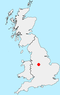
Location Map
Derbyshire Guide
Derbyshire has a wide range of walking to suit all abilities. The best walks are within the boundaries of the Peak District National Park with the limestone dales of the White Peak and wild gritstone moors of the Dark Peak. Outside of the National Park there is still much of interest to walkers with pleasant rural countryside often with similar characteristics to the area within the National Park boundaries.
Other walks in Britain - For a list of all the areas where walks are available go to the Main Walk Index.
Walk grading - Learn how each walk is assessed and select a walk to suit your ability and experience by going to Walk Grading Details.
Messaging & Social Media
Message Walking Britain and follow the latest news.

Mountain Weather
Stay safe on the mountains with detailed weather forecasts - for iOS devices or for Android devices.