Warwickshire WalksWalking Routes & Hiking Trails
Find Warwickshire walks from the list below which features the best walking routes in the area. Most are circular walks and are listed from the shortest and easiest to the longest more challenging routes.
The Warwickshire walks listed below range from easy circular walks to longer routes. All walks are free to download and print and all longer routes have GPS files. The routes include most of the attractive countryside of the County, including the section of the Cotswolds that lie within the county border. Some of the walks include sections of long-distance footpaths including the Heart of England Way and the Millennium Way. For those who like walking along waterways, there are routes along the canals and rivers within the county.
| Walk | Description | Grade | Miles |
|---|---|---|---|
| 1724 | Hartshill Hayes Country Park (route 2 ) | easy | 1.70 |
| 1722 | Hartshill Country Park near Nuneaton | easy | 2.00 |
| 2673★ | Stratford-upon-Avon circular | easy | 3.75 |
| 1713★ | Packwood House Circular from Dorridge | easy | 4.00 |
| 2340★ | Ilmington Down | easy/mod | 4.25 |
| 1040★ | Leamington Spa circular | easy | 4.50 |
| 3246★ | River Avon & Cleeve Prior from Bidford-on-Avon | easy | 4.50 |
| 3687★ | Circular Waterside Walk around Warwick | easy | 4.50 |
| 3105★ | Preston Bagot from Henley-in-Arden | easy | 4.70 |
| 1077★ | Newbold Comyn Park from Offchurch | easy | 4.80 |
| 1820★ | Napton on the Hill circular | easy | 5.00 |
| 1376★ | Balsall Common Circular | easy | 5.00 |
| 1349★ | Hunningham & Wappenbury Circular | easy | 5.30 |
| 3690★ | Lias and Stockton Locks Circular | easy | 5.30 |
| 2125★ | Edge Hill & Ratley from Radway | easy/mod | 5.40 |
| 3700★ | West from Henley-in-Arden | easy | 5.50 |
| 2711★ | Henley-in-Arden Circular | easy/mod | 5.50 |
| 2489★ | Upper Brailes Circular | easy/mod | 5.60 |
| 3710★ | Burton Green & Beechwood Circular | easy/mod | 5.80 |
| 3665★ | Honington & Idlicote Circular | easy/mod | 6.00 |
| 3704★ | Napton & Stockton Circular | easy | 6.40 |
| 1819★ | Long Itchington Circular | easy/mod | 6.50 |
| 3222★ | Edge Hill and Upton House | easy/mod | 6.50 |
| 3703★ | Kenilworth Castle circular | easy/mod | 6.60 |
| 3702★ | Coughton Circular | easy/mod | 6.80 |
| 1359★ | Stratford-upon-Avon from Milcote | easy/mod | 7.00 |
| 1854★ | Coombe Abbey and Country Park | easy/mod | 7.00 |
| 2929★ | The Pleasance & Meer End from Kenilworth | easy/mod | 7.00 |
| 1345★ | Alcester Town & Country Circular | easy/mod | 7.00 |
| 3016★ | Preston Bagot & Finwood from Henley-in-Arden | easy/mod | 7.00 |
| 3712★ | Leek Wootton & Woodloes Park Circular | easy/mod | 7.10 |
| 3734★ | Compton Verney Circular from Combrook | easy/mod | 7.20 |
| 3711★ | Heronfield & Temple Balsall Circular | easy/mod | 7.20 |
| 2430★ | Napton-on-the-hill, Grand Union Canal & Beacon Hill | easy/mod | 7.40 |
| 1774★ | Priors Hardwick & Wormleighton Circular | easy/mod | 8.00 |
| 2408★ | Ebrington & Hidcote from Ilmington | easy/mod | 8.00 |
| 2836★ | Wootton Wawen from Edstone Aqueduct | easy/mod | 8.00 |
| 3714★ | Lapworth & Kingswood Circular | easy/mod | 8.00 |
| 1614★ | Meriden & Berkswell Circular | easy/mod | 8.00 |
| 2813★ | Long Itchington to Ufton and Return | easy/mod | 8.00 |
| 3249★ | Hidcote & Ilmington Down | easy/mod | 8.00 |
| 3518★ | Offchurch Circular | easy/mod | 8.10 |
| 3235★ | Studley Circular | easy/mod | 8.25 |
| 3716★ | Morton Bagot & Bannam's Wood from Studley | easy/mod | 8.40 |
Walks that start in adjacent counties / areas.
Walks that start in adjacent counties or areas but cross the boundary and include sections of the route within Warwickshire.
| Walk | Description | Starts In |
|---|---|---|
| 2541★ | Hidcote & Foxcote from Mickleton | Gloucestershire |
| 1749★ | Upper Quinton & Hidcote Bartrim from Mickleton | Gloucestershire |
| 2276★ | Oxford Canal & Stoneton | Northamptonshire |
| 1971★ | Gallow Hill, Epwell & Swalcliffe | Oxfordshire |
| 3681★ | New End & Cladswell Circular | Worcestershire |
★ GPS file ☩ Route profile
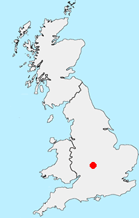
Location Map
Warwickshire Guide
The county of Warwickshire is in the English Midlands. The north and centre of the county are the areas with the highest population density. The north offers undulating countryside in contrast to the largely rural and sparsely populated south, which contains a small section of the Cotswolds. The highest point in the county, at 261 m (856 ft), is Ebrington Hill, on the border with Gloucestershire. The featured walks include sections of the Millennium Way and Heart of England Way.
Other walks in Britain - For a list of all the areas where walks are available go to the Main Walk Index.
Walk grading - Learn how each walk is assessed and select a walk to suit your ability and experience by going to Walk Grading Details.
Messaging & Social Media
Message Walking Britain and follow the latest news.

Mountain Weather
Stay safe on the mountains with detailed weather forecasts - for iOS devices or for Android devices.