Abbotsham Cliff beach and Kipling's Tor, Westward Ho!
Devon Walk
County/Area - Devon
Author - The Pig on the Hill
Length - 3.5 miles / 5.7 km Ascent - 300 feet / 91 metres
Time - 2 hours 0 minutes Grade - easy
Maps 

| Ordnance Survey Explorer 139 | Sheet Map | 1:25k | BUY |
| Anquet OS Explorer 139 | Digital Map | 1:25k | BUY |
| Ordnance Survey Landranger 180 | Sheet Map | 1:50k | BUY |
| Anquet OS Landranger 180 | Digital Map | 1:50k | BUY |
Walk Route Description
Click image to see photo description.
This walk along the North Devon Coast includes a section of the South West Coast National Trail. The route follows paths and lanes so a stout pair of walking shoes is not essential but, when wet, you might be glad of them. A waterproof jacket is always advisable. Remember this is the Atlantic coast after all. Route finding is straightforward and you might wish to explore away from the route as described.
Begin the walk at the entrance to the Pig on the hill driveway. Turn left up the country lane and cross the stile on your left. Continue through two fields and then turn left onto the lane. Follow this down the hill and up the other side. At the next junction turn right (un-signposted) and follow the lane towards the sea. By now you should be feeling the sea breeze (or howling wind). There is a gate to lean on up ahead perfectly positioned to enjoy the view.
Continue along the lane to Abbotsham Court. Turn right on the paved lane towards the beach. At the end, turn left over a stile. Follow the path towards the sea, kinking to the right as you come over the brow of the hill. Lundy is ahead, Clovelly and Hartland Point are to the left, and Baggy Point is on the right.
In the 1920s, the valley below was home to Shebberton race course 'the most beautifully situated racecourse in England'. At the bottom of the hill, cross the stile to Abbotsham Cliff beach. The gullies and crevices of this beach are home to lobster, shrimp and Conger eels, with occasional visits from porpoises and seals.
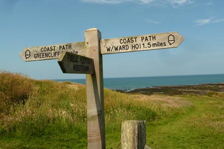
Turn right and follow the coast path with the sea on your left. The path here follows the course of the old Bideford to Westward Ho! railway. Built in 1901, the cuttings were blasted through the rock. This stretch is long and straight and the walking easy.
The village of Westward Ho! Soon comes into view. On your right is Kipling Tor, which is names after the Jungle Book author, Rudyard Kipling, whose schooldays here in the 1870s inspired his novel Stalky and co.
The climb onto the Tor is worth the effort providing some wonderful views. Turn right on the steep path that leads upwards. At its end is the Lookout, with the best views of Bideford Bay. From the Lookout you can see the white Saunton Sands Hotel. The beach below it has starred on album covers (Pink Floyd) and in music videos (Robbie Williams). During WW2, over 10,000 American GIs trained for the D-Day invasion on Braunton Burrows (the dunes behind), which is now a designated UNESCO biosphere.
After taking in the view, retrace your footsteps down the hill and turn right on the first path. Follow the path across the top of the Tor. At the crossroads of paths, turn right and follow the path upwards through the trees and all the way up until you come to a metal gate at a road. Go straight across and follow the lane downwards.
You soon arrive at the Pig on The hill for well needed refreshment!
Other walks nearby
| Walk 2161 | Appledore to Westward Ho! | easy | 4.5 miles |
| Walk 2295 | Buck's Mill & Peppercombe | easy/mod | 6.2 miles |
| Walk 2028 | Croyde to Baggy Point Circular | easy | 5.5 miles |
| Walk 1719 | Clovelly & the South West Coast Path | easy/mod | 6.0 miles |
| Walk 3749 | Codden Hill Circular | easy/mod | 4.8 miles |
| Walk 1797 | Morthoe, Morte Point & Bull Point circular | easy/mod | 6.0 miles |
| Walk 1824 | Hartland Point Circular | easy | 3.0 miles |
| Walk 1261 | Hartland Point circular | moderate | 10.0 miles |
| Walk 3208 | Stoke & Hartland Quay | moderate | 6.4 miles |
| Walk 3207 | Knap Head to Mansley Cliff | moderate | 8.0 miles |
Recommended Books & eBooks
South West Coast Path Map Booklet - Minehead to St Ives
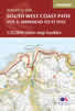 Map of the northern section of the 630 mile (1014km) South West Coast Path National Trail. Covers the trail from Minehead to St Ives along the north Devon and Cornish coastline. This convenient and compact booklet of Ordnance Survey 1:25,000 maps shows the route, providing all of the mapping you need to walk the trail in either direction.
More information
The South West Coast Path
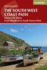 Guidebook to walking the entire South West Coast Path National Trail. The route runs for 630 miles from Minehead to Poole along the north Devon, Cornish, south Devon and Dorset coastline. Divided into 45 stages, this long-distance coastal trek could be completed within 4 weeks, or walked in sections. Guide includes maps and essential information.
More information
Messaging & Social Media
Message Walking Britain and follow the latest news.

Mountain Weather
Stay safe on the mountains with detailed weather forecasts - for iOS devices or for Android devices.