Faringdon, Buckland & Pusey
Oxfordshire Walk
County/Area - Oxfordshire
Author - Visit Southern Oxfordshire
Length - 10.5 miles / 17.1 km Ascent - 300 feet / 91 metres
Time - 5 hours 30 minutes Grade - easy/mod
Maps 

| Ordnance Survey Explorer 170 | Sheet Map | 1:25k | BUY |
| Anquet OS Explorer 170 | Digital Map | 1:25k | BUY |
| Ordnance Survey Landranger 163 | Sheet Map | 1:50k | BUY |
| Anquet OS Landranger 163 | Digital Map | 1:50k | BUY |
| Ordnance Survey Landranger 164 | Sheet Map | 1:50k | BUY |
| Anquet OS Landranger 164 | Digital Map | 1:50k | BUY |
Walk Route Description
Click image to see photo description.
This circular walk starts from Faringdon and explores two villages lying to the west, Buckland and Pusey, crossing typical countryside of the area en-route. The walk uses well defined paths and tracks and includes the opportunity to see Buckland House together with a fine restored dovecote. This walk is based on a shorter walk that can be found at Walk 1062
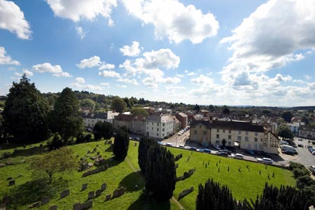
1 - Start the walk in Faringdon Market Place and head uphill to Church Street, past the churchyard and past the A4095 to Witney. When the metalled road turns 90 degrees right, Carry straight on to a farm track. When it starts to bend, continue straight on to an enclosed footpath (Church Path).
2 -- At Grove Lodge continue ahead to Littleworth and Buckland. The route needs careful navigation through the village of Littleworth and a map is recommended. Reaching the road on the outskirts of Buckland, walk straight ahead down St George's Road. This leads to the Memorial Hall where you join the route detailed in Walk 1062.
3 - Start at the large car park at Buckland Memorial Hall. Turn right and walk downhill. At the end of the road, take the bridleway straight ahead along the edge of a field.
4 - At the main road (A420) cross the road to a gateway slightly to the right. This is a very busy road, with poor visibility to the right. It may be better to walk along the verge to the right to improve sight of oncoming traffic.
5 -Cross a stile, and walk along a slightly raised path, with a hedge on your right. Proceed for about 150 metres and then fork left diagonally (waymarked) across two fields following overhead cable lines. At the edge of the field, the path leads over two stiles into a small copse. Through the trees, continue along a track in the same direction as before, to a gate onto the B4508 road.
6 - At the road, turn right and walk through Pusey village (or turn left and walk for 150 metres to see Pusey House, and return).
7 - After following the road for around 300 metres, take the bridle path to the right, and follow this between a double fence and through a copse, continuing along the field path to a road.
8 - Cross the road and continue along the track, which continues alongside woodland (Buckland Warren) until you reach a junction of tracks (See alternative return route below).
9 - At the junction of tracks, turn right with woodland to the left and a field on the right. Keep right at the next intersection and walk through a marshy copse, passing a large and beautifully restored stone dovecot on the right and farm buildings (Home Farm) on the left. Continue along the track until you reach the road (A420).
10 - At the main road, cross with care and take the path opposite through stone gateposts. Go past the lodge and take a stile on the right. Take the path, bearing right, across the field to another stile into woodland. Look to the left to see Buckland House. Follow the path through woodland to the road and turn left. Walk until you see The Lamb public house on your left. Continue ahead to St George's Road and turn left retracing your outward route to Faringdon.
Alternative Return Route -Continue ahead at the junction of tracks (if you wish to see the restored dovecote turn right and then return to this junction). The suggested route takes you through Buckland Warren to the Hideaway to continue via The Folly to Faringdon. Note this route is shown on this walk's route map.
Other walks nearby
| Walk 1069 | Badbury Hill, including the Great Barn at Great Coxwell | easy | 6.0 miles |
| Walk 3630 | Longcot & Uffington Circular | easy | 5.2 miles |
| Walk 1062 | Pusey & Buckland circular | easy | 3.5 miles |
| Walk 1554 | Wayland's Smithy & Uffington Castle | easy/mod | 5.5 miles |
| Walk 2915 | Uffington Castle, the White Horse and Wayland's Smithy | easy/mod | 6.5 miles |
| Walk 3116 | Uffington White Horse & Wayland's Smithy | easy | 3.3 miles |
| Walk 2410 | Wayland's Smithy, Ashdown House and Ashbury | easy/mod | 7.5 miles |
| Walk 1419 | The Lambourn Downs from near Astbury | moderate | 14.0 miles |
| Walk 1873 | The Ridgeway from Ardington | easy/mod | 7.0 miles |
| Walk 1439 | Fulbrook & Widford | easy | 6.0 miles |
Recommended Books & eBooks
No suggestions for this area.Messaging & Social Media
Message Walking Britain and follow the latest news.

Mountain Weather
Stay safe on the mountains with detailed weather forecasts - for iOS devices or for Android devices.