Hampsthwaite & Ripley Park
North Yorkshire Walk
County/Area - North Yorkshire - Vale of York
Author - Allan Friswell
Length - 7.5 miles / 12.2 km Ascent - 550 feet / 167 metres
Time - 4 hours 20 minutes Grade - easy
Maps 

| Ordnance Survey Explorer 298 | Sheet Map | 1:25k | BUY |
| Anquet OS Explorer 298 | Digital Map | 1:25k | BUY |
| Ordnance Survey Landranger 99 | Sheet Map | 1:50k | BUY |
| Anquet OS Landranger 99 | Digital Map | 1:50k | BUY |
Walk Route Description
Click image to visit gallery of 6 images.
A straightforward ramble along the reclusive River Nidd crossing undulating country with gentle slopes offering fine views across Nidderdale. The walk also includes some pleasant deciduous woodlands and offers a visit to Ripley Castle, if desired. The paths can be muddy or boggy in places after heavy rain, but never impassable!
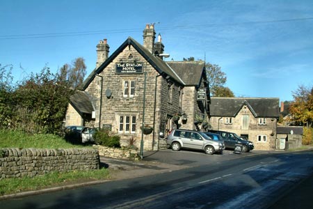
Park in the village centre near the green triangular island ensuring that no inconvenience is caused to local residents and businesses. Go left along High Street with your back to the school. Follow the road for half a mile to the hidden stile on the right located on a rather difficult bend to the left. Descend the field diagonally left to the kissing gate and follow the Nidd to the outskirts of Birstwith. When you reach the factory, take the path on the right which skirts the plant, arriving eventually at a small bridge, where you turn right and follow Wreaks Road up past the Station Hotel and the former North Eastern Railway bridge foundations. After a further 100 yards cross and head up Nidd Lane. An obvious track on the right leads you to West House Farm.
At the farmhouse go through the gateway on the right and follow the very clear track round left uphill, through the gate and then keep to the several fields' left edge to a corner (Grid ref SE249608) where the path to Burnt Yates is now apparent. At the road cross take the path leading down past the play areas. After 200 yards go through two metal gates on the right and descend at 11 o'clock to the gate near the far corner. The obscured stone stile is in the corner ahead on the right, and the path leads you to Pye Lane. Left here, and cross shortly to the bridleway on the right which you follow to Spinner Lane and then Law Lane, passing a crosspaths and Hill Top Farm on the way.
Turn right and walk along Law Lane to the B1615. Cross with care and take the small wrought-iron pedestrian gate next to the large gates. Follow the left hand edge to reach a gate and a crosspaths, and then climb the field to the top left corner and two kissing gates. Keep ahead, arriving soon at a large metal gate where you go left. Here the track becomes very muddy. Walk down it to a much firmer one, turn left and walk to the small copse called Sadler Carr, the site of an old 14th century moated-manor house.
Turning left here (the Nidderdale Way) soon brings you to Ripley and its castle, where you may care to rest and snack. Or explore! Returning to Sadler Carr, simply follow your nose. The Nidderdale Way leads through Hollybank Wood, comes out at a tarmac lane which you almost immediately leave on the left, plunging down a very narrow and slightly insecure path (Grid ref. SE269600). This descends, then climbs up to a narrow lane, at the top of which you turn left and follow the road over the narrow bridge back to the start.
Other walks nearby
| Walk 1358 | Ripley & Knox circular | easy | 5.5 miles |
| Walk 1800 | West of Harrogate without a car | easy/mod | 9.0 miles |
| Walk 2404 | Ripon Rowel Walk Leg 2 - South Stainley to Sawley | easy/mod | 8.5 miles |
| Walk 3507 | Dacre Banks Circular | easy/mod | 6.5 miles |
| Walk 3726 | Brimham Rocks Circular | easy | 4.7 miles |
| Walk 1572 | Swinsty Reservoir | easy | 3.0 miles |
| Walk 2405 | Ripon Rowel Walk Leg 3 - Sawley to Ilton | moderate | 11.0 miles |
| Walk 1405 | Thruscross Reservoir & Kex Gill Moor | easy/mod | 8.5 miles |
| Walk 3528 | Fountains Abbey & Markenfield Hall | moderate | 8.7 miles |
| Walk 1574 | Thruscross Reservoir | easy | 4.5 miles |
Recommended Books & eBooks
Trail and Fell Running in the Yorkshire Dales
 Guidebook to 40 of the best trail and fell runs in the Yorkshire Dales National Park. Ranging from 5 to 24 miles, the graded runs start from bases such as Ribblehead, Dent, Sedbergh, Malham and Grassington and take in the region's diverse delights, from castles and waterfalls to iconic mountains such as Whernside, Ingleborough and Pen Y Ghent.
More information
Messaging & Social Media
Message Walking Britain and follow the latest news.

Mountain Weather
Stay safe on the mountains with detailed weather forecasts - for iOS devices or for Android devices.