White Ladies & Aston circular from Broughton Hackett
Worcestershire Walk
County/Area - Worcestershire
Author - Millennium Way
Length - 5.5 miles / 8.9 km Ascent - 150 feet / 45 metres
Time - 2 hours 50 minutes Grade - easy
Maps 

| Ordnance Survey Explorer 204 | Sheet Map | 1:25k | BUY |
| Anquet OS Explorer 204 | Digital Map | 1:25k | BUY |
| Ordnance Survey Landranger 150 | Sheet Map | 1:50k | BUY |
| Anquet OS Landranger 150 | Digital Map | 1:50k | BUY |
Walk Route Description
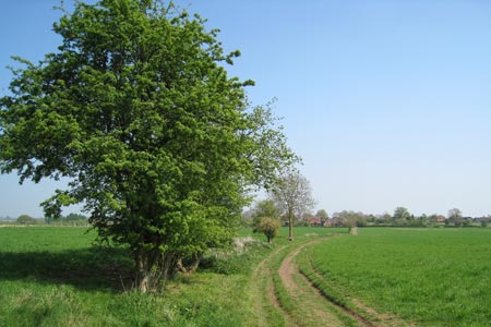
Click image to visit gallery of 3 images.
This Worcesteshire walk is mostly flat and takes you across open countryside, through farmland with 11 stiles en route. During the early part of the walk, you will follow a short section of the Millennium Way just north of the village of White Ladies Aston.
A - We start our walk from The March Hare in Broughton Hackett. Emerging from the car park turn immediately right down the surfaced lane passing the leisure centre. Cross over cattle grid to go gently uphill across field ahead. Pass under power lines and take the large metal gate ahead continuing with fence and hedge right to large metal gate in corner of field. Here you have joined The Millennium Way and will see the distinctive green Millennium Way waymarker. Go through gate and after a few paces take the next large gate left into field. Follow around edge of field with hedge right to find far right corner metal gate. Take gate then go over bridge and ahead to take gated hedge gap then 1/4 left to find stile into copse. Ahead through copse to find track (which can often be quite muddy.) Go right on track which becomes a road passing houses left to arrive at a junction of roads.
B - At the junction, take gap immediately left by power pole, and go with hedge left to find stile leading to road. Go right on right on road passing St John the Baptist church on left to arrive at T-junction. (You may wish to make a short visit to the church.) At the T-junction go left and after 100m take footpath right down wide cinder path. Here we leave The Millennium Way. Continue into next field passing large pond on left. Keep ahead with hedge left and on reaching gap ahead turn right keeping in the same field and continue along with hedge left. At the marker post go ahead into next field keeping hedge left towards narrow copse. On reaching copse turn right ( do not enter copse ) and go up field with hedge and copse left. Pass under power lines and through gap into next field. After a few paces take waymarked path left through hedge gap into next field continuing with hedge left. At the next gap enter field left following waymarker ahead keeping hedge right. After 100m take the waymarked gap right over wooden footbridge and through kissing gate into field and continue up field with hedge right to take the stile ahead. Follow waymarker right around edge of next field to reach road.
C - Go left on road and immediately past Spring Cottage take footpath right through wooden gate. Go diagonally left across grassy area to take corner stile into next field and go ahead with hedge right. Stay on same heading through field corner gap ahead and continue along edge of four fields with hedge and wooded area right, to reach the main road.
D - Cross over main road ( A 422 ) taking great care as this is a very busy road. Follow footpath opposite keeping Churchill Wood on your right. (The route does not enter the wood but you may find a shady nook to take a break and some refreshment.) Take the gap ahead into next field going left along edge of field with hedge left. At the way post follow direction of waymarker to go diagonally left across field. Soon another way post comes into view, take gap then over stile and go downhill. Just before reaching road take footpath right through large metal gate and go ahead keeping stream left. Take corner field double stile and footbridge then immediately over next stile to go half right across field under power lines to take corner gate into next field. Continue up field keeping hedge left and over stile to reach road.
E - Turn right on lane for 500m and just before the bridge turn right through gate and continue along edge of field with stream left. Take gate into next field then through gap ahead over stream. After a few paces take waymarked gate left then go right up field keeping hedge right. Go gently uphill, under power lines to take stile at corner. Go ahead 20 paces to take next stile right then continue along next field with hedge left. Go through large metal gate and follow waymarker towards the hamlet of Broughton Hackett directly ahead. Pass houses to T-junction then turn right past the attractive church of St. Leonards. At the next T-junction turn right and follow lane around to left to reach the main road. Turn left and you are now back to The March Hare.
Other walks nearby
| Walk 2313 | Upton Snodsbury Circular | easy/mod | 7.5 miles |
| Walk 3680 | Broughton Hackett and Upton Snodsbury | easy | 3.0 miles |
| Walk 3692 | Egdon, Stoulton & White Ladies Aston | easy | 6.3 miles |
| Walk 1355 | Stoulton Circular | easy/mod | 7.5 miles |
| Walk 3684 | Flyford Flavell and Dormston circular | easy | 4.5 miles |
| Walk 3502 | Two Rivers Walk to Powick and Worcester | easy | 6.5 miles |
| Walk 3226 | New End & Holberrow Green from Inkberrow | easy/mod | 8.0 miles |
| Walk 3686 | Dormston from Inkberrow Circular | easy | 5.4 miles |
| Walk 3715 | Holberrow Green & New End from Inkberrow | easy/mod | 8.3 miles |
| Walk 2142 | Severn Valley from Grimley | easy | 5.0 miles |
Recommended Books & eBooks
No suggestions for this area.Messaging & Social Media
Message Walking Britain and follow the latest news.

Mountain Weather
Stay safe on the mountains with detailed weather forecasts - for iOS devices or for Android devices.