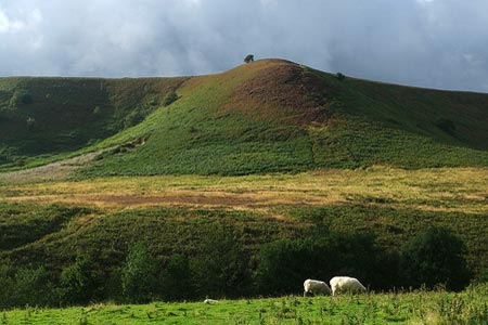
Hole of Horcum and Saltergate Brow from Lockton
North York Moors Walk
Nat Park - North York Moors - North York Moors East
County/Area - North Yorkshire
Author - Andy Chaplin
Length - 10.3 miles / 16.7 km Ascent - 1000 feet / 303 metres
Time - 6 hours 10 minutes Grade - moderate
Maps 

| Ordnance Survey Explorer OL27 | Sheet Map | 1:25k | BUY |
| Anquet OS Explorer OL27 | Digital Map | 1:25k | BUY |
| Ordnance Survey Landranger 101 | Sheet Map | 1:50k | BUY |
| Anquet OS Landranger 101 | Digital Map | 1:50k | BUY |
| Ordnance Survey Landranger 94 | Sheet Map | 1:50k | BUY |
| Anquet OS Landranger 94 | Digital Map | 1:50k | BUY |
Walk Route Description
Click image to see photo description.
This North York Moors walk takes in the Levisham Beck valley to the Hole of Horcum, provides views over the moors north of Saltergate Brow and finishes with more views of Stain Dale, Dove Dale and Green Dale.
The start is at Lockton cemetery (grid ref. SE846899) where there is off road parking for about 4 cars and plenty of on-road parking for more. There are even benches to sit while you boot-up! After parking, head west along the road towards Lockton for 50 yards. Take the footpath on your right. At the first junction branch left across the farm tracks to pick up the path from Wedland Slack down to St Robert Well. Ignore the "No right of way" path on the east side of Levisham Beck. Cross on the footbridge a little further along, then angle up the hill to the path at the top (grid ref. SE835903) where a sign directs you east to Horcum.
The path initially heads east before turning north up Levisham Brow with good views up and across the valley. At the signpost which indicates Dundale Pond off to the left (grid ref. SE838917), keep straight on and cross Dundale Griff then Levisham Beck on the footbridge. Continue past Low Horcum (grid ref. SE843931) then climb up out of the Hole of Horcum and admire the view looking back while you regain your breath (grid ref. SE849940).
Follow the path on the south side of the A169 east towards the car park overlooking the Hole of Horcum (now Pay & Display). Before reaching the car park turn left and cross the road onto Old Wife's Way (grid ref. SE852939). Continue a short way along this track before turning north (left) at grid ref. SE854938. Continue a short way north on this path towards Saltergate Brow with excellent views northwards across the moors. Reaching a junction (grid ref. SE854941) turn right. The path initially follows the brow but soon starts to descend towards Malo Cross (grid ref. SE866949). At the Cross take the path south signposted to Newgate Foot. This skirts the forest on your left and passes Blakey Topping on the same side.
After passing through fields you stay on the signposted path which avoids the farm which is on your left. The track then heads up Newgate Brow and picks up the Old Wife's Way again (grid ref. SE870929). Carry on in a south easterly direction for 500 metres until you reach the woodland (grid ref. SE873925). Here turn right on the signposted path. Continue on the forestry track that skirts the Dalby forest on its western edge. At grid ref. SE876912 a path out of the woods to your left has a National Trust sign (facing away from you) confirming you are at Bridestones. Carry on south for another 250 metres and then the most obvious path bends around to the right and heads off to the Bridestones to give you a view into Dove Dale.
Turn left at the two most southerly Bridestones and take the path that arcs downhill towards one of the Dalby Forest Drive car parks and information boards (grid ref. SE878904). All of the paths are well defined here. Before reaching the parking area turn right (grid ref. SE876905) and take the path along Stain Dale to Low Staindale Farm. Take the track that goes around the house and heads uphill into the wood and towards Low Pasture Farm.
Before the farm (grid ref. SE866902) take the footpath to the left. Continue behind the farm and pick up the track, which seems to be made out of old concrete railway sleepers, to pass Pasture Villa Farm. Continue down through Thwaite Wood before climbing up to the A169. You emerge just across from the Locton Cemetry where you started.
Other walks nearby
| Walk 1867 | Hole of Horcum & Bridestones from Lockton | moderate | 9.8 miles |
| Walk 3337 | Dundale Pond from Levisham | easy | 4.8 miles |
| Walk 3585 | Skelton Tower & Hole of Horcum from Levisham | easy/mod | 7.4 miles |
| Walk 1397 | Hole of Horcum from Levisham Station | easy/mod | 8.5 miles |
| Walk 3534 | Dundale Pond & Hole of Horcum from Saltergate | easy/mod | 5.2 miles |
| Walk 1602 | Saltergate, Fylingdales & Allerston High Moor | moderate | 11.5 miles |
| Walk 2665 | Cawthorne Roman Camp Circular | moderate | 12.2 miles |
| Walk 2325 | Troutsdale Circular | moderate | 10.1 miles |
| Walk 1930 | Wheeldale Moor circular | moderate | 11.3 miles |
| Walk 1922 | Goathland & Howl Moors | moderate | 11.2 miles |
Recommended Books & eBooks
Trail and Fell Running in the Yorkshire Dales
 Guidebook to 40 of the best trail and fell runs in the Yorkshire Dales National Park. Ranging from 5 to 24 miles, the graded runs start from bases such as Ribblehead, Dent, Sedbergh, Malham and Grassington and take in the region's diverse delights, from castles and waterfalls to iconic mountains such as Whernside, Ingleborough and Pen Y Ghent.
More information
Messaging & Social Media
Message Walking Britain and follow the latest news.

Mountain Weather
Stay safe on the mountains with detailed weather forecasts - for iOS devices or for Android devices.