Berkhamsted & Northchurch Commons
Chilterns Walk
Region - Chilterns
County/Area - Hertfordshire
Author - Donald Morton
Length - 5.5 miles / 8.9 km Ascent - 420 feet / 127 metres
Time - 3 hours 10 minutes Grade - easy
Maps 

| Ordnance Survey Explorer 181 | Sheet Map | 1:25k | BUY |
| Anquet OS Explorer 181 | Digital Map | 1:25k | BUY |
| Ordnance Survey Landranger 165 | Sheet Map | 1:50k | BUY |
| Anquet OS Landranger 165 | Digital Map | 1:50k | BUY |
Walk Route Description
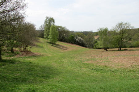
Click image to see photo description.
Start the walk by Bridgewater School (Grid ref. SP984090). It is possible to park in Bridle Way approaching the school. Walk uphill passing the school gates on the right and continue up an enclosed footpath. On reaching a crossing path turn right through a kissing gate onto another enclosed but much broader path. At the next gate turn left and walk up the field with fence and hedge on the left. At the top of the first field do a left/right dog leg over a stile and continue walking in the same direction but now with the hedge on the right. Go through a hedge gap at the end of this field and continue still in the same direction and still with the hedge on the right. After a slight wiggle in the field edge continue over a stile, down into a Chiltern bottom - dry valley - and up the edge of the field towards woods.
At the field corner go straight on over a stile into woods. Go up to meet a bridle path. Follow the bridle path left and immediately up through the woods so that the previous direction is more or less continued. For a bridle path this is quite narrow but as it twists through the woods it is marked by white painted arrows on the trees. It comes out onto a crossing track which on the right enters the garden of Brickkiln Cottage. Go over the track and straight on into the woods the other side. The track is unmarked and ill defined but the objective is to skirt round the boundary of the cottage so keep as near as possible to this; at a cross track turn right still skirting the cottage. This track arrives at a gate into the garden. Here Turn Left and in a few yards arrive at a gravel track by a finger post. This is on the Hertfordshire Way which runs to the right and left (but is signed only to the right). Go Left - signed as part of the Ashridge Boundary Trail. The path goes about twenty or thirty yards inside the wood with a large grass expanse beyond. When the grass expanse ends the path continues through the wood in the same direction. Follow it until arriving at Great Coldharbour Farm.
Continue straight on past the farm and follow the clear access track which runs through the woods quite close to the left hand edge. After passing Little Coldharbour Farm on the left the track passes through wood bollards and continues straight on through the woods. This part of the way can be quite muddy and there are several parallel tracks. The line of the track is quite clear, however. Just keep going straight on keeping reasonably close to the left hand edge of the wood until this starts to bend further away. Soon after this starts to happen, reassuringly, there is a cross track with a way mark post pointing the way straight forward. From here the track is clear going through the woods until it comes out to the B4506 at a road junction (Grid ref. SP977117).
Cross over the road and go down the minor road opposite signed to Aldbury and Tring. Soon after passing a "beware of deer" road sign turn left down a bridle path. This post does have a Hertfordshire Way sign but pointing the way you have come from. On entering the woods, you will see diagonally on the right some green banks. It is worth while making your way over to these; they are the banks topped with ancient coppiced trees which bordered the original ride through the woods. Sadly what would have been a superb path has fallen into disuse and branches from the old trees have blocked it. The current, twisting, path runs a little way to the left of it and has been formed by National Trust tractors more or less parallel to the original. You can make sure you are maintaining the right direction by keeping an eye on the line of the old trees to your right. Soon after the old and new paths more or less converge there is a way mark post.
The bridle path goes straight on but at this point the walking is easier and the views much better if you turn left and in a few yards come out to an extensive open common - Northchurch Common. Here turn right and walk along the edge of the wood. Ignore paths off to the left going across the common and also any to the right; continue straight on past one signed with an axe marker - this shows you have just joined the Icknield Way, one of Englands ancient trackways, for a short distance. Where the edge of the wood turns left across your route carry straight on into the woods. At the next marker post the path bends left. Then in a very short distance at a second marker post go a little more left to continue once again with the wide green space on your left and woods and scrub falling away to your right. Follow this broad green path ignoring all paths to right and left until you reach a low marker post. Here turn right; marked as a bridle path and also Grand Union Canal Circular Walk. The wide track goes down hill through woods over two crossing tracks and after the second goes up to hit the B4506 (Grid ref. SP978100).
Cross over the road and continue on the marked bridle path. Ignore a left fork signed Ashridge Estate Boundary Trail and go straight on and down to reach a tarmac road. Just before the road the path forks right and then continues on down over the road. If you miss the fork turn right down the road for a few yards to pick up the path. This reaches a grassy parking area by the side of the B4506. Cross this and go up the tarmac road ahead of you. Where this access road turns left go straight ahead on a gravel road to retrace your steps back to Bridgewater School, this time with the houses on the left and where the houses finish turning right through the barrier into the narrow enclosed path.
Other walks nearby
| Walk 1504 | Potten End Circular | easy/mod | 6.0 miles |
| Walk 1007 | The Ashridge Estate circular | easy/mod | 6.0 miles |
| Walk 1999 | The Chilterns above Tring | moderate | 12.0 miles |
| Walk 2399 | The Chilterns above Tring (short version) | easy/mod | 8.0 miles |
| Walk 2064 | Ivinghoe Beacon from the Ashridge Estate | easy/mod | 6.5 miles |
| Walk 3025 | Ashridge Estate Circular | easy | 4.5 miles |
| Walk 2071 | Ivinghoe Beacon and Bridgewater Monument from Tring | easy/mod | 8.0 miles |
| Walk 2496 | Cow Roast and Aldbury from Tring Station | easy | 5.5 miles |
| Walk 2795 | Circular from Great Gaddesden to Little Gaddessden | easy/mod | 7.5 miles |
| Walk 2999 | Mansions & Parklands from Great Gaddesden | easy/mod | 7.0 miles |
Recommended Books & eBooks
No suggestions for this area.Messaging & Social Media
Message Walking Britain and follow the latest news.

Mountain Weather
Stay safe on the mountains with detailed weather forecasts - for iOS devices or for Android devices.