Aubourn Country Circular
Lincolnshire Walk
County/Area - Lincolnshire
Author - North Kesteven Council
Length - 4.5 miles / 7.3 km Ascent - 25 feet / 8 metres
Time - 2 hours 20 minutes Grade - easy
Maps 

| Ordnance Survey Explorer 272 | Sheet Map | 1:25k | BUY |
| Anquet OS Explorer 272 | Digital Map | 1:25k | BUY |
| Ordnance Survey Landranger 121 | Sheet Map | 1:50k | BUY |
| Anquet OS Landranger 121 | Digital Map | 1:50k | BUY |
Walk Route Description
Click image to see photo description.
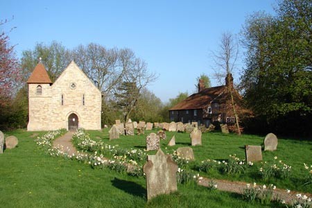
Aubourn sits in the valley formed by the River Witham as it bends north eastwards, 7 miles south of Lincoln. Several small streams flow northward into the Witham nearby, including the River Brant. The village is enclosed to the north and east by the 'washlands' of the Witham and has historically been prone to frequent flooding. After the last war high flood banks were built along both shores of the Witham to reduce the risk.
1 - From the car park of the Royal Oak in Aubourn turn left and follow this road until you reach the 30 mph speed limit signs. You will notice two Stepping Out finger blade signs leading right from this section of the road. Take the furthest path, which is a permissive farm track, leading off through the fields towards some woodland. The other pathway is a public footpath that crosses a field providing less pleasant walking, but offers and alternative route should you wish.
2 - Follow the track straight on until a waymarked permissive path leads you left, along a ditch side, towards a strip of woodland. Please ensure you stay on the route and do not stray onto the track leading to Marlborough Farm as this is private property. Follow the ditch through the wood until you reach a farm track. The majority of this walk is on permissive pathways where access has been granted by kind permission of the landowner. The permission is for walkers only and is not extended to horses or cycles.
3 - Turn right at the farm track, with a large hedgerow on your right. This track takes you past small areas of mixed woodland to a Poplar plantation. At the end of the plantation continue straight on until you reach a raised bank.
4 - Turn right onto the bank, a good vantage point for bird of prey spotting, and continue until you reach a cottage.
5 - Follow the track around the cottage and right onto a narrow lane. Follow this until you reach a row of Poplars, just before the trees leave the road and follow the pathway straight on.
6 - Follow this path until you reach a strip of woodland and turn right along the side of the woodland bringing you back to the track at the beginning of the walk.
7 - Turn left onto this track and back to the main road.
8 - Turn left onto the road and back into Aubourn, taking the right hand fork back to the car park.
This route is from the Stepping Out series of walks produced by North Kesteven Council.
Other walks nearby
| Walk 1431 | Haddington - Story of Two Churches | easy | 2.9 miles |
| Walk 1438 | River Witham, North Hykeham | easy | 4.5 miles |
| Walk 1440 | Lincoln Edge | easy | 5.0 miles |
| Walk 1432 | Doddington circular | easy | 4.9 miles |
| Walk 2502 | Branston village Circular | easy | 5.0 miles |
| Walk 2224 | Dunston & Nocton | easy | 5.0 miles |
| Walk 1428 | Blankney Circular | easy | 3.8 miles |
| Walk 3512 | Scopwick, Kirkby Green & Blankney | easy | 7.3 miles |
| Walk 1436 | High Wood and North Rauceby | easy | 4.8 miles |
| Walk 1437 | South Rauceby and Rauceby Hall | easy | 4.0 miles |
Recommended Books & eBooks
No suggestions for this area.Messaging & Social Media
Message Walking Britain and follow the latest news.

Mountain Weather
Stay safe on the mountains with detailed weather forecasts - for iOS devices or for Android devices.