Historic Long Melford
Suffolk Walk
County/Area - Suffolk & Essex
Author - Rob Simpson
Length - 8.0 miles / 13 km Ascent - 150 feet / 45 metres
Time - 4 hours 10 minutes Grade - easy/mod
Maps 

| Ordnance Survey Explorer 196 | Sheet Map | 1:25k | BUY |
| Anquet OS Explorer 196 | Digital Map | 1:25k | BUY |
| Ordnance Survey Landranger 155 | Sheet Map | 1:50k | BUY |
| Anquet OS Landranger 155 | Digital Map | 1:50k | BUY |
Walk Route Description
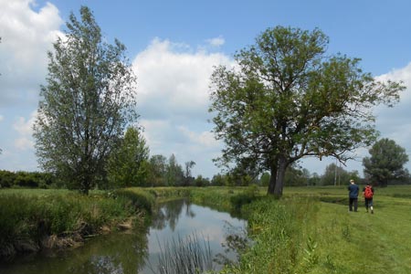
Click image to visit gallery of 7 images.
Long Melford is one of Suffolk's most historic, and outstanding scenic rural villages, nestled in the picturesque Stour Valley, in the heart of Constable and Gainsborough country. Located between the other historic smaller village of Lavenham, & Sudbury town, it serves perfectly as a central location to embark on numerous country and river walks, and provides more historic locations in one village, than any other in Suffolk.
The start is the Long Melford Country Park (grid ref. TL858437), which is located south of the village on the Sudbury Road (B1064). Free all day parking is available here. Before you start, you may like to go to the Long Melford Village Website, and download the History Map for historical reference. Visitors may wish to explore the Country Park before they embark on the walk. Signage near to the toilet block, will indicate numerous walking paths, that incorporate numerous small lakes, wooded areas, and viewing points beside the River Stour.
To start the walk, proceed past the picnic benches close to the car park embankment, and see the entrance to your right, with a sign saying To Valley Trail, and go through the wooden gate, out of the park boundary, and follow the path up onto the bridge across the scenic River Stour. Once over the bridge, having walked about twenty paces, carefully cross the road to start the walk on the other side, with a foot path sign and entrance as indicated. Follow the path over another bridge with a wooden walkway and proceed through the shaded pathway before gently inclining upwards to your right, along a car track (Ropers Lane) with a large high hedge on your left, and properties on your right, as you make your way up the slope to the main road.
As you reach the top of the road, you will see a recently restored 200 year old milestone on the other side. However turn left, and follow the pathway past the two Long Melford signs with the road on your right, and the large historic Victorian Maltings coming into view on your left (now residential) built in 1878.
Follow the pavement down, minding the road junction before the Melford Inn, and carry on down the slope with the road on your right, and then Victorian Cottages on your left. As you walk along it will open up, and you will go past Melford Place Farm and the Old Chapel. On your right is Chapel Place Green, and it was here in 2011, that BBC TV Historian Michael Wood, and villagers, discovered a Roman Road, which extended diagonally across the rectangular green.
Carrying on walking into the southern entrance to the main street via the pavement, you will see the Long Melford Antiques Centre on your right, and on your left more Victorian Cottages in flint. Small shops start to appear, and then when you see the sign pointing left for Sports Field and Suffolk A1 Route, turn left into Liston Lane.
As you walk down the narrow lane, it opens up to a large meadow for cattle on your left, under which ancient Roman Floors and walls were discovered about fifty years ago. It is now a protected ancient monument. As you come to the small junction, continue straight on and take the road down to the Bridge that crosses the River Stour. To your right and left are water meadows. Continue onwards down the road, walking beside the river down below you on your right with the Essex sign on your left. Soon you will be approaching Liston Mill as the sound of fast running river water starts to get louder.
Just before Liston Mill, and almost directly opposite the Liston sign, turn right off the road. There is a large metal gate and kissing gate allowing access to the meadows (Grid ref. TL857449). Cross two foot bridges taking you across the fast flowing river channels and enjoy the views from the Liston Mill bridges. Please note the footpath can be muddy in winter and dogs must be kept on leads.
Once over the second bridge, you are on the water meadow. Keep left and follow the edge of the river bank as it meanders through the meadow. Cattle are often grazing hence the need for dogs on leads. The cattle are very used to walkers but always give them their space. Occasionally the meadows flood in winter and a diversion will be necessary. As you walk along the river bank, cross the concrete slipway and continue around the river's edge. In the distance you will see the Holy Trinity Church on the hill. You reach a fence line, and using an old Victorian kissing gate go through to the next meadow (grid ref. TL858455). Follow the path ahead, with the meadow on your left and football ground lights on your right, to reach a fork in the footpaths. Take the left hand path along the line of tall trees, beside the meadow, with allotments on your left. Turn left over the allotment foot bridge, and the Chad Brook (grid ref. TL861456). Carry on straight along the field following the line of two telegraph poles, until you reach a track (grid ref. TL858 459). Turn right along the track to another junction (grid ref. TL861460). Turn right occasionally glimpsing Melford Hall in the distance on your left. Cross the wooden footbridge over the River Chad. On the right is the village Heritage Centre, which is open spring and summer weekend afternoons with free entry. Keep left around the village hall (Chemist Lane) following the wall on your left. The Bull Hotel comes into view at the road junction (Hall Street).
Turn left along the pavement. Cross the humped bridge over the River Chad. You will see Melford Hall on your right to reach the large village green. Passing a number od period houses make your way up to the junction with the Black Lion Hotel in front, and slightly to your left. Carefully cross the busy junction, and go up beside the Black Lion along Church Walk, reaching the Holy Trinity Church at the top, and Old Hospital at the top of the green (Grid ref. TL865467). You are now 3.6 miles into your walk.
Visitors can explore the magnificent Church and grounds, before taking the pathway left by the War Memorial at the church grounds entrance, along beside the Old Hospital wall and out through the Victorian Metal Gate, back onto the green. Walk the Cemetery fence line, passing the wooden seats, and take in the views across the extensive village green. As you finish the cemetery fence line, and just before approaching the road, look for a gap in the trees to your left, block paving, and see the set back small building. Follow around it and take the path through the trees. You then get to the inner gate entrance of Kentwell Hall, where you will see 5 very large stones set beside the driveway entrance.
Turn left, and walk straight up the long tree lined avenue of Kentwell Hall, until you reach the top gates, and have a look around. Then walk back down the tree lined avenue, until about halfway down to where it widens. On the left is a stile giving access over the meadow fence (Grid ref. TL865473). Walk straight ahead along the path to the large tree line ahead. Cross the next stile. Continue on the path to reach a metal gate and the main road.
Turn left and walk about 100 yards along the pavement. Cross the road just before the thatched house and take the signed Footpath walk. Continue, avoiding the farm buildings on your left, and take the farm track as it bears round to the right. As you reach the two metal gates along the track, you are at the 5 mile stage.
Keep bearing right, with the hedge line on your left and open field on your right, until you reach the Bridleway (grid ref. TL875468). Turn immediately right and follow the Hare Drift tree lined pathway to the Cherry Lane Garden Centre on your left, minding the cars, before you reach the main road.
Taking care, cross the road, and go past the Kentwell Hall entrance on your right and follow the flint wall down to the green, taking care to cross the junction, as you walk beside the village green on your right. Continue to just before the next junction with the distinctive historical conduit in front of you. Before the second busy curving junction, cross over to the flint brick wall of Melford Hall, and follow the wall and grass path down past the historic Melford Hall entrance gate. Carry on past the hedge and moat, and high wall behind, until you pass the topiary hedges, Old Mill House is on the right. Continue to the stone bridge across the Chad Brook. The small green with the village sign on, appears on your right.
You are now on the final return leg, through Hall Street, the heart of Long Melford. Take care crossing Bull Lane as you approach the Bull Hotel, and then walk on which ever side of historic Long Melford's main street you prefer. Enjoy walking past the myriad of historical houses, small independent contemporary shops, pubs, tea rooms, clothing and antique boutiques, as you make your way back down south along Hall Street. You pass the Long Melford Antique Centre on your left as the main street ends.
Chapel Green appears again with the familiar high wall of Melford Place. This is a good location to cross the main road, if you haven't already done so, onto the right hand pavement. Again passing the Victorian cottages, continue past the large Maltings building on your right, spot the Milestone on the other side of the road, and then turn immediately right and walk down Ropers Lane. Continue to the end of the lane and turn left on the waymarked path which will lead back to the start.
Turn right and walk along the edge of the road on the verge, and the familiar site of the Melford Country Park comes into sight. Cross over the road at the lay-by, and seeing the small footpath marker post, walk back into the Melford Country Park, along the winding pathway and back up into the car park and your original starting point.
Other walks nearby
| Walk 1448 | Lavenham circular from Long Melford | easy/mod | 9.8 miles |
| Walk 3618 | Brent Eleigh from Lavenham | easy | 5.0 miles |
| Walk 3263 | Clare and Cavendish Circular | easy/mod | 7.7 miles |
| Walk 3724 | River Box from Stoke-by-Nayland | easy | 6.0 miles |
| Walk 3245 | Woolpit and Rattelesden circular | easy/mod | 6.0 miles |
| Walk 3411 | Buxhall to Drinkstone Green | easy/mod | 7.5 miles |
| Walk 3744 | Great Bardfield & Finchingfield Circular | easy | 4.7 miles |
| Walk 3660 | Stour Valley & Dedham from Flatford Mill | easy | 3.5 miles |
| Walk 2476 | Moulton & Gazeley Circular | easy | 6.7 miles |
| Walk 3658 | Manningtree, Flatford Mill and Dedham | easy/mod | 7.1 miles |
Recommended Books & eBooks
Suffolk Coast and Heath Walks
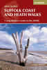 Guidebook to three long-distance routes exploring the varied landscapes of the Suffolk Coast and Heaths AONB. The Suffolk Coast Path covers 55 to 60 miles from Lowestoft to Felixstowe. The Stour and Orwell Walk is 40 miles from Felixstowe to Cattawade near Manningtree, while the Sandlings Walk is 59 miles from Ipswich to Southwold.
More information
Messaging & Social Media
Message Walking Britain and follow the latest news.

Mountain Weather
Stay safe on the mountains with detailed weather forecasts - for iOS devices or for Android devices.