Lavenham circular from Long Melford
Suffolk Walk
County/Area - Suffolk
Author - Rob Simpson
Length - 9.8 miles / 15.8 km Ascent - 400 feet / 121 metres
Time - 5 hours 20 minutes Grade - easy/mod
Maps 

| Ordnance Survey Explorer 196 | Sheet Map | 1:25k | BUY |
| Anquet OS Explorer 196 | Digital Map | 1:25k | BUY |
| Ordnance Survey Landranger 155 | Sheet Map | 1:50k | BUY |
| Anquet OS Landranger 155 | Digital Map | 1:50k | BUY |
Walk Route Description
Click image to visit gallery of 6 images.
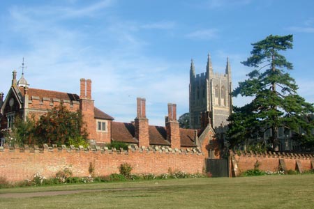
The start is the free Old School Car Park (grid ref. TL865462). Exit the car park towards the road opposite Melford Hall. Turn left with the large village green on your left and the road on your right. You pass the entrance gate to Melford Hall on your right with the Holy Trinity Church clearly visible at the top of the green on your left.
Carefully cross the two road junctions, and as the village green ends, follow the flint wall up to the entrance gates to Kentwell Hall on your left. Across the road is the Cherry Lane Garden Centre. Take care crossing the main road and take the entrance to the garden centre walking up the slope between Victorian end terrace house and garden centre fence. Keep straight ahead, past the front entrance to the garden centre, with a metal gate on the right, and follow the concrete path between the two high hedges, down the slope into what is known as Hare Drift.
Keep walking along Hare Drift until you get to the end. You will notice a metal five bar gate ahead, located just before the main bypass road. There is a wooden gate, and footpath post to your right. Go through the gate and walk straight ahead. Take care crossing the main bypass. Once across, continue ahead, either through the two metal farm gates if open, or go in via the wooden footpath gate. Follow the footpath sign direction walking down the field with the hedge on your right and large field to your left. Do not follow the Bridle Way direction sign indicating right.
Continue up the main farm path to the brow of the hill. Continue down with a large hedge and tree line at the bottom coming into view. Reaching the tree line and the field corner, bear left, and follow the footpath arrow left (grid ref. TL881469). Follow the hedgeline on your right, along the field edge, where you may spot a few old WW2 pillboxes tucked away to your right. Ignore a small footpath to your left along the second hedgeline, and shortly after, you will soon spot a gap in the tree line to your right, and a marker post. Turn right at (grid ref. TL883475) and go through the tree gap. Walk down the slope, which narrows and twists and turns. Cross a small wooden railway sleeper bridge and follow the path up the slope, until you bear to your left, and come out of the tree line. Carry on walking along the grass path, with another large tree line to your right, and on your left are meadows, and a tree line some distance away on your left.
You are now following the old railway line as it bears right. Keep on the path up the gentle slope, and walk the path between the tree line on either side, which affords dappled shade, as the high ground drops away from you on either side. Come out of the tree lined path, as you arrive at a footpath T junction (grid ref. TL891482). Walk over the wider farm path, and follow a grass footpath just slightly to your left, and follow it along the tall tree and hedgeline, on your left, almost going straight ahead. Do not turn right at the farm track T junction, and ignore the footpath discs on the post on your right, by the farm track.
As you curve right to the end of tree line, before it diverts right, look for a gap in the trees at (grid ref. TL892485) and follow the pathway through the trees, with a large ditch on your left. Keep going until you reach the end of the tree line. There is a WW2 pillbox to your left. Ignore the footpath off the main track on the right, with the wooden rails.
Coming out of the tree line, drop down a small steep slope onto the disused railway track and follow the path left, with grassy banks, wood piles and trees dotted along the way. The path can get muddy as you make your way up to two wooden rails and an old Victorian brick arched bridge at (grid ref. TL900490). The Suffolk Threads & Heritage Trail.
Go under the bridge, and keep to the long pathway straight ahead. Along the way is a small bench and low seat on your left and views of Lavenham Church on your right in the distance. See the signs stating "The Lavenham Walk" before you cross over the minor concrete road, via the metal gates, and keep following the main footpath straight ahead. Do not take the smaller paths off the main track. Eventually you approach another old brick Victorian bridge (grid ref. TL916497) and a house with a large sloping roof on your right. Follow the path all the way round to the right.
You are now on pavement with a sloping hill ahead of you that takes you through the heart of Lavenham village. Period Houses, small shops are on either side of you, as you take the right hand pathway, with Norman Way to your right, and an old fire hydrant on your left. Walk up the hill, past the Co-Op store across the road, and as you start to do downhill why not follow the sign into the old historic Market Square, by crossing the road, and walking down Market lane (grid ref. TL915493) to see the old timbered buildings in the square.
Having seen Market Square, come back out of Market Lane, turn left and walk down the pavement past The Swan Hotel, and cross the junction of Water Street on your left. Follow the pavement up and to your right, into Church Street. Soon the Cock Pub appears on your left and public toilets. Cross the main road, Lavenham Church (St Peter & St Paul) comes into view on your right. Keep walking past the low stone church boundary wall, and then turn right down Potland Lane (grid ref. TL913490).
Walk past the church. As you reach the bottom of Potland Lane, before it bears right, look immediately left for the wooden gates and the Brook Farm sign. Go through the gates at grid ref. TL912491. Follow the path with the hedge on your left. Continue through two more sets of gates until you come to the end of the path with a country road is ahead of you.
Turn right along the road and walk for a few hundred yards until you spot the small footpath sign pointing left and by the large tree, take the gravel farm track on your left (grid ref. TL904488. Follow the farm track, and notice the white Private Road sign to traffic, as you walk by. Continue on the farm track to take the right hand fork. Proceed past two large farm buildings on either side and bear right around the right hand barn. Stay on the track through the gaps in the trees and walk down the long slope for quite some distance to the end. Then take the track around to the right. You may then recognise you are back at grid ref. TL891 482 with the disused railway path entrance on your left, through the trees.
Continue walking back the way you originally came, eventually taking the sloping path to your right, over the wooden railway sleeper bridge, up the slope and back through the tree line onto the path, with the large field ahead of you at grid ref. 883475. Standing on the path facing the field turn left again, and walk back with the tree line now on your left. Ignore the first small footpath sign and track on your right, and continue until you reach the second hedgeline and footpath marker post as you follow the curve to your right, walking up the hill back to the gates and then across the main bypass road.
Carry on down Hare Drift , up the slope and past the Cherry Lane Garden Centre on your left to the entrance with the road in front of you. Taking care, cross the main road (High Street) and turn left, and walk back down the pathway with the Kentwell Hall entrance on your right. Follow the pavement beside the stone wall to reach the large Long Melford top green on your right.
Enjoy the view to your left, as you walk straight across the green. Perhaps walk through the cemetery gates and visit the large and very impressive Holy Trinity Church, before you walk down pretty Church Lane, and down to the junction with the Black Lion Hotel on your right. Cross the main road carefully and follow the wide pavement past more period houses on your right, and the large green on your left, and back down into the Old School car park, opposite Melford Hall and the end of the walk.
From here it is an easy walk straight over the bridge and into the heart of Long Melford, with its many tea shops, pubs, contemporary shops, Heritage Centre, and main street shops. There is also more free parking all the way down. Also why not visit the Country Park at the southern end of the village and a variety of interesting short walks.
Other walks nearby
| Walk 1445 | Historic Long Melford | easy/mod | 8.0 miles |
| Walk 1446 | Sudbury circular from Long Melford | easy | 5.5 miles |
| Walk 3618 | Brent Eleigh from Lavenham | easy | 5.0 miles |
| Walk 3263 | Clare and Cavendish Circular | easy/mod | 7.7 miles |
| Walk 3724 | River Box from Stoke-by-Nayland | easy | 6.0 miles |
| Walk 3245 | Woolpit and Rattelesden circular | easy/mod | 6.0 miles |
| Walk 3411 | Buxhall to Drinkstone Green | easy/mod | 7.5 miles |
| Walk 3660 | Stour Valley & Dedham from Flatford Mill | easy | 3.5 miles |
| Walk 3744 | Great Bardfield & Finchingfield Circular | easy | 4.7 miles |
| Walk 2476 | Moulton & Gazeley Circular | easy | 6.7 miles |
Recommended Books & eBooks
Suffolk Coast and Heath Walks
 Guidebook to three long-distance routes exploring the varied landscapes of the Suffolk Coast and Heaths AONB. The Suffolk Coast Path covers 55 to 60 miles from Lowestoft to Felixstowe. The Stour and Orwell Walk is 40 miles from Felixstowe to Cattawade near Manningtree, while the Sandlings Walk is 59 miles from Ipswich to Southwold.
More information
Messaging & Social Media
Message Walking Britain and follow the latest news.

Mountain Weather
Stay safe on the mountains with detailed weather forecasts - for iOS devices or for Android devices.