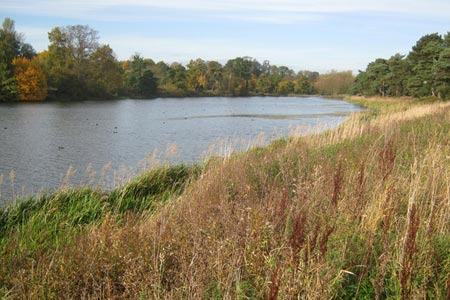
Thornton Reservoir from Ratby
Leicestershire Walk
County/Area - Leicestershire
Author - David McMahon
Length - 6.3 miles / 10.2 km Ascent - 700 feet / 212 metres
Time - 3 hours 50 minutes Grade - easy/mod
Maps 

| Ordnance Survey Explorer 233 | Sheet Map | 1:25k | BUY |
| Anquet OS Explorer 233 | Digital Map | 1:25k | BUY |
Walk Route Description
Click image to see photo description.
Ratby is a pleasant commuter village to the west of Leicester and south of the M1. Car parking is available (Monday - Friday) at Ratby Sports Ground (entrance on Desford Lane), or on the Main Street (opposite Co-op). Arriva Services 26 and 27 from Leicester offer a regular bus service.
To start the walk, continue up Desford Lane and take the bridleway off to the right. Carry on until you reach a cutting and take the path up the slope to the left. Go through a gate and then follow the headland and when you reach the end of the field take the right-hand path. After the gate the route twists and turns through an area of shrubbery; followed by another gate which takes you through into a wood which has a fine display of bluebells in spring.
Continue along the track until it opens out and turns to the right. Go through another gate and onto a wide grassy track. Follow along until there is a turn to the right and another gate. Shortly afterwards you will come to a fork and you have a choice of routes.
Option (a) Take the left-hand fork and continue along the side of a wood. Eventually you cross a footbridge and you are onto a wide wooded track. Eventually this becomes tarmac and you will have Forest Hill Golf Club on the left-hand side. You will see a yellow marker post, indicating a footpath crossing at right angles and immediately afterwards, a driveway giving vehicular access to the golf club. On the right-hand side of the gateway is a gap which brings you onto a narrow wooded footpath which takes you off the tarmac. Follow this path until you are once more on the tarmac. Continue along the tarmac until you reach Thornton Lane.
Option (b) Take the right-hand fork and continue along through wood. Eventually you cross The Ivanhoe Way (Cycle Route 63) and you carry on in the same direction to the side of John Hayes Wood. You will see a footpath coming in from the right, but pass it by and then you'll reach a fork. Take the left-hand path and this will bring you out onto the golf course. Follow the hedge-line and then the path goes into a wood, follow it through as it goes gradually uphill until you join up with the Ivanhoe Way. Continue along the tarmac until you hit Thornton Lane
Go straight across the road and follow the path as, at first, it parallels the road. It then starts to go downhill, through the edge of a copse and then into a field. Continue downhill to the bottom right-hand corner of the field, over a footbridge and then start the climb to Merrylees Road. Turn right and walk up it until you reach the junction with Reservoir Road.
From here you have several alternatives. You can continue along in the same direction what is now the Main Street of Thornton with the Reservoir Inn on the left hand side and further on, on the right, is The Bricklayers Arms (from where you can get access down onto the reservoir footpath). Another option is to turn right onto Reservoir Road and then left through the car park to the footpath which circles the reservoir and you will find a café further along. You can of course do a complete circuit of the reservoir before continuing (see walk 1591).
To continue the walk, carry on along Reservoir Road to cross the dam proper and follow the road up the slope until you see a stile on the left. Climb over it and then go diagonally to the right up the slope. At the top straighten up and follow the hedgeline along to the road. Turn left and walk along the road until you see another footpath sign on the right.
Go right along the side of the field to the end. Then go diagonally right in the next one. Over the stile and a quick left, right and left again followed by straight ahead to the gate. Go along the enclosed footpath and turn left at the end. Continue until you reach a junction. Go right and then immediately left, go to the right of the hedgerow, pass through several fields and then follow the track as it curves round to the right.
This will bring you onto a wide, gravel track. Continue along to the left, until you see a yellow marker post. Pick up the woodland footpath and continue to cross a footbridge and the path opens out. Continue, passing straight through two wooden gates and then an extremely muddy section. Cross the field diagonally right and onto Burroughs Road and finally turn left towards Ratby Main Street.
Other walks nearby
| Walk 2315 | Old John & Beacon Hill | easy/mod | 8.8 miles |
| Walk 2175 | Bradgate Park from Newtown Linford | easy | 4.8 miles |
| Walk 1592 | Thornton Reservoir | easy | 2.5 miles |
| Walk 2187 | Bradgate Country Park from Hallgates | easy | 3.4 miles |
| Walk 3087 | Normanton Park & Desford Crossroads | moderate | 11.5 miles |
| Walk 1540 | Nanpantan Reservoir, Wood Brook and Buck Hill | easy | 2.5 miles |
| Walk 1487 | Blackbrook Reservoir & Nanpantan | moderate | 12.0 miles |
| Walk 3486 | Sutton Cheney & Market Bosworth | easy/mod | 7.4 miles |
| Walk 2941 | Out Wood & Beacon Hill from Loughborough | easy/mod | 6.8 miles |
| Walk 1624 | Willoughby Waterleys & Bruntingthorpe | easy/mod | 9.2 miles |
Recommended Books & eBooks
No suggestions for this area.Messaging & Social Media
Message Walking Britain and follow the latest news.

Mountain Weather
Stay safe on the mountains with detailed weather forecasts - for iOS devices or for Android devices.