Hexton circular
Chilterns Walk
Region - Chilterns
County/Area - Hertfordshire & Bedfordshire
Author - Tony Kellett
Length - 13.0 miles / 21.1 km Ascent - 1000 feet / 303 metres
Time - 7 hours 30 minutes Grade - moderate
Maps 

| Ordnance Survey Explorer 193 | Sheet Map | 1:25k | BUY |
| Anquet OS Explorer 193 | Digital Map | 1:25k | BUY |
| Ordnance Survey Landranger 166 | Sheet Map | 1:50k | BUY |
| Anquet OS Landranger 166 | Digital Map | 1:50k | BUY |
Walk Route Description
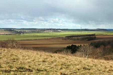
Click image to see photo description.
The northern end of the Chilterns, on the Bedfordshire Hertfordshire border almost seem to be a geological afterthought as they relatively isolated from the rest of a range of hills that stretch as far as Oxfordshire to the Southwest. It is a great place to walk though, with stunning views through mile after mile of beautiful countryside, in an area that is steeped in history, especially on the hilltops with their commanding views. This walk is an extended version of walk 2910 visiting the village of Lilley where an old fashioned pub is located.
In what is possibly the nicest part of the Chilterns and probably the least visited, this walk visits three separate groups of hills, none of which are more than 640ft high, using well marked paths such as the Icknield Way and the John Bunyan Trail. The start and finish is near the welcoming Raven Public House (grid ref TL106306) in the village of Hexton.
With the pub on your left, head north along the road for 50 meters and turn left at the signpost marked "Higham Goblon & Recreation Ground". The road soon veers to the right and a few metres later take the waymarked footpath northwest across the field on your left (Grid ref TL105 308). This is part of the John Bunyan Trail and after crossing the field and the small footbridge over a stream, the path veers left to head in a westerly direction towards the outskirts of Barton-le-Clay, with some good views of the Barton Hills to be seen to your left. Cross another footbridge over a stream to come out at the road in Barton-le-Clay and then turn left to reach the main road, crossing to the lane on the far side.
Go past the church and soon turn left onto the bridleway, with the prominent Barton Hills now in front of you. At the gate to the entrance of the Nature Reserve, leave the bridle path as it sweeps around this section and instead take the left of the two paths up through the reserve to reach the top of the hills. This is fairly steep walking up the grassy slopes, but wooden steps help to take care of the hardest sections. Gaining height fairly rapidly now, do not wait until you get to the top for the best views though. Keep looking behind from about half way up.
Follow the obvious line near the crest to reach the deep dry valley in front of you. You may wish to pause here for a while and if so then there is a handily situated wooden bench close by. This valley is an extremely unusual sight to be seen in this part of Britain and the effort to get here makes seeing it all the more worthwhile. Go left from here to leave the reserve at grid ref TL091296 and rejoin the bridleway, turning right. Continue in a southerly direction to reach the road near Barton Hill Farm.
Turn right at the road for approximately 300 metres. Cross the road to pick up the path on the other side to reach the edge of the golf course. Reaching the Icknield Way (grid ref. TL096274) continue straight ahead. The John Bunyan Trail comes in from the right (grid ref. TL100268) which you follow passing Ward's Wood on your left to turn right at grid ref. TL109269 towards Lilley reaching the main road through the village by the church.
The Lilley Arms is a good, old-fashioned pub with decent food. This can be reached by turning right along the road through the village. However the walk continues by turning left along the road (north). In less than 200 metres, turn right down a signed bridleway. At the first junction go straight ahead and walk towards the wood. Reaching the wood (grid ref. TL123269) bear left following the bridleway along Lilley Hoo. At grid ref. TL122283, bear left with Telegraph Hill on your right to meet the Icknield Way once more. Turn right.
After a short distance leave the Icknield Way and enter the Pegsdon Hills Nature Reserve (at the gateway with an information board nearby) taking a choice of paths (easiest and most direct to the right) that will lead to the trig pillar and summit of Deacon Hill, (172m). This is the last of the hills visited and the views over the Bedfordshire plains and into Hertfordshire are arguably the best to seen on the walk.
Come off the hill going to the left to reach the path alongside the road (Hitchin Road) in front of you. Leave the Reserve and cross the road at the junction to the side of Pegsdon (grid ref. TL119301). Please note the tempting direct route along the drive between Pegsdon and Hexton Manor is not a right of way and should not be used. Follow the lane north as far as the entrance to Green End and Bury Farms (grid ref. TL119306). Turn left down the lane and pass between the farms. Continue along the lane ignoring the bridleway on the right at grid ref. TL115310. Reaching a t-junction (grid ref. TL108311), turn left. This will lead you back to reach the Raven pub and the end of the walk.
Other walks nearby
| Walk 1130 | Clophill and Haynes Circular | easy/mod | 6.0 miles |
| Walk 3115 | Ampthill & Steppingley Circular | easy/mod | 9.0 miles |
| Walk 3513 | Ampthill and Clophill Circular | moderate | 12.0 miles |
| Walk 2810 | Haynes Circular | easy/mod | 7.0 miles |
| Walk 2221 | Circular from St Paul's Walden to Little Almshoe | easy/mod | 7.0 miles |
| Walk 2708 | Cuckolds Cross & Whitwell from St Paul's Walden | easy/mod | 7.0 miles |
| Walk 1985 | Houghton Park Circular | easy | 4.0 miles |
| Walk 3409 | The Three Counties Tops | mod/hard | 17.0 miles |
| Walk 2316 | Dunstable Downs Circular | easy | 4.0 miles |
| Walk 3089 | Dunstable Downs & Totternhoe from Robertson Corner | easy/mod | 8.8 miles |
Recommended Books & eBooks
No suggestions for this area.Messaging & Social Media
Message Walking Britain and follow the latest news.

Mountain Weather
Stay safe on the mountains with detailed weather forecasts - for iOS devices or for Android devices.