Burrator Reservoir from Yelverton
Dartmoor Walk
Nat Park - Dartmoor
County/Area - Devon
Author - Peter Smyly
Length - 8.5 miles / 13.8 km Ascent - 900 feet / 273 metres
Time - 5 hours 10 minutes Grade - easy/mod
Maps 

| Ordnance Survey Explorer OL28 | Sheet Map | 1:25k | BUY |
| Anquet OS Explorer OL28 | Digital Map | 1:25k | BUY |
| Ordnance Survey Landranger 201 | Sheet Map | 1:50k | BUY |
| Anquet OS Landranger 201 | Digital Map | 1:50k | BUY |
Walk Route Description
Click image to visit gallery of 6 images.
The Devon village of Yelverton is the start and end point for this walk that includes a circuit of the Burrator Reservoir. This is a pleasant countryside ramble which includes a few gentle up and down slopes particularly on the narrow country lane between Yelverton and Meavy. Four of Dartmoor's tors are seen in the distance from different points on the route - Sheeps Tor, Leather Tor, Sharpitor and Down Tor.
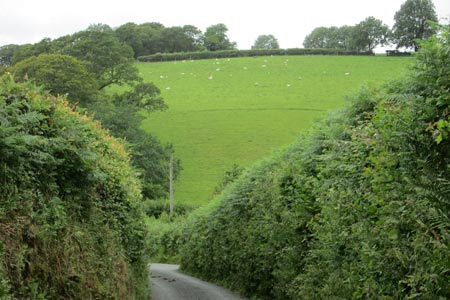
The route is an "out and back" to, and then a circular route around, the reservoir. The "out and back" section adds up to a few miles of road walking but along narrow country lanes with high hedges and bracken and occasional vehicles. Beyond the hedges there are pastoral views of fields, hedgerows, low hills and grazing livestock. The church at Meavy is seen above the hedgerows some time before the village is reached.
Start the walk at the main road of Yelverton (grid ref. SX520678) and walk along Meavy Lane in a south-easterly direction. For much of this stretch there is a pavement on one side of the road or the other but this road is relatively busy with traffic before you leave it to turn left at the next road junction along a much quieter country lane - actually a continuation of Meavy Lane. This lane leads all the way to the village of Meavy where there is a village green, a church and a pub. Follow the road ahead and when a house appears directly ahead, the road goes round to the left in front of it. This is the point (grid ref. SX543672) where you leave the road and follow a public footpath on the left of the house, across a field and through woodland. The route passes through three wooden gates in quick succession. After the third gate, the path divides at a fork. Take the left hand path uphill through woods. This path leads to a road and a short walk to the right along the road brings you to one of the two dams of the Burrator Reservoir. From the dam, there is a view across the expanse of water, leading the eye to Sheeps Tor on the far horizon.
For this route, follow the road ahead to enable a circuit in a clockwise direction. There are various points on the route where there is an optional digression along paths down to the reservoir since tree cover means it is largely not seen from the road. A waterfall appears on the left but this is artificial - the clue is in the pipe at the top from which the water appears. A little further on a totem pole appears outside a visitors centre where you can learn about the history of the area and see on a map what the region looked like before the reservoir was created.
Of the four tors seen on the walk, Sheeps Tor appears the most inviting for a route extension with a car park and path on the eastern side of the reservoir. Dartmoor ponies may be seen along the route. The road back to the dam leads past mossy dry stone walls and moss-covered trees. At a T junction, bear right and follow the road back to the dam. On the way there is an optional slight digression worth doing where there is a small car parking space on the right for perhaps three cars and a walk along a path leads in fifty metres or so to one of the better views of the walk looking out across the reservoir from the second dam. Once back at the first dam, provided you remember the outgoing route from earlier in the day, you can put your map away. The pub at Meavy is your last possible refreshment stop before returning to Yelverton.
Other walks nearby
| Walk 2015 | The Meavy & Plym valleys from Shaugh Bridge | moderate | 6.0 miles |
| Walk 2016 | Cross Gate to Nuns Cross via Leather Tor | moderate | 8.0 miles |
| Walk 1083 | Eylesbarrow & Sheeps Tor | moderate | 8.0 miles |
| Walk 3671 | Nun's Cross & Peat Cot from Princetown | easy/mod | 7.0 miles |
| Walk 2013 | The Plym Valley from Plym Bridge | easy | 5.0 miles |
| Walk 2018 | Saltram Park & Hardwick Wood, Plymouth | easy | 5.0 miles |
| Walk 2230 | Exploring Plymouth | easy | 6.5 miles |
| Walk 3387 | Upper Erme Valley & Ugborough Moor | moderate | 9.3 miles |
| Walk 3223 | Avon Dam Reservoir & White Barrows | easy/mod | 5.5 miles |
| Walk 2219 | The Avon Dam Reservoir from Shipley Bridge | easy | 3.5 miles |
Recommended Books & eBooks
No suggestions for this area.Messaging & Social Media
Message Walking Britain and follow the latest news.

Mountain Weather
Stay safe on the mountains with detailed weather forecasts - for iOS devices or for Android devices.