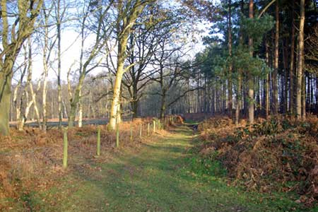
The Brecks from near Thompson
Norfolk Walk
County/Area - Norfolk
Author - Lou Johnson
Length - 6.8 miles / 11.1 km Ascent - 200 feet / 61 metres
Time - 3 hours 40 minutes Grade - easy
Maps 

| Ordnance Survey Explorer 229 | Sheet Map | 1:25k | BUY |
| Anquet OS Explorer 229 | Digital Map | 1:25k | BUY |
| Ordnance Survey Landranger 144 | Sheet Map | 1:50k | BUY |
| Anquet OS Landranger 144 | Digital Map | 1:50k | BUY |
Walk Route Description
Click image to see photo description.
This walk starts in the parking alongside the old railway close to the A1075 between Watton and Thetford (grid ref. TL940965). After parking walk to the north (i.e. back towards the main road) and take the concessionary path on your left into woodland. The path is waymarked and takes a somewhat indirect route to reach a lane (grid ref. TL933966).
Turn left along the lane. Initially with a tarmac surface the lane soon becomes a restricted by-way with hedges either side. Where this ends (grid ref. TL928955) continue on another concessionary footpath The path goes half left to the far corner of the first field and enters woodland (Thompsons Carr). Reaching a track (grid ref. TL919951) turn right (north) following the waymarks. After 100 metres turn left off the track and follow the path through moor woodland to skirt the northern shore of Thompson Water and soon after to reach a clear track (grid ref. TL912950).
Turn left (south) along the Peddars Way & North Norfolk Coast Path heading south. This track runs dead straight and was a former Roman Road. Stay on this road for nearly a mile and a quarter. The track becomes more substantial as you proceed south and where it turns right (grid ref. TL920932), take the path off to the left. This follows the northern boundary of Cranberry Wood for 600 metres before turning right onto a track heading south. This track leads to the old railway line (grid ref. TL927931). Turn left along the old railway and you will reach the car park used at the start of the walk after just over two miles of easy but pleasant walking.
Other walks nearby
| Walk 2436 | The Nar Valley from Castle Acre | easy | 6.1 miles |
| Walk 2246 | Tittleshall, Mileham & Godwick | easy/mod | 7.0 miles |
| Walk 2075 | Tyrrel's Wood and Boudicca Way | easy/mod | 8.5 miles |
| Walk 1834 | Shelton & Fritton Common from Tyrrels Wood | easy/mod | 7.0 miles |
| Walk 2242 | Cavenham Heath and Lark Valley from Mildenhall | easy/mod | 7.8 miles |
| Walk 3245 | Woolpit and Rattelesden circular | easy/mod | 6.0 miles |
| Walk 3256 | Great Bircham & Fring Circular | easy/mod | 8.4 miles |
| Walk 3411 | Buxhall to Drinkstone Green | easy/mod | 7.5 miles |
| Walk 3678 | Brampton & the Bure Valley from Buxton | easy/mod | 6.0 miles |
| Walk 3348 | River Yare & Claxton from Rockland Staithe | easy | 5.2 miles |
Recommended Books & eBooks
No suggestions for this area.Messaging & Social Media
Message Walking Britain and follow the latest news.

Mountain Weather
Stay safe on the mountains with detailed weather forecasts - for iOS devices or for Android devices.