Mare Way & Wimpole Estate from Orwell
Cambridgeshire Walk
County/Area - Cambridgeshire
Author - Lou Johnson
Length - 5.2 miles / 8.5 km Ascent - 300 feet / 91 metres
Time - 2 hours 50 minutes Grade - easy
Maps 

| Ordnance Survey Explorer 209 | Sheet Map | 1:25k | BUY |
| Anquet OS Explorer 209 | Digital Map | 1:25k | BUY |
Walk Route Description
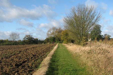
Click image to see photo description.
A Cambridgeshire walk that provides a scenic excursion into the varied countryside lying to the north of the village of Orwell. The route follows part of the Mare Way which also forms a section of the Harcamlow Way. The walk also enters the National Trust's Wimpole Estate. On street parking is available (grid ref. TL363504) and there is a small car park opposite the village hall on the north side of the High Street.
After parking walk west along High Street and just before reaching the parish church take the signed public footpath to Hillside by metal railings. Follow this path north to reach the A603 (Hillside). Cross the road with care and turn right. After 100 metres turn left onto Rectory Farm Lane joining the Greenwich Meridian Trail. After 400 metres, you reach a bungalow (halfway House). Turn right here and follow the path with the hedge to your right. The path crosses two fields to reach the Mare's Way (grid ref. TL363518).
Turn left and enjoy the views over the surrounding countryside soon reaching the reservoir marked on OS maps (grid ref. TL352254) and the adjacent OS Trig point. Continue straight ahead, joining the Harcamlow Way, with the hedge to your left. You soon reach the edge of woodland on your left. The path soon enters the wood and you need to take a clear path on your left (grid ref. TL339525). Follow this path to a T-junction. Turn left and continue along the track through Wimpole Woods. There is a grassy path leading off to the right which leads to a fine viewpoint over the Wimpole Estate.
After enjoying the view, return to the main path and continue to a 'crossroads' of tracks. Turn right soon regaining open countryside and descend to Cobb's Wood Farm. Keep to the left of the barns and join a track. Turn right past the front of Cobb's Wood Farm and cross the bridge over a small stream. Turn left onto a path between buildings soon turning left over a small footbridge. Once across, walk right parallel to a stream on your left to reach a track (grid ref. TL346512). Cross the track and following the clear path across the northern flank of Thornberry Hill. Reaching the corner of a wood (grid ref. TL351510), follow the clear path with the woodland to your left. This leads you to the A603. Cross this main road with care and walk along Fisher's Lane into Orwell to reach the start of the walk.
Other walks nearby
| Walk 3103 | Wimpole Park and Whaddon | easy/mod | 8.3 miles |
| Walk 1599 | Therfield Heath circular from near Royston | easy/mod | 6.5 miles |
| Walk 1812 | Therfield to Royston & Reed Circular | easy/mod | 10.0 miles |
| Walk 2305 | Gamlingay, Tetworth & Everton from Potton | easy/mod | 9.5 miles |
| Walk 1118 | Roe Green and Sandon from Therfield circular | easy/mod | 7.3 miles |
| Walk 1963 | Elsworth & Conington | moderate | 10.1 miles |
| Walk 2107 | Reed to Nuthampstead Circular | easy/mod | 7.3 miles |
| Walk 3721 | Oakington and Longstanton round via Rampton Drift | easy | 6.0 miles |
| Walk 2220 | Hertfordshire Way from Nuthampstead to Great Hormead | easy/mod | 10.0 miles |
| Walk 3113 | Sandy and Everton Circular | easy/mod | 7.5 miles |
Recommended Books & eBooks
No suggestions for this area.Messaging & Social Media
Message Walking Britain and follow the latest news.

Mountain Weather
Stay safe on the mountains with detailed weather forecasts - for iOS devices or for Android devices.