Cuckolds Cross & Whitwell from St Paul's Walden
Hertfordshire Walk
County/Area - Hertfordshire
Author - Donald Morton
Length - 7.0 miles / 11.4 km Ascent - 400 feet / 121 metres
Time - 3 hours 50 minutes Grade - easy/mod
Maps 

| Ordnance Survey Explorer 182 | Sheet Map | 1:25k | BUY |
| Anquet OS Explorer 182 | Digital Map | 1:25k | BUY |
| Ordnance Survey Landranger 166 | Sheet Map | 1:50k | BUY |
| Anquet OS Landranger 166 | Digital Map | 1:50k | BUY |
Walk Route Description
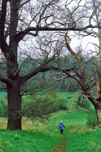
Click image to visit gallery of 5 images.
This Hertfordshire walk starts from St Paul's Walden, a small hamlet on the B651 between Whitwell and Hitchin. It has associations with Queen Elizabeth, the Queen Mother, who was born at The Bury just north of Whitwell which, although now a much larger village, is within the parish. The church itself (where the Queen Mother was baptised in 1900) dates from the 14th Century and is notable for an English Baroque chancel. It can be reached by turning off the B651 up the side of the Strathmore Arms PH. The walk is described from the parking place opposite the church (Grid Ref TL193222).
Having parked, start the walk by continuing up the lane, past the church, past a lane on the right and continuing on gravel past a 17th(?) century redbrick house to the tarmac drive to the Sue Ryder Home at Stagenhoe. Turn left towards the house, but on reaching the gates go to the right to follow the iron fence on your left. Where the fence bends left go straight on through a gap between bushes to reach a waymark at a cross path. Turn left and follow this enclosed green lane which soon becomes more open. Where it descends into a dip turn right on a broad path to continue downhill towards a prominent white house. The path swings to the left and joins a gravel track from the right. When you come level with the white house, turn right to go through an iron barrier and past the house to a lane.
Turn left and at the next T-junction turn left again. After passing the charming Stagenhoe Bottom Farm and a group of comparatively modern rural cottages, turn right on Public Restricted Byway 15 to Bendish Lane. After going over the headwaters of the River Mimram the track swings right and left before following the field edge, hedge right, to the lane. Turn right and then, after a right bend, turn left down another green lane signed as a "Public Highway" to Long Lane. Follow it through a hedge gap (where we watched as three kestrels soared and glided gracefully over the fields) and along a field edge, hedge right. Level with the outlying buildings of Bendish (and a dump for old farm machinery) the track swings left and then through a hedge gap to continue along another field edge, hedge left. Where the hedge finishes, the track swings right over an open field, and then after going over a cross track, continues - now more grassy - over a second open field.
When it comes to a T-junction, turn left through a hedge gap and continue down a field edge (hedge right, and vistas right of traditional fields over Whiteway Bottom) to reach a lane (here the track is signed as Public Restricted Byway 19). Turn right and walk along the lane to The Holt. Just past The Holt turn left over a stile on a footpath signed to Pancake Wood. Three more stiles take you across small paddocks, and after the last cross the next larger pasture, aiming to the left of an obvious hole in the hedge ahead. As you approach you will see that a stile leads into the woods. You quickly emerge to follow the field edge, hedge right, as far as a waymark. Here turn left along an unploughed grass strip, heading first for the corner of a wood and then a large cream painted house.
This is at Cuckolds Cross, one of only two houses, on the B651. There must be a story, a legend, some sort of old English usage behind the name, but I have been unable to find it. (There is an explanation for a similarly named place in another county, that it was given in compensation to the wronged husband by the cuckolder; but there is no apostrophe here so, fancifully, perhaps the derivation is that it was here that two cheating husbands would meet, exchange friendly greetings, and then each, unsuspected and unsuspecting, hasten to enjoy their assignation with the other's wife.) There is possibly another more recent story to be unearthed. Not so long ago when one drove along the B651 there was a place name "Cuckolds Cross" as one approached. This has now gone. Why? A new oversensitive resident, a PC council official? What's next? Removal from the OS maps? And obliteration of a traditional place name?
At the B651 turn right and after 20 yards left down a footpath along a field edge, hedge left. The next section may be rather tricky. The farmer here apparently does not believe in restoring footpaths - leastways, when we walked the route, crops were already showing and the paths were still not restored - so it is a matter of luck how many walkers have trod them before you from ploughing through spring and shown the way. Along the field edge you find a waymark post. Here turn right over an arable field aiming downhill for the corner of a hedge. When you arrive here there turns out to be at a waymark on a cross path. Turn left at right angles (going NE) across the same arable field aiming for a gap in the hedge ahead.
Here you join the Hertfordshire Way and continue (still NE) about 1/3rd diagonally right across a large arable field; if there have been no previous walkers, there is nothing to aim for until a large cedar comes into sight - aim well to the left of this - and then, when you get to the brow of the hill, you should be able to spot a hedge gap as you descend into the "bottom". A waymark at the hedge gap with a Hertfordshire Way sign on the opposite side confirms you are on track. Here the route, still apparently unrestored, changes direction to go uphill (almost due N) slightly diagonally left from the hedge gap. Again there is nothing to aim for until reaching the brow of the hill when another hedge gap comes into view ahead. Cross a "Public Highway", go through the hedge gap and diagonally towards a power line pole where you turn right. At the fence turn left and in a few yards right down an enclosed path to the B651 opposite The Old Brewery in Whitwell (the core High Street is interesting but much else is new development).
Turn right and in 100 yards or so turn left on a public footpath, signed as the Chiltern Way Extension. At R V Restorers turn left through a kissing gate, across pasture, over the River Mimram, through a second kissing gate, over a track and then up an enclosed path which takes you to the drive leading to The Bury, birthplace of the late Queen Mother. The enclosed path goes between paddocks belonging to a rare breeds farm so look out for unusual breeds: the view of The Bury is surprisingly unrestricted. When you reach the drive to The Bury, it is tempting to cross over and continue through the open gate and along the clear track opposite, but this goes into the private parkland. Instead turn right down the tarmac drive (the left hand one of the two) and follow it until it turns sharp right. Here go straight on a gravel drive past a house with ornate windows, ignore a track forking right, and soon arrive back at St Paul's Waldon church.
Other walks nearby
| Walk 1372 | Ayot St Lawrence Circular | easy | 6.0 miles |
| Walk 2338 | The Upper Mimram Valley | easy | 5.7 miles |
| Walk 2944 | Ayot St Lawrence to Ayot St Peter Circular | easy | 4.6 miles |
| Walk 2799 | Ayot Green Circular | easy | 4.3 miles |
| Walk 1532 | Wheathampstead circular | easy | 4.5 miles |
| Walk 2945 | Lea Valley from Batford to Mill Green | easy/mod | 8.5 miles |
| Walk 1810 | Graveley and Warren's GreenWeston | easy/mod | 7.0 miles |
| Walk 1139 | St Albans via Redbournbury Watermill from Harpenden | moderate | 12.0 miles |
| Walk 1503 | Weston & Clothall circular Weston | easy | 5.5 miles |
| Walk 2970 | The Beane Valley from Walkern to Hertford | moderate | 14.3 miles |
Recommended Books & eBooks
No suggestions for this area.Messaging & Social Media
Message Walking Britain and follow the latest news.

Mountain Weather
Stay safe on the mountains with detailed weather forecasts - for iOS devices or for Android devices.