Between Beeston and Old Warden
Bedfordshire Walk
County/Area - Bedfordshire
Author - Donald Morton
Length - 11.5 miles / 18.7 km Ascent - 250 feet / 76 metres
Time - 6 hours 0 minutes Grade - easy/mod
Maps 

| Ordnance Survey Explorer 208 | Sheet Map | 1:25k | BUY |
| Anquet OS Explorer 208 | Digital Map | 1:25k | BUY |
| Ordnance Survey Landranger 153 | Sheet Map | 1:50k | BUY |
| Anquet OS Landranger 153 | Digital Map | 1:50k | BUY |
Walk Route Description
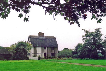
Click image to visit gallery of 8 images.
Beeston is a small dormitory area of Sandy bordered by the A1. It seems now to be mostly newish development but at one time was a typical rural village, established by the time of the Norman Conquest, and being fortunate in having a long green. This still survives and the older cottages are mainly down one side, so that much of its former charm is retained. The other side, formally named The Green, provides plenty of parking space and this walk starts from opposite number 25 (Grid Ref TL169481) where the Greensand Ridge Walk is picked up.
Start by walking across the green, down an enclosed footpath to the right of a timbered house and straight on along a field break. At the end of the field dogleg left/right to go along a field edge with a ditch on the right. At the end of the second field turn left on a wide track for some 200 yards. At a sandstone obelisk (and information board about the history of farming in the area and wild life to look out for) turn down an avenue of mixed broadleaf trees created in 1990 which brings you to a lane. Cross and carry straight on down a broad track to a gate. Here you have bear left and in about 100yds turn right to skirt a nature reserve. (Judging by the amount of bird song in the area, a successful one.) After crossing a bridge, an enclosed path continues straight out into an open field and then with a hedge left out into a road. Turn left and follow the road into Northill, an ancient settlement now a harmonious mix of houses and cottages of all periods with a 14th Century church and, right next door, an 18th Century pub.
In the village turn right up Bedford Road. At No19, The Barracks, turn left up a gravel track and then continue straight on between fenced paddocks. After passing the medieval fishponds on the left enter Home Wood. Go straight on over a cross track and later a bridge to reach a t-junction where you turn left. Look out for a waymark post where you turn right following the Greensand Ridge Walk marker. On exiting the wood turn left and then right to skirt the field with the wood on the left. At the next field corner the path goes into the wood, bears right to come to a kissing gate. In order to avoid the large Georgian Highlands Farm the path bears left to a gate visible in the fence ahead, and then bears right towards the left hand corner of the farm buildings. Go up the side of the farm and then straight on across the pasture to the gate ahead in the wood edge. This turns out to be only a thin strip of woodland and on emerging, turn left and then right go up a wide field break. (Noticeable birdsong again around this point.) At the end of the field turn left on a crossing bridleway - not the better looking one 50yds further on, but the one that runs just inside woodland with fields left. Look out for a waymark post on the left and turn right here over a bridge. After about 50yds turn left between fields; views over N Bedfordshire and the old airship sheds at Cardington can be seen over to the right. At the field corner at a crossing of paths leave the Greensand Ridge Walk and turn left on a bridleway, hedge right.
At the field corner go over a bridge and continue down the field edge, hedge left, to Palmers Wood. As you go the views to the North stretch as far as the historic County of Huntingdonshire. You cannot enter the wood directly but must turn right, then after about 150yds cross a bridge on the left to follow the broad track through. When you emerge go straight on soon following the edge of another wood. (At the first corner of this look out for the two communication masts disguised as trees - give them credit for trying - and at the far corner there is a rough bench with a restful view which is a convenient place for sandwiches.) Go straight on through the kissing gate which soon brings you to the 12th Century Old Warden Church (unfortunately not open weekdays but it is a pleasant spot with lots more seats for sandwich time). The drive goes past the church but level with the south porch turn right onto a footpath. Over to the left can be seen the mansion built by Joseph Shuttleworth in 1875, and now an Agricultural College. The path goes along the fence, through a gate and then descends steeply to the village to a road where you turn left. The road is lined with "chocolate box" cottages, and the Hare and Hounds pub, and larger buildings but few, if any, older than 1872 when Shuttleworth bought the estate and created the village as it is today. Still it's a nice overall effect (but do mind the traffic while you are looking). Just before the entrance to the estate and opposite Parsonage Piece (one of the original older cottages, albeit updated by Shuttleworth) turn right onto a footpath to go uphill through pines. At the top of the hill the way continues as a broad drive through larch and pines. It gradually swings left, passing permissive access routes to renovated Queen Anne's Summerhouse and Keeper's Cottage, before descending to a lodge cottage by a road. Turn left down the road. On the right look out for the lake in the grounds of Southill Park and perhaps a glimpse of the enormous 18th Century mansion built by Admiral George Byng and now the home of the Whitbread family (there must be a lot of money in beer), but in summer at least it is all pretty well concealed behind trees. Before the trees on the right end turn left on a broad bridleway.
Go straight on until a waymark points left. This, apparently unnecessarily, points you down a path to a brook where it turns right alongside the brook before coming out on a field edge which is a continuation of the line you were on before the diversion. Carry on with the brook on the left to come out to an Agricultural College service road. Turn right and at a broad passing place turn left onto a bridleway. Cross the field with a fence right to another bridle gate and continue with a pond and then a brook on your left. You dogleg left/right to cross the brook and continue with it on you right and then, after you have crossed it again, turn left to go round the side of Biggleswade Aerodrome. Signs state that it is forbidden to use the path "for static purposes" - don't stand and gawp - and I am sure this is enforced on air display days, but we enjoyed a free show from aircraft practising aerobatics for a little while without being moved on. After passing the airfield the path comes to a road. Cross and continue up The Sheep Walk. After not a great distance look out for a finger post pointing to Upper Caldecote 3/4m. Turn right over the bridge and across the field to a gap, slightly right, in the hedge opposite. Cross the bridge and go straight on along a field edge and then between field to Upper Caldecote. At the road turn left. On reaching number 56, turn right to walk past a narrow three storey 19th Century farmhouse and along the green. Where the tarmac ends and become grass and then totally grass, bear left. Keep close to the backs of houses so that you do not miss the double metal handrail where you turn left to come out on an estate road. Follow this straight out to a main road. Turn left and opposite No 18 turn right down a Public Footpath. At the end of the enclosed section turn right for about 150yds and then left. After nearly 1/2 mile between fields, having gone straight on at a cross path, turn right at a t-junction. Go along the field edge, ignore one field break left and then turn left up a concrete track. Follow this when it swings right to go between derelict glass houses (Is there any sadder sight?) until just before a big breeze block shed turn left to arrive at one end of The Green at Beeston. (Between the start of the glasshouses and the green there are more information boards about the local wild life, including one devoted to skylarks on the nearby fields. Thanks should be given to the volunteer Beeston Wildlife Group who provide the boards and encourage interest in and study of the local environment.)
Other walks nearby
| Walk 2123 | Everton & Potton | moderate | 12.0 miles |
| Walk 3113 | Sandy and Everton Circular | easy/mod | 7.5 miles |
| Walk 2305 | Gamlingay, Tetworth & Everton from Potton | easy/mod | 9.5 miles |
| Walk 2810 | Haynes Circular | easy/mod | 7.0 miles |
| Walk 1130 | Clophill and Haynes Circular | easy/mod | 6.0 miles |
| Walk 1985 | Houghton Park Circular | easy | 4.0 miles |
| Walk 1798 | Little Paxton & River Ouse Circular | easy/mod | 6.4 miles |
| Walk 3103 | Wimpole Park and Whaddon | easy/mod | 8.3 miles |
| Walk 3115 | Ampthill & Steppingley Circular | easy/mod | 9.0 miles |
| Walk 3513 | Ampthill and Clophill Circular | moderate | 12.0 miles |
Recommended Books & eBooks
No suggestions for this area.Messaging & Social Media
Message Walking Britain and follow the latest news.

Mountain Weather
Stay safe on the mountains with detailed weather forecasts - for iOS devices or for Android devices.