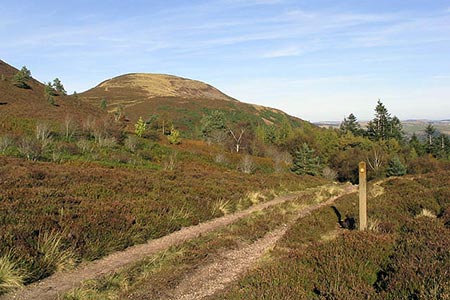
The Eildon Hills from Melrose
Scottish Borders Walk
County/Area - Scottish Borders
Author - Lou Johnson
Length - 5.3 miles / 8.6 km Ascent - 1400 feet / 424 metres
Time - 4 hours 0 minutes Grade - easy/mod
Maps 

| Ordnance Survey Explorer 338 | Sheet Map | 1:25k | BUY |
| Anquet OS Explorer 338 | Digital Map | 1:25k | BUY |
Walk Route Description
Click image to see photo description.
The Eildon Hills rise sharply from the landscape to the south of Melrose. The area is crossed by many paths, which for some can be confusing. However, in periods of clear visibility the next objective is always in view so that navigation is much easier than might be the case with low cloud on the summits. As might be expected the views are superb and worth the effort of the ascent involved in this route.
The start is the Market Square in Melrose (grid ref. NT558340) where there is usually ample parking. After parking walk, north on Abbey Street towards Melrose Abbey. Turn right and follow Priorswalk alongside the Abbey into a park. Cross footbridge and go left where the path forks onto the Borders Abbey Way. Stay on the pavement along Priorswalk. When this road bends to the right, take the footpath on the left (grid ref. NT552341). Follow this path for 800 metres to reach Dean Road (grid ref. NT560341).
Go left and then right onto the Borders Abbey Way through trees. Continue under a railway bridge and through an underpass below the A6091. Once under the A6091, turn right onto a track heading south and continue to reach a road (grid ref. NT563336). Turn right along the lane and after 80 metres take the path on the left. Reaching a strip of woodland on your left (grid ref. NT562333) to reach a gate. Keep left where the path forks and start the steep ascent onto Eildon North Hill. Reaching the summit take a breather and enjoy the wonderful views. It is also worth checking the location of Eildon Wester Hill and Eildon Mid Hill as these are the next two summits to be climbed.
Descend southwest keeping right when the path divides. At the next path junction, bear right and continue downhill to the broad col before Eildon Mid Hill and a cross path (grid ref. NT550234). Turn left on clear path (St Cuthbert's Way) and descend towards Broad Wood. Do not enter the woods, instead bear right along the edge of the woods on a clear path. Keep left at first junction (grid ref. NT549320) and continue to the summit of Eildon Wester Hill where a different panorama awaits with views to the Cheviots in the south.
Retrace your steps to the path junction at grid ref. NT549320 and turn left. Keep right at the next two path junctions to reach the steep path climbing onto Eildon Mid Hill. Continue uphill to the highest point in the Eildon Hills from where the Lake District Fells are visible on a clear day. From the trig point the path zigzags down to the col between Mid and North Hills. Go straight ahead at a 'crossroads' of paths to reach the St Cuthbert's Way (grid ref. NT550325).
Turn left and follow this clear path (St Cuthbert's Way) across the eastern flank of North Hill descending gradually. Join a track and continue through two large fields. Cross a stile, walk down some steps, go over a footbridge and take the steps up to Dingleton Road (grid ref. NT547338). Turn right and continue back to the start.
Other walks nearby
| Walk 3576 | River Tweed & Dryburgh Abbey | easy | 5.5 miles |
| Walk 3293 | Three Brethren & Brown Knowe from Yarrowford | moderate | 8.3 miles |
| Walk 1944 | Yarrow Valley Five Hills Circular | mod/hard | 11.4 miles |
| Walk 3296 | Grubbit Law & Hownam Law from Morebattle | moderate | 7.0 miles |
| Walk 1201 | Black Hag from Kirk Yetholm | moderate | 8.5 miles |
| Walk 1894 | Burnhope Reservoir Circular | easy | 2.8 miles |
| Walk 2241 | Gladhouse Reservoir | easy | 4.0 miles |
| Walk 1314 | Great Hetha and Elsdon Burn from Hethpool | easy/mod | 4.0 miles |
| Walk 3644 | Blackhaggs Rigg & Great Hetha from Hethpool | moderate | 9.6 miles |
| Walk 3646 | Hethpool, Sutherland Bridge & Great Hetha | moderate | 6.0 miles |
Recommended Books & eBooks
The Borders Abbeys Way
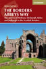 Guidebook to the Borders Abbeys Way, a 68 mile circuit in the Scottish Borders, taking in 4 of Britain's grandest ruined medieval abbeys. Beginning and ending in Tweedbank, the route, which is described over 6 stages, is as rich in history as it is in pastoral charm. Relatively flat, it is suitable for people with a moderate level of fitness.
More information
Walking in the Southern Uplands
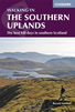 Guidebook to 44 varied day walks and over 100 summits in the Southern Uplands of Scotland, stretching south-west from Edinburgh to the English border, including the Galloway and Pentland Hills. Between 2 and 29km, there is something for all seasons and all abilities in remote and rugged hill country.
More information
Messaging & Social Media
Message Walking Britain and follow the latest news.

Mountain Weather
Stay safe on the mountains with detailed weather forecasts - for iOS devices or for Android devices.