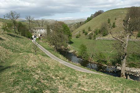
The River Aire & Kirkby Malham from Malham
Yorkshire Dales Walk
Nat Park - Yorkshire Dales - Malhamdale
County/Area - North Yorkshire
Author - Lou Johnson
Length - 3.0 miles / 4.9 km Ascent - 320 feet / 97 metres
Time - 1 hours 50 minutes Grade - easy
Maps 

| Ordnance Survey Explorer OL30 | Sheet Map | 1:25k | BUY |
| Anquet OS Explorer OL30 | Digital Map | 1:25k | BUY |
| Ordnance Survey Landranger 98 | Sheet Map | 1:50k | BUY |
| Anquet OS Landranger 98 | Digital Map | 1:50k | BUY |
Walk Route Description
Click image to visit gallery of 3 images.
The village of Malham is popular with visitors who explore the village and make the 'pilgrimage' to Malham Cove. This Yorkshire Daless walk goes in the opposite direction to most of the visitors and explores the Aire Valley and Malhamdale. For those staying in the area, this route is an ideal summer evening walk as you can stop for a drink in the pub in Kirkby Malham.
This walk starts from the Visitor Centre (Grid ref SD900627) located on the approach to Malham. Exit the car park onto the main road. Cross over and walk a short way towards the village centre before taking the signed footpath on your right. This path heads south in the field opposite the visitor centre and initially crosses meadows towards Kirkby Malham. In just over 500 metres the path follows goes alongside a mill race, which is followed past Scalegill Mill. Shortly after the mill there is a path junction. Fork right here and climb up the field to meet the road from Malham to Kirkby Malham (Grid ref. SD896611).
Turn left along the road into the attractive village of Kirkby Malham. Follow the main where it turns left and continue past cottages to the pub, which is a short way along on your right. Just past the pub, turn left and walk down the lane to cross the River Aire (Grid ref. SD900611). Continue along the lane past Hanlith Hall and then uphill into the hamlet of Hanlith. At a sharp bend (Grid ref. SD901614) the Pennine Way goes off left. Take this and follow the clear path across meadows with the River Aire below to your left.
Reaching the path junction near Mires barn (Grid ref. SD902264) go straight ahead towards Malham village. Turn left over the bridge and turn left down the road to reach the start.
Other walks nearby
| Walk 1282 | Malham Tarn & Arncliffe | moderate | 12.5 miles |
| Walk 3092 | Malham Cove, Malham Tarn & Watlowes | easy | 4.4 miles |
| Walk 2385 | Airton & Bell Busk Circular | easy/mod | 6.8 miles |
| Walk 1377 | Calton and Hanlith Moors | easy/mod | 6.5 miles |
| Walk 2066 | Winterburn Reservoir circular | easy | 6.0 miles |
| Walk 1701 | Bordley Hall & Malham Moor from Threshfield Moor | easy/mod | 7.0 miles |
| Walk 2332 | Mastilles Lane & Bordley from Kilnsey | easy/mod | 6.8 miles |
| Walk 3107 | Flasby Fell from Flasby | easy/mod | 6.5 miles |
| Walk 3109 | Rylstone Edges & Cracoe from Rylstone | easy/mod | 6.0 miles |
| Walk 2617 | Nappa Cross & Victoria Cave from Langcliffe | moderate | 9.5 miles |
Recommended Books & eBooks
Pennine Way Map Booklet
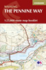 Map of the 270 miles (435km) Pennine Way National Trail, between Edale in the Peak District and Kirk Yetholm in the Scottish Borders. This booklet is included with the Cicerone guidebook to the trail, and shows the full route on Ordnance Survey 1:25,000 maps. This popular long-distance route typically takes three weeks to complete.
More information
Walking in the Yorkshire Dales: North and East
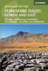 This guidebook contains 43 circular day walks in the north and east Yorkshire Dales. It explores the dales, hills and moors between Kirkby Stephen and Pateley Bridge. Walking ranges from gentle 3 mile strolls to more strenuous day-long rambles across the Howgills, Wensleydale, Swaledale, Nidderdale, Mallerstang and Coverdale.
More information
Messaging & Social Media
Message Walking Britain and follow the latest news.

Mountain Weather
Stay safe on the mountains with detailed weather forecasts - for iOS devices or for Android devices.