Circular from Great Gaddesden to Little Gaddessden
Chilterns Walk
Region - Chilterns
County/Area - Hertfordshire
Author - Donald Morton
Length - 7.5 miles / 12.2 km Ascent - 770 feet / 233 metres
Time - 4 hours 30 minutes Grade - easy/mod
Maps 

| Ordnance Survey Explorer 181 | Sheet Map | 1:25k | BUY |
| Anquet OS Explorer 181 | Digital Map | 1:25k | BUY |
| Ordnance Survey Landranger 165 | Sheet Map | 1:50k | BUY |
| Anquet OS Landranger 165 | Digital Map | 1:50k | BUY |
| Ordnance Survey Landranger 166 | Sheet Map | 1:50k | BUY |
| Anquet OS Landranger 166 | Digital Map | 1:50k | BUY |
Walk Route Description
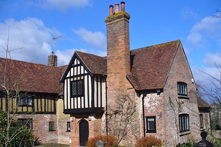
Click image to see photo description.
This Hertfordshire walk starts from a dirt layby on the A4146 (Grid ref TL030116), the Hemel Hempstead to Leighton Buzzard Road. The layby is opposite 4 blocks of houses on the right hand side of the road coming from Hemel Hempstead just after passing the turning signed to Great Gaddesden and with a large Wyvale Garden Centre notice. Coming from Leighton Buzzard after passing the crossroads with lanes going off to Little Gaddesden and Studham look out for Bradden Lane on the left: the houses are soon after on the left with the layby opposite.
Start the walk through the kissing gate at the Hemel Hempstead end of the layby, signed Hertfordshire Way. Go across the field and over a long wooden bridge over the river Gade and a patch of swampy ground. Once over the bridge bear left and emerge through another kissing gate by a childrens' play area. This is Great Gaddesden: it is the parish which is bigger in area; as a village it is much smaller than Little Gaddesden which was a "company town" for the Ashridge estate. Turn left along the road, pass the school, ignore a road on the right and come to a T junction. Turn right and go up the lane past some typical redbrick and timber houses. Pass the lane to the right signed to St Margarets and continue along this quiet lane for about 1km, up over Piper's Hill and down into the pretty little village of Nettleden. You come out in front of the church and turn right along the road for a few yards before turning left up a road marked unsuitable for motor vehicles.
The road soon becomes a track, ascending in a walled ravine under a bridge to emerge at the top of the hill, and then descending to the hamlet of Frithsden. On the way you pass Frithsden Vineyard, currently being brought back into production with the first wine possibly available in 2008. You emerge into Frithsden itself by the Alford Arms. Cross the road and go up the slightly stepped track through woods. Continue on this track until you come out onto a drive to the left of a large house. Cross the drive, go through a barrier and continue along an enclosed path between gardens. At the end go through another barrier, at crossing paths turn right and then right again to emerge - with a green on the right and a hole on the left -at the golf course which originated on Berkhamsted Common in the 1880s.
Take the path between tee and hole and then, with due consideration to the golfers, skirt the right hand side of the course along the backs of gardens. This is the route of the Hertfordshire Way. It soon plunges into a narrow strip of woodland between the fairway and the gardens. It is actually a bridle way so, although it maybe muddy, it is easy to follow out to a road (Grid ref TL005096). Cross the road and continue diagonally right across the fairway - watch out to the left before crossing - towards a line of trees: hoof marks in the grass define the line. At the far side continue through the trees with the golf course now on both sides. The path through the trees ends with hole 6 on the right and tee 7 on the left. Follow the bridle path straight on - muddy in winter but possible to find parallel tracks. The muddiest part terminates at a finger post at crossing bridle paths. Again go straight on through gorse bushes and down a broad grass avenue between woods. On the right are Frithsden Beeches - ancient woodland with National Trust signs warning of the danger from falling branches: it is not unusual to see deer hereabouts.
The grass avenue ends with Brickkiln Cottage on the left. You now leave the Hertfordshire Way to turn right down a gravel drive with Frithsden Beeches on the right and a wide open grassy space on left. Follow the drive down to the road. Turn left along the road and in about 100yards or so pass "Charnis" and then turn right up a footpath and permissive bridle path - Gaddesden 1 mile. Where the ways fork, keep left past "Rodinghead" and continue down an enclosed footpath with wide expansive views to the right. At the end go through a kissing gate and straight on over a wide field to a gate in a fence. Through this and you are at the end of Golden Valley. Cross to the other side and to the left of a water treatment plant find a broad gravel track. Follow this up behind the plant and as it swings left to come out a road (Grid ref TL001122). This is the outskirts of Great Gransden; the main part of the village stretches as a strip along the road to the left for about 2 miles. Cross the road to the pavement and turn right. Go past Ashridge Cottages 1929 and opposite Cromer Close turn left down a footpath, signed to Nettleden. You have now rejoined the Hertfordshire Way which will take you back to the start. Go right diagonally across the field and through a gate, at the top of a valley, into an enormous field under cultivation. The footpath is apparently not restored after ploughing or planting and there are no waymarks. However, other walkers will probably have come this way to show the route which goes straight on descending down the valley bottom. Look out for an isolated clump of trees up to the left. When you come level with it this is where you leave the path which goes on to Nettleden (Grid ref TL007118). Turn left at right angles to your previous direction to go up hill to pass to the left of the trees. There may be a small pile of stones to mark the junction of the two paths but there is no waymark. Again other walkers will probably have pioneered the trail. But if you cannot discern one, once you have passed the trees, bear diagonally right aiming for the tallest trees to the right of a white house. When you arrive, you will discover that they surround a small pond: skirt this to come out at track.
Turn right and go along this track for about 1km. On the right you will come to buildings behind a wall including what look like accommodation huts. They possibly are, for this is Amavarati Buddhist Temple which offers contemplative retreats. Opposite to these take a footpath to the left signed Great Gransden. An enclosed path round the edge of the field exits through a kissing gate into a field. Cross this past a clump of trees on the left, go through a gate and hedge gap and straight on to the opposite corner of the field (at the corner of the grounds of the 12th century church). Turn left past garages, then right through a small estate to arrive back at the kissing gate by the children's play area. From here back over the water meadows to the start.
Other walks nearby
| Walk 1833 | Great Gaddesden from Jockey End | easy | 5.2 miles |
| Walk 1504 | Potten End Circular | easy/mod | 6.0 miles |
| Walk 3503 | Circular from Berkhamsted | easy | 4.0 miles |
| Walk 1297 | Berkhamsted and Northchurch Commons | easy | 5.0 miles |
| Walk 1399 | Berkhamsted & Northchurch Commons | easy | 5.5 miles |
| Walk 1007 | The Ashridge Estate circular | easy/mod | 6.0 miles |
| Walk 3097 | Markyate and Flamstead Circular | easy/mod | 7.0 miles |
| Walk 2907 | Hemel Hempstead Circular | easy | 6.5 miles |
| Walk 3537 | Hemel Hempstead, Great Gaddesden, Nettleden & Potten End | moderate | 10.8 miles |
| Walk 1999 | The Chilterns above Tring | moderate | 12.0 miles |
Recommended Books & eBooks
No suggestions for this area.Messaging & Social Media
Message Walking Britain and follow the latest news.

Mountain Weather
Stay safe on the mountains with detailed weather forecasts - for iOS devices or for Android devices.