Cross Hills to Skipton via Low Bradley
North Yorkshire Walk
County/Area - North Yorkshire - Skipton
Author - Allan Friswell
Length - 6.5 miles / 10.6 km Ascent - 1100 feet / 333 metres
Time - 4 hours 20 minutes Grade - easy/mod
Maps 

| Ordnance Survey Explorer OL2 | Sheet Map | 1:25k | BUY |
| Anquet OS Explorer OL2 | Digital Map | 1:25k | BUY |
| Ordnance Survey Explorer OL21 | Sheet Map | 1:25k | BUY |
| Anquet OS Explorer OL21 | Digital Map | 1:25k | BUY |
| Ordnance Survey Landranger 103 | Sheet Map | 1:50k | BUY |
| Anquet OS Landranger 103 | Digital Map | 1:50k | BUY |
| Ordnance Survey Landranger 104 | Sheet Map | 1:50k | BUY |
| Anquet OS Landranger 104 | Digital Map | 1:50k | BUY |
Walk Route Description
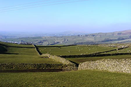
Click image to visit gallery of 5 images.
A straightforward linear ramble taking in the picturesque villages of Kildwick and Low Bradley on the Leeds & Liverpool Canal. Parking in Crosshills town centre is usually straightforward and will allow you to catch one of the half-hourly buses back from Skipton.
From Cross Hills centre (grid ref. SE008453) pass the chemist's on your left and then turn down Station Road, making for the Skipton - Keighley road. As you near the roundabout take the underpass on the left and, after passing beneath the road, cross the old stone bridge into Kildwick, where the bustle and noise suddenly vanishes. Climb the steps of the church, and follow the path to the left. Cross the bridge over the canal and, passing through the gap stile, climb the narrow path to the lane at the top. Turn left and walk downhill for 200 yards to the steps and footpath on the right. The path soon forks and you should follow the narrower one, keeping close to the wall.
When you reach the farm, the path goes to the left of the building and almost at once forks. Take the right hand path, and wander gently uphill, enjoying the lovely view over the Aire Valley and the quietness of the accompanying trees. At grid ref SE011472 take the rather indistinct path up towards the wall through the silver birches. By following this path close to the wall you will come to a step stile (grid ref. SE012474) which you cross and then turn left. Follow the path and moving gently away from the wall make for the corner and negotiate another step stile.
Do not make for the obvious stile ahead but make for that about 25 yards to its left in the field corner. Once over this start to descend towards Low Bradley, keeping the wall on your right and passing through a couple of stiles and a gateway to a concrete track. This brings you a tarmacked lane, where you cross the stile on the left by Sire Bank farm and continue down towards Low Bradley. You pass a spring whose bubbling waters lead you to a hole in the wall which you pass through, then through a metal gate. You will see two more gates ahead - take the right hand one and walk into the village.
Walk between the cottages and pass the church on your right. Turn right along College Road. This soon brings you to massive double fronted stone house with the date 1678 above the door. The path runs ahead to the left via a couple of gates. Drop left down the slight hill to the lane which you follow left over the beck, then turning right past Eller Ghyll Cottage. Walking round behind the cottage you should follow the unsigned and indeed invisible path along the left edge of the field to a gate, a short narrow path and then another lane where you turn right.
Climb steeply for 150 yards to the bench and stile on the left. As you climb the latter the panorama of Low Bradley lies before you. Ignore the misaligned finger post but follow the left hand wall, pass through the gate and maintain your line with the wall now on your right. Pass through a gap in the wall ahead and continue uphill to the stile by a metal gate. Cross the charming walled green lane, over another stile and at the next one, where two paths converge, (grid ref. SE000492) take that to the left. Your next stile is clear, Skipton is ahead and the sprawl of Snaygill Industrial estate is to your left. Follow the left hand wall.
Negotiate the narrow squeeze still (are there any fat Yorkshiremen?), heading downhill at 11 o'clock to the stile in the corner. Then follow the right hand edge of the field to the corner, look down to your left to see the crossing point over the beck. The path then runs alongside the beck. Go through the gate (permissive footpath, although this seems a bit whimsical of the landowner) and cross the meadow to the "style", (grid ref. SE998498) though small fence with a hole and no step might be more apposite. From here go straight ahead, passing hawthorn bushes on your left, passing close to a power pole and descending to a sturdy bridge.
Once over this, keep ahead parallel with the power lines, emerging on to a metalled lane. Turn right. Passing Cawder Hall Cottages' entrance drive, go through the gate and where the path forks take the left hand arm. Soon it bends sharply left, and you leave it, walking ahead across the meadow, eventually having a wall on your left and crossing the beck cutting deeply below you on the right.
Cross the step stile by the gate and follow the clear track gently upwards. Cross the refurbished step stile, and then head steeply uphill to a marker post. Maintain your line, though you may have slight difficulty crossing the beck, and go over the stile by the gate at the top. Keep straight on, and the reservoir suddenly appears below you on the outskirts of Skipton. Pass under two sets of power lines and just before reaching the third set go over the stile in the wall on your left.
The path starts to descend slowly to a new stile, where you follow the left hand path. Where it forks the more attractive of the two is the right hand one with a low wall on your left and the noise of the beck below you still pleasingly obvious. Eventually it joins a broader track - just keep descending. Watch out for the tree roots! The rural walk ends suddenly at an estate of houses. Follow this road all the way into the centre of town.
Here you've two choices. Either turn left to the bus station for transport to Cross Hills, or keep straight on to the canal where the more hardy can turn left and walk the 5 ½ miles back to Kildwick and then Cross Hills.
Other walks nearby
| Walk 3430 | Farnhill Moor from Kildwick | easy/mod | 4.5 miles |
| Walk 3215 | Steeton to Ilkley without a car | moderate | 7.5 miles |
| Walk 2657 | Bradleys Both, near Skipton | easy/mod | 5.5 miles |
| Walk 3079 | Silsden Reservoir circular | easy | 6.0 miles |
| Walk 1793 | Lothersdale | easy/mod | 6.0 miles |
| Walk 2661 | Keighley Moor Reservoir & Hitching Stone from Cowling | moderate | 9.5 miles |
| Walk 2861 | Pinhaw Beacon from Lothersdale | easy | 4.0 miles |
| Walk 2942 | Below Silsden Moor | easy/mod | 6.8 miles |
| Walk 1135 | Top Withins and the Bronte Bridge | moderate | 8.0 miles |
| Walk 1811 | Sharp Haw in Airedale | easy/mod | 7.0 miles |
Recommended Books & eBooks
Trail and Fell Running in the Yorkshire Dales
 Guidebook to 40 of the best trail and fell runs in the Yorkshire Dales National Park. Ranging from 5 to 24 miles, the graded runs start from bases such as Ribblehead, Dent, Sedbergh, Malham and Grassington and take in the region's diverse delights, from castles and waterfalls to iconic mountains such as Whernside, Ingleborough and Pen Y Ghent.
More information
Messaging & Social Media
Message Walking Britain and follow the latest news.

Mountain Weather
Stay safe on the mountains with detailed weather forecasts - for iOS devices or for Android devices.