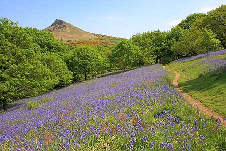
Roseberry Topping from Newton under Roseberry
North York Moors Walk
Nat Park - North York Moors - North York Moors West
County/Area - Redcar and Cleveland
Author - Lou Johnson
Length - 3.2 miles / 5.2 km Ascent - 600 feet / 182 metres
Time - 2 hours 10 minutes Grade - easy
Maps 

| Ordnance Survey Explorer OL26 | Sheet Map | 1:25k | BUY |
| Anquet OS Explorer OL26 | Digital Map | 1:25k | BUY |
Walk Route Description
Click image to see photo description.
Roseberry Topping is an easily recognised North York Moors hill that offers some wonderful views over the surrounding countryside and moorland. The start of this walk is carpark off the A173 on the south side of the village of Newton under Roseberry.
After parking walk to the northern end of the parking area and take the path through trees to reach Roseberry Lane. Turn right along the lane and climb very gently to reach a junction of paths and tracks at the western edge of Newton Wood (grid ref. NZ574128). Bear left here and continue along the lane. Go through the first gate and at the second date bear right uphill. You are now on Brant Gate path. At the first fork in the path go left. The path climbs steadily and veers to the right. At this point take the left hand path and continue through a gate.
After the gate stay on the main path and take the second path on the right (grid ref. NZ579129). Follow this rising path as it climbs gently around Roseberry Topping until it reaches a fence (grid ref. NZ5832126). Turn right here and follow the path alongside the wall to reach the summit. After having enjoyed the views, turn south-east from the summit descending quite steeply to reach a fence. Turn right along the fence losing height down to a gate (grid ref. NZ577123). Go through the gate and take the left-hand footpath and continue in a southerly direction to reach a path junction (grid ref, NZ575117).
Turn right and follow the path which after one field enters the southern end of Newton Wood. Continue down through the wood to reach a track that leads down to cross the railway. Just before crossing the railway, turn right and take the path running parallel to the railway north towards the A173. Turn right along this often busy main road. Initially the path is on the grass verge of the road but you soon reach a stile on your right. Cross the stile and turn left to follow the path through fields running parallel to the road. This path leads back to the start.
Other walks nearby
| Walk 1330 | Roseberry Topping & Captain Cook's Monument | easy/mod | 6.5 miles |
| Walk 1467 | Cleveland Way - Roseberry Common to Tidy Brown Hill | moderate | 15.0 miles |
| Walk 3165 | Roseberry Topping & Highcliff Nab from Eston | moderate | 14.3 miles |
| Walk 3319 | Eston Moor from Flatts Lane | easy | 3.0 miles |
| Walk 1050 | Highcliff Nab & Roseberry Topping from Slapewath | moderate | 10.5 miles |
| Walk 2685 | Highcliff Nab and Guisborough Moor | moderate | 11.1 miles |
| Walk 1468 | Wain Stones, Bank Foot & Bloworth Crossing | moderate | 14.3 miles |
| Walk 1538 | Baysdale Circular | moderate | 9.5 miles |
| Walk 1469 | Carlton Bank, Scugdale, Raisdale & Kirby Bank | moderate | 10.5 miles |
| Walk 3418 | Cringle Moor & the Wain Stones | easy/mod | 6.0 miles |
Recommended Books & eBooks
No suggestions for this area.Messaging & Social Media
Message Walking Britain and follow the latest news.

Mountain Weather
Stay safe on the mountains with detailed weather forecasts - for iOS devices or for Android devices.