Thurlestone circular from Bantham
Devon Walk
County/Area - Devon
Author - Lou Johnson
Length - 4.0 miles / 6.5 km Ascent - 250 feet / 76 metres
Time - 2 hours 20 minutes Grade - easy
Maps 

| Ordnance Survey Explorer OL20 | Sheet Map | 1:25k | BUY |
| Anquet OS Explorer OL20 | Digital Map | 1:25k | BUY |
| Ordnance Survey Landranger 202 | Sheet Map | 1:50k | BUY |
| Anquet OS Landranger 202 | Digital Map | 1:50k | BUY |
Walk Route Description
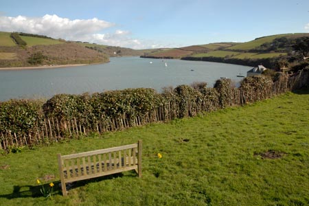
Click image to visit gallery of 9 images.
This short walk offers some superb views of Burgh Island and includes a fine section of cliff top walking. The start is the large car park (grid ref. SX663437) between the beach and the village at Bantham on the south side of the River Avon. Bantham is reached by a lane (narrow in places) from the A381/A379 near Churchstow.
After parking we decided the first priority was to visit the beach. Facing the sea we walked to our right and then continued around the Ham, an area of dunes adjacent to the river, before making our way back to the kiosk where you pay parking fees. Continue along this road past the Sloop Inn. Bear right at the road junction and then turn sharp right to pick up the signed footpath to Thurlestone. This descends to a field. Turn sharp left and then cut across the field to follow a well beaten track up a steep hill. During this ascent you get excellent views to the beach and beyond.
Follow the signed route to Thurlestone joining a tarmac road near the church (grid ref. SX672428), which is on your right. Continue past the war memorial and down the lane passing tennis courts on your left. Turn right onto the driveway to the Golf Club and continue on until you arrive at the sea (grid ref. SX674421). Turn sharp right to pick up the South West Coast Path keeping the sea on your left.
All that remains is to follow the clear path back to the car park at Bantham enjoying the magnificent seascapes as you walk. Do be careful if you have small children with you as there are a couple of sections of the path with a steep drop to the sea. Looking back you will see a rock arch just off the coast and as you get nearer to Bantham look out for the small rock stack beside the cliffs. As you near the Avon estuary the view to Bigbury-on-sea and across the water to Burgh Island is superb and is probably the highlight of the walk.
Other walks nearby
| Walk 2461 | Warren Point & Bolt Tail from Bantham | moderate | 9.0 miles |
| Walk 3657 | Bigbury-on-Sea, Arymer Cove & Burgh Island | easy/mod | 5.0 miles |
| Walk 1975 | Erme Mouth | moderate | 9.0 miles |
| Walk 3432 | Salcombe to Thurlestone | mod/hard | 11.0 miles |
| Walk 3276 | Gara Point & Stoke Point from Noss Mayo | easy/mod | 7.0 miles |
| Walk 2012 | Wembury Bay & St Peter's Church from Noss Mayo | easy/mod | 6.0 miles |
| Walk 1866 | East Prawle & Prawle Point | easy/mod | 4.1 miles |
| Walk 2474 | East Prawle Coast Circular | easy/mod | 5.6 miles |
| Walk 3431 | Beeson to Salcombe | mod/hard | 12.0 miles |
| Walk 3387 | Upper Erme Valley & Ugborough Moor | moderate | 9.3 miles |
Recommended Books & eBooks
The South West Coast Path
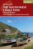 Guidebook to walking the entire South West Coast Path National Trail. The route runs for 630 miles from Minehead to Poole along the north Devon, Cornish, south Devon and Dorset coastline. Divided into 45 stages, this long-distance coastal trek could be completed within 4 weeks, or walked in sections. Guide includes maps and essential information.
More information
South West Coast Path Map Booklet - St Ives to Plymouth
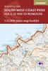 Map of part of the southern section of the 630 mile (1014km) South West Coast Path National Trail. Covers the trail from St Ives to Plymouth along the west Cornwall and Devon coastline. This convenient and compact booklet of Ordnance Survey 1:25,000 maps shows the route, providing all of the mapping you need to walk the trail in either direction.
More information
Messaging & Social Media
Message Walking Britain and follow the latest news.

Mountain Weather
Stay safe on the mountains with detailed weather forecasts - for iOS devices or for Android devices.