Beinn Ghlas & Ben Lawers from near Killin
Perth and Kinross Walk
County/Area - Perth and Kinross
Author - Lou Johnson
Length - 6.5 miles / 10.6 km Ascent - 2900 feet / 879 metres
Time - 6 hours 10 minutes Grade - mod/hard
Maps 

| Ordnance Survey Explorer OL48 | Sheet Map | 1:25k | BUY |
| Anquet OS Explorer OL48 | Digital Map | 1:25k | BUY |
| Ordnance Survey Landranger 51 | Sheet Map | 1:50k | BUY |
| Anquet OS Landranger 51 | Digital Map | 1:50k | BUY |
Walk Route Description
Click image to visit gallery of 6 images.
Ben Lawers is a relatively easy proposition as far as Scottish Munros are concerned. The start is reached by taking a minor road off the A827 Killin to Aberfeldy road about five miles east of Killin. The start, the small Information Centre, is situated above 400 metres so there is a considerable saving in ascent.
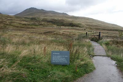
After parking (Grid ref. NN608378) exit the car park at the northeastern end through a gate and onto a well maintained path. This continues, climbing gently, through a fenced off area where natural ground cover is protected from hungry sheep. The contrast between the open hillside and this protected area is remarkable.
Exiting the protected area the path continues towards the foot of Ben Lawers' southern ridge. Keep right at the first path junction after which the climbing begins in earnest. The path, generally excellent, climbs easily in zigzags with no problems at all. As height is gained the view south across Loch Tay is superb and always a good excuse for a rest!
The ascent steepens for the next section soon reaching the summit of Beinn Ghlas (1103m.) from where the route ahead is in view. Away to your left are some crags and an equally spectacular view north towards Glen Lyon. Losing height is always annoying but the path is easy and the way ahead interesting. Reaching a col to which we will return later the start of the final ascent to Ben Lawers begins.
Again the path is excellent and the climb hardly noticeable as you head ever upwards to Ben Lawers' summit (1214m.). The view of the whole area is good and much what one would anticipate being on Scotland's 10th highest mountain. Once thought to be over 4000 feet, recent surveys have confirmed this status cannot be confirmed.
Return down the path to the col between Beinn Ghlas and Ben Lawers. Exit right on a descending path that contours across the northwestern flank of Beinn Ghlas. This is another excellent path and rapid progress is made to the col below Meall Corranaich where a stop to enjoy the view is worthwhile.
Continuing down hill you reach the junction just outside the fenced area. Turn right go through the gate into the enclosure and retrace your steps back to the car park.
Other walks nearby
| Walk 2185 | Ben Vorlich from Loch Earn | moderate | 6.0 miles |
| Walk 1046 | Schiehallion via main path | moderate | 6.4 miles |
| Walk 1406 | Ben More and Stob Binnein | mod/hard | 6.0 miles |
| Walk 1968 | Loch Turret to Comrie | easy/mod | 8.0 miles |
| Walk 3747 | Ben Chonzie from Loch Turret | mod/hard | 10.0 miles |
| Walk 2418 | Inverlochlarig, Beinn a'Chroin & Beinn Chabhair | hard | 12.5 miles |
| Walk 1350 | Ben Ledi from near Falls of Leny | moderate | 5.5 miles |
| Walk 3647 | Callander, Samson's Stone & Coilhallan Wood | easy | 4.7 miles |
| Walk 1019 | Beinn an Dothaidh & Beinn Dorain | moderate | 8.5 miles |
| Walk 3277 | Beinn Dorain | mod/hard | 6.2 miles |
Recommended Books & eBooks
No suggestions for this area.Messaging & Social Media
Message Walking Britain and follow the latest news.

Mountain Weather
Stay safe on the mountains with detailed weather forecasts - for iOS devices or for Android devices.