Salcombe to Thurlestone
Devon Walk
County/Area - Devon
Author - Andy Smith & Tony Maries
Length - 11.0 miles / 17.9 km Ascent - 3000 feet / 909 metres
Time - 8 hours 30 minutes Grade - mod/hard
Maps 

| Ordnance Survey Explorer OL20 | Sheet Map | 1:25k | BUY |
| Anquet OS Explorer OL20 | Digital Map | 1:25k | BUY |
| Ordnance Survey Landranger 202 | Sheet Map | 1:50k | BUY |
| Anquet OS Landranger 202 | Digital Map | 1:50k | BUY |
Walk Route Description
Click image to visit gallery of 3 images.
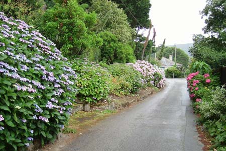
South Devon offers some of the finest coastline on mainland Britain, ranging from golden sandy beaches to dramatic rocky cliffs plunging into the sea. Although this route is spread over two days, the going is relatively easy as this section of the South West Coast Path is well walked and the way ahead clear. The walk takes in the lovely seaside resort of Salcombe as the half waypoint, with its stunning cliff top approach from the east.
Day Two - Starting from the ferry point on the estuary in Salcombe (Grid ref SX741388), pick up the South West Coast Path signs along the tiny coast road passing the castle remains and south sands beach. Head south to Sharp Tor, which proved to be the main highlight of the entire walk. Once there the views on a good day are totally stunning, to the north you can look right up the estuary and over the whole of Salcombe, whilst to the east at least 5km of pre-walked coastline can be seen. Looking west, Bolt Head springs into view, which is the next step, although very heavy going at this point as you painfully climb up from the very steep Stairhole Bottom. There now follows almost 7km of barren landscape as you head towards Bolt Tail and Outer Hope.
After admiring the fine views from Bolt Tail, drop down into the town where there are a useful number of shops and public toilets etc. The last leg of the journey heads directly north passing Thurlestone Sands, and turning into the village (grid ref. SX 676431) itself where hopefully you remember where you parked the other car! A perfect weekend along Britain's south coast is completed.
Other walks nearby
| Walk 1866 | East Prawle & Prawle Point | easy/mod | 4.1 miles |
| Walk 2474 | East Prawle Coast Circular | easy/mod | 5.6 miles |
| Walk 3431 | Beeson to Salcombe | mod/hard | 12.0 miles |
| Walk 1857 | Start Point & East Prawle | moderate | 8.2 miles |
| Walk 3427 | Slapton Sands & Stokenham from Torcross | easy/mod | 8.0 miles |
| Walk 3346 | Start Point from Torcross | easy/mod | 8.0 miles |
| Walk 2461 | Warren Point & Bolt Tail from Bantham | moderate | 9.0 miles |
| Walk 3041 | Thurlestone circular | easy | 4.0 miles |
| Walk 3657 | Bigbury-on-Sea, Arymer Cove & Burgh Island | easy/mod | 5.0 miles |
| Walk 1975 | Erme Mouth | moderate | 9.0 miles |
Recommended Books & eBooks
The South West Coast Path
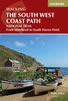 Guidebook to walking the entire South West Coast Path National Trail. The route runs for 630 miles from Minehead to Poole along the north Devon, Cornish, south Devon and Dorset coastline. Divided into 45 stages, this long-distance coastal trek could be completed within 4 weeks, or walked in sections. Guide includes maps and essential information.
More information
South West Coast Path Map Booklet - Minehead to St Ives
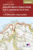 Map of the northern section of the 630 mile (1014km) South West Coast Path National Trail. Covers the trail from Minehead to St Ives along the north Devon and Cornish coastline. This convenient and compact booklet of Ordnance Survey 1:25,000 maps shows the route, providing all of the mapping you need to walk the trail in either direction.
More information
Messaging & Social Media
Message Walking Britain and follow the latest news.

Mountain Weather
Stay safe on the mountains with detailed weather forecasts - for iOS devices or for Android devices.