Argyll and Bute WalksWalking Routes & Hiking Trails
Find Argyll and Bute walks from the list below which features the best walking routes in the area. Most are circular walks and are listed from the shortest and easiest to the longest more challenging routes.
| Walk | Description | Grade | Miles |
|---|---|---|---|
| 2597 | Cnoc an Sroine from Selen | easy/mod | 6.00 |
| 3699 | The Black Lochs from Connel | easy/mod | 6.00 |
| 1406 | Ben More and Stob Binnein from Benmore Farm | mod/hard | 6.00 |
| 3277★☩ | Beinn Dorain from Bridge of Orchy | mod/hard | 6.20 |
| 2491★ | Old Military Road from Victoria Bridge | easy/mod | 6.50 |
| 2317★☩ | Ben Vorlich from Ardlui | mod/hard | 6.80 |
| 1298★☩ | The Cobbler from Arrochar | mod/hard | 7.50 |
| 1459★☩ | Ben Arthur ("The Cobbler") from Arrochar | mod/hard | 7.50 |
| 1606 | Ben Cruachan and Meall Cuanail | hard | 8.00 |
| 1296★☩ | Beinn Eich & Doune Hill from Glenmollochan Farm | mod/hard | 8.00 |
| 1019★☩ | Beinn an Dothaidh & Beinn Dorain from Bridge of Orchy | moderate | 8.50 |
| 1865★ | Loch Dochard (near Bridge of Orchy) | easy/mod | 8.50 |
| 1495 | WHW - Day 5 - Inveroran to Kinlochleven | moderate | 19.00 |
| 1494 | WHW - Day 4 - Inverarnan to Inveroran | moderate | 21.00 |
Walks that start in adjacent counties / areas.
Walks that start in adjacent counties or areas but cross the boundary and include sections of the route within Argyll and Bute.
| Walk | Description | Starts In |
|---|---|---|
| 1493 | WHW - Day 3 - Rowardennan to Inverarnan | Stirling |
| 2552 | West Highland Way Experience | East Dunbartonshire |
| 1490 | West Highland Way - A personal experience | East Dunbartonshire |
★ GPS file ☩ Route profile
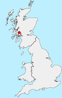
Location Map
Other walks in Britain - For a list of all the areas where walks are available go to the Main Walk Index.
Walk grading - Learn how each walk is assessed and select a walk to suit your ability and experience by going to Walk Grading Details.
Messaging & Social Media
Message Walking Britain and follow the latest news.

Mountain Weather
Stay safe on the mountains with detailed weather forecasts - for iOS devices or for Android devices.