East Yorkshire WalksWalking Routes & Hiking Trails
Find East Yorkshire walks from the list below which features the best walking routes in the area. Most are circular walks and are listed from the shortest and easiest to the longest more challenging routes.
| Walk | Description | Grade | Miles |
|---|---|---|---|
| 1575 | Tophill Reservoir | easy | 3.00 |
| 2482★ | Fordon and Dales Circular | easy/mod | 5.20 |
| 2141★ | Brantingham & Elloughton Dale | easy/mod | 5.70 |
| 3428★ | Boynton from Rudston Circular | easy | 6.50 |
| 2921★ | Bempton Cliffs from Flamborough | easy/mod | 6.70 |
| 2264★ | Bridlington & Flamborough Head | easy/mod | 6.80 |
| 2655★ | Wayram To Fridaythorpe Circular | easy/mod | 7.50 |
| 3740★ | Cowlam & Cottam Circular | easy/mod | 8.00 |
| 1649★ | Spurn Head from Kilnsea | easy/mod | 8.50 |
| 2906★ | Circular from Wayrham Through Painsthorpe | moderate | 8.50 |
| 1779★ | Horse Dale, Holm Dale, Tun Dale and Frendal Dale from Huggate | easy/mod | 9.00 |
| 3349★ | Pasture Dale, Frendal Dale and Horsedale from Huggate | easy/mod | 9.10 |
| 1620★ | Flamborough Head from Flamborough | easy/mod | 9.70 |
| 1760★ | Pocklington Canal, Melbourne & East Cottingwith | easy/mod | 11.00 |
| 2727★ | Pocklington Canal from Allerthorpe Wood | moderate | 11.00 |
| 1842★ | Buttercrambe & Youlthorpe from Stamford Bridge | moderate | 11.80 |
| 3127★ | Bishop Wilton & Millington | moderate | 13.40 |
Walks that start in adjacent counties / areas.
Walks that start in adjacent counties or areas but cross the boundary and include sections of the route within East Yorkshire.
| Walk | Description | Starts In |
|---|---|---|
| 2703★ | Thixendale & Kirby Underdale | North Yorkshire |
★ GPS file ☩ Route profile
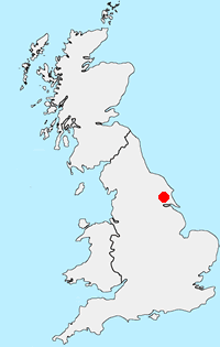
Location Map
Other walks in Britain - For a list of all the areas where walks are available go to the Main Walk Index.
Walk grading - Learn how each walk is assessed and select a walk to suit your ability and experience by going to Walk Grading Details.
Messaging & Social Media
Message Walking Britain and follow the latest news.

Mountain Weather
Stay safe on the mountains with detailed weather forecasts - for iOS devices or for Android devices.