Northumberland WalksWalking Routes & Hiking Trails
Find Northumberland walks from the list below which features the best walking routes in the area. Most are circular walks and are listed from the shortest and easiest to the longest more challenging routes.
Great walks in the Northumberland National Park listed below cater for walkers of all abilities from easy circular walks to harder routes across the hills and moors. All walks are free to download and print and all routes have GPX files. The walks explore Hadrian's Wall and cross the wild hills and moors further north including the Cheviot, which is the highest point in this National Park.
| Walk | Description | Grade | Miles |
|---|---|---|---|
| 2153★ | Housey Crags from Langleeford | easy/mod | 2.00 |
| 1805★ | An introduction to the Breamish Valley | easy | 2.00 |
| 3404★ | Hadrian's Wall - Cawfields to Steel Rigg | easy/mod | 3.50 |
| 1314★ | Great Hetha and Elsdon Burn from Hethpool | easy/mod | 4.00 |
| 2163★ | Darden Pike & Darden Lough | easy/mod | 4.20 |
| 2152★ | Hartshope Linn (waterfall) from Langleeford | easy | 4.40 |
| 1202★ | The Simonside Hills near Rothbury | easy | 4.50 |
| 2148★ | Simonside Circular | easy/mod | 4.70 |
| 3343★ | Hadrian's Wall, Walltown Crags & Aesica | easy/mod | 5.00 |
| 2671★ | Hotbank Crags & Housesteads from Vindolanda | easy | 5.30 |
| 2169★ | Chew Green & Upper Coquet Valley | easy/mod | 5.80 |
| 3353★ | The Roman Camp at Chew Green | easy/mod | 5.80 |
| 3646★ | Hethpool, Sutherland Bridge & Great Hetha | moderate | 6.00 |
| 1200★☩ | Windy Gyle from Coquet Valley | moderate | 7.50 |
| 2337★ | Greenlee Lough and Steel Rigg | easy/mod | 7.50 |
| 1677★ | Peel Crags & Winshield Crags from Vindolanda | easy/mod | 7.80 |
| 2251★ | Yearning Saddle & Brownhart Law | moderate | 7.80 |
| 2095★ | Simonside Hills & Rothbury | moderate | 7.90 |
| 1198★ | Hadrian's Wall & Steel Rigg | moderate | 8.00 |
| 3739★ | Elsdonburn & Trowupburn from Hethpool | moderate | 8.20 |
| 1763★☩ | Mozie Law & Windy Gyle from Coquet Valley | moderate | 8.20 |
| 1764★☩ | The Cheviot from Langleeford | mod/hard | 8.20 |
| 3331★ | Cragend & Crow Crags from Housesteads | easy/mod | 8.40 |
| 1201★ | Black Hag from Kirk Yetholm | moderate | 8.50 |
| 1765★☩ | Comb Fell & Hedgehope Hill from Langleeford | mod/hard | 8.90 |
| 2299★☩ | The Cheviot from College Valley | moderate | 9.00 |
| 3085★ | The Dodd & Wether Cairn from Alwinton | moderate | 9.50 |
| 3644★☩ | Blackhaggs Rigg & Great Hetha from Hethpool | moderate | 9.60 |
| 1776★☩ | The Cheviot & Auchope Cairn from Langleeford | mod/hard | 10.00 |
| 1766★☩ | Cushat Law and Bloodybush Edge from Hartside | mod/hard | 12.50 |
| 1477★ | Bellingham to Kiln Rigg by Pennine Way Circular | moderate | 14.25 |
| 1478★ | Ladyhill to Bellingham circular | moderate | 16.00 |
| 2803★ | Hadrian's Wall and Haughton Common from Brocolitia Fort | hard | 20.00 |
★ GPS file ☩ Route profile
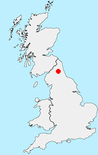
Location Map
Northumberland Guide
Walking in the Northumberland National Park covers a diverse area of landscape between the Tyne and the Scotland England border. The highest point within the National Park is the Cheviot and besides this famous hill there are many other notable summits. The valleys are also of interest to walkers, although some have restricted access.
Northumberland Walking Guide
Other walks in Britain - For a list of all the areas where walks are available go to the Main Walk Index.
Walk grading - Learn how each walk is assessed and select a walk to suit your ability and experience by going to Walk Grading Details.
Messaging & Social Media
Message Walking Britain and follow the latest news.

Mountain Weather
Stay safe on the mountains with detailed weather forecasts - for iOS devices or for Android devices.