Yorkshire Wolds WalksWalking Routes & Hiking Trails
Find Yorkshire Wolds walks from the list below which features the best walking routes in the area. Most are circular walks and are listed from the shortest and easiest to the longest more challenging routes.
All Yorkshire Wolds walks are free to download and print. All routes have GPS files. This ares has some dramatic coastal walking between Filey and Flamborough Head where the cliffs rise to 420 feet above the sea. Elsewhere the deep dry valleys cut into the undulating chalk plateau offer excellent and relaxing circular walks passing through some lovely villages along the way.
| Walk | Description | Grade | Miles |
|---|---|---|---|
| 1738★ | The deserted village of Wharram St Percy | easy | 2.70 |
| 3515★ | Deepdale and the deserted village of Wharram St. Percy | easy | 5.00 |
| 2482★ | Fordon and Dales Circular | easy/mod | 5.20 |
| 2141★ | Brantingham & Elloughton Dale | easy/mod | 5.70 |
| 3428★ | Boynton from Rudston Circular | easy | 6.50 |
| 2921★ | Bempton Cliffs from Flamborough | easy/mod | 6.70 |
| 1990★ | Settrington from North Grimston | easy/mod | 7.30 |
| 2655★ | Wayram To Fridaythorpe Circular | easy/mod | 7.50 |
| 3247★ | Stockingdale and Muston from Hunmanby | easy/mod | 7.80 |
| 3740★ | Cowlam & Cottam Circular | easy/mod | 8.00 |
| 2906★ | Circular from Wayrham Through Painsthorpe | moderate | 8.50 |
| 2703★ | Thixendale & Kirby Underdale | easy/mod | 8.50 |
| 1779★ | Horse Dale, Holm Dale, Tun Dale and Frendal Dale from Huggate | easy/mod | 9.00 |
| 3349★ | Pasture Dale, Frendal Dale and Horsedale from Huggate | easy/mod | 9.10 |
| 1620★ | Flamborough Head from Flamborough | easy/mod | 9.70 |
| 1630★ | Filey, Camp Dale & Hunmanby | moderate | 10.50 |
| 1842★ | Buttercrambe & Youlthorpe from Stamford Bridge | moderate | 11.80 |
| 3434★ | North Grimston, Birdsall & Wharram Percy | moderate | 12.10 |
| 3127★ | Bishop Wilton & Millington | moderate | 13.40 |
★ GPS file ☩ Route profile
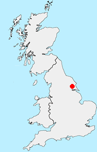
Location Map
Yorkshire Wolds Guide
The Yorkshire Wolds are chalk hills that run in an arc from west of Hull to the North Sea coast south of Bridlington. At their eastern end the Wolds produce the high cliffs rising to 420 feet above the sea east of Speeton. To the south the Yorkshire Wolds continue across the River Humber to the Lincolnshire Wolds which have a similar geological character. Most of the Yorkshire Wolds lie in the county of East Yorkshire although some of the hills at western end are in neighbouring North Yorkshire.
Yorkshire-Wolds Walking Guide
Other walks in Britain - For a list of all the areas where walks are available go to the Main Walk Index.
Walk grading - Learn how each walk is assessed and select a walk to suit your ability and experience by going to Walk Grading Details.
Messaging & Social Media
Message Walking Britain and follow the latest news.

Mountain Weather
Stay safe on the mountains with detailed weather forecasts - for iOS devices or for Android devices.