Loch Lomond and Trossachs Walking Guide
Walking in the Loch Lomond and the Trossachs National Park, which covers some 720 sq miles (1,865 sq km), offers some of the finest scenery in Scotland. Inaugurated in 2002, this National Park lies within an hour's drive of 70% of Scotland's population. From rolling lowland landscapes in the south to high mountains in the north, there are many lochs and rivers with forests and woodlands adding variety to the landscape. Today it is a working landscape and there is much of interest charting past mans' activities.
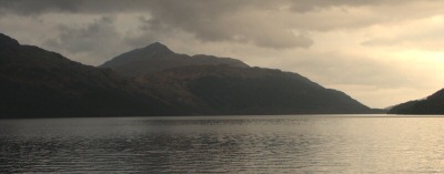
The National Park is divided into four distinct areas each with its own special character. The first includes Ben Lomond which stands guard over Loch Lomond, the largest expanse of freshwater in Great Britain. The second area is the Trossachs, which lie between Callander and Aberfoyle. This area is a wonderful mix of wild glens and sparkling lochs.
Breadalbane, the high country of the north, forms the third distinct area. This area is home to some of Scotland's finest Munros including Ben Lui, Ben Challum, Ben More and Ben Vorlich. The final area is the Argyll Forest of the Cowal peninsula. Here the sea lochs are dominated by the Arrochar Alps including the Cobbler.
For the hill walker the Loch Lomond and the Trossachs National Park boasts an enviable amount of mountain landscape. The highest point is Ben More (1174 m.) with another 19 Munros within the park boundary. Furthermore there are 20 Corbetts rising between 2,500ft and 3,000ft. In the valleys between the hills lie 22 larger lochs with countless smaller lochs and lochans.
The National Park is rich in wildlife along the coats, in the woods and lochs and across the mountains. Ospreys are summer visitors to Loch Lomond and nearby Lake of Menteith whilst Golden Eagles can be seen soaring in the high country of Breadalbane. Porpoises and seals are regular visitors to the sheltered waters of Loch Long and Loch Goil.
The West Highland Way starts from the outskirts of Glasgow and passes through the National Park on its way to Fort William. 95 miles (155 km) long this long distance trail is completed by around 15,000 walkers each year with many more using shorter sections as part of their circular day walks. The West Highland Way was Scotland's first long distance route and it celebrates its 25th birthday in 2006.
For more information on this area visit the
official web site for Loch Lomond and Trossachs
Further Information
Regional Walking Guides
A full list of "Where to Walk" Walking Guides can be found at List of Regional Walking Guides.
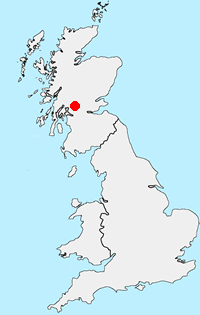
Location Map
Messaging & Social Media
Message Walking Britain and follow the latest news.

Mountain Weather
Stay safe on the mountains with detailed weather forecasts - for iOS devices or for Android devices.