Gear Review - Ordnance Survey Explorer Active Maps
Ordnance Survey Explorer Active Maps cover the whole of England, Scotland and Wales with 403 sheets in the series. They feature the same detailed mapping as their paper equivalents offering laminated maps which are an encapsulated in a weatherproof covering. The result is tough, durable and weatherproof maps that will defy the variable weather conditions experienced in the British Isles.
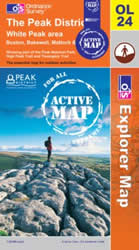 Living close to the Peak District National Park I opted to test sheet OL24 in what might be considered as very poor weather conditions. It was blowing a gale with intermittent heavy showers scurrying across the landscape. The format is the familiar Explorer series 1:25000 mapping which is a perfect scale for walking with good levels of detail such as walls clearly shown.
When walking I regularly refer to the map checking my current position and the next stages of the route. In the test conditions my normal paper map would have been blown inside out, perhaps suffered a few rips and would have started to turn into papier mache! However the study Active Map resisted just about everything the weather could throw at us and survived the walk without any obvious damage.
One other habit of mine is to walk as light as possible. The Active map weighs more than its paper equivalent and is considerably more bulky refusing to fit in my favourite map pocket in my waterproof. However with less protection required I stowed it in a mesh pocket on my rucksack and despite a couple of soakings survived the ordeal.
One interesting feature is that you can use a marker pen to show your intended route. Depending on the forecast a non-permanent pen is fine for dry conditions with permanent markers used when rain is likely. If you do use permanent markers then you need to use a solvent such as methylated spirits to clean the map after use.
With a price premium to pay for the weatherproof map you might ask whether they offer value for money when compared to the paper versions. If you visit an area frequently then the extra investment is almost certainly worthwhile and I will certainly add a few more Active maps to my collection for my favourite walking destinations.
More information can be obtained on the Ordnance Survey Web Site.
Review date – 23rd January 2014- Reviewed by LJ
News & Reviews
A range of product reviews including books and maps are available. The following reviews are the most recent.
Wainwright Hill Bagging Map - A scratchable map showing all 214 Wainwrights in the Lake District. More info.
the people's poncho 2.0 - Lightweight, stylish and lightweight alternative to traditional waterproofs ideal for walkers. More info.
the people's poncho - A durable, lightweight, stylish and compact alternative to traditional waterproofs ideal for walkers with 10% Discount. More info.
AZ Adventure Series Maps - Convenient 1:25000 OS maps in booklet form covering the National Trails of Britain. More info.
Walking in the Aire - A new book by Lee Senior featuring 14 walks in the Aire valley. More info.
West Yorkshire's Wild Side - Two new books in the 'Wainwright' style featuring Calderdale and moorland walks. More info.
Follow Walking Britain for the latest news. 
![]()