Broadsands Beach and Brixham
Devon Walk
County/Area - Devon
Author - Barry Mackie
Length - 4.0 miles / 6.5 km Ascent - 500 feet / 152 metres
Time - 2 hours 30 minutes Grade - easy
Maps 

| Ordnance Survey Explorer OL20 | Sheet Map | 1:25k | BUY |
| Anquet OS Explorer OL20 | Digital Map | 1:25k | BUY |
| Ordnance Survey Landranger 202 | Sheet Map | 1:50k | BUY |
| Anquet OS Landranger 202 | Digital Map | 1:50k | BUY |
Walk Route Description
Click image to visit gallery of 8 images.
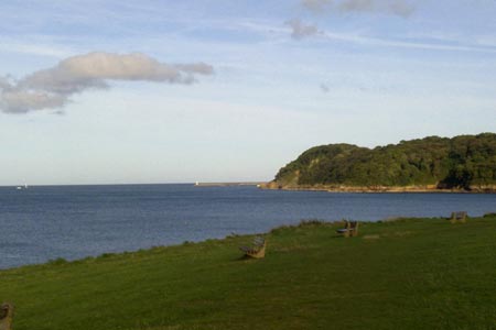
This walk, out alongside the South Devon coastline and then back through the countryside has superb views over Tor Bay and visits a couple of secluded coves before passing through some quiet stretches of woodland and open countryside. Part of the route follows a section of Britain's longest National Trail, The Southwest Coast Path. Along here, the cliff top walking can be arduous going in places due to the continual rise and fall of the coastline. Bear this in mind on this short and enjoyable ramble.
From the Broad Sands beach (Broadsands) car park at grid ref. SX897572, head west alongside the beach, with the sea on your left. Continue up the steps onto the grassy slopes alongside the cliffs. There's plenty of seating along here and although this is the start of the walk, maybe pause here for a while as the views are simply wonderful. The bay itself is protected from the prevailing south westerly winds, Paignton and Torquay should be easily seen over the water and with clear weather the coastline up towards Exmouth and beyond.
Continue on to reach the pebble beach at Elberry Cove with a ruin ahead of you at the far end. Look out for the information board here; the Cove is an important conservation area for many sea grasses. Go past the ruin and the path now zig zags up the steep and wooded slope alongside the cliff edge on the left and a golf course now to your right. Go down some steps and cross a small cove and almost immediately up another set of steps at the far side to soon reach the edge of Brixham. There's plenty to see here and further along, Brixton itself is well worth a visit. This walk goes only as far as the couple of exhibits of the Battery Park alongside the road though.
From there, retrace your steps to the edge of the woodlands at grid ref SX919568. Walk in a general south westerly direction along the path through wooded and open land to reach the lane approximately three quarters of a mile later. Turn right then soon right again to reach the hotel with the church alongside. Go round to the back of the church (on your left) and initially go north on the private road at the rear of the church. Veer northwest to cross the golf course (following the yellow staked markers) to reach and follow the path heading north at grid ref SX901566. Go left at the road/farm track and pass Elberry Farm to return to the car park and the end of the walk.
Other walks nearby
| Walk 3587 | Kingswear from Coleton Fishacre | moderate | 7.0 miles |
| Walk 2371 | Kingswear to Brixham | moderate | 10.8 miles |
| Walk 2912 | Dartington from Totnes | easy | 2.5 miles |
| Walk 3427 | Slapton Sands & Stokenham from Torcross | easy/mod | 8.0 miles |
| Walk 3346 | Start Point from Torcross | easy/mod | 8.0 miles |
| Walk 3431 | Beeson to Salcombe | mod/hard | 12.0 miles |
| Walk 1857 | Start Point & East Prawle | moderate | 8.2 miles |
| Walk 1657 | Huntingdon Warren & Lud Gate from Scorriton | moderate | 7.0 miles |
| Walk 3223 | Avon Dam Reservoir & White Barrows | easy/mod | 5.5 miles |
| Walk 2219 | The Avon Dam Reservoir from Shipley Bridge | easy | 3.5 miles |
Recommended Books & eBooks
South West Coast Path Map Booklet - St Ives to Plymouth
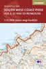 Map of part of the southern section of the 630 mile (1014km) South West Coast Path National Trail. Covers the trail from St Ives to Plymouth along the west Cornwall and Devon coastline. This convenient and compact booklet of Ordnance Survey 1:25,000 maps shows the route, providing all of the mapping you need to walk the trail in either direction.
More information
South West Coast Path Map Booklet - Minehead to St Ives
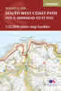 Map of the northern section of the 630 mile (1014km) South West Coast Path National Trail. Covers the trail from Minehead to St Ives along the north Devon and Cornish coastline. This convenient and compact booklet of Ordnance Survey 1:25,000 maps shows the route, providing all of the mapping you need to walk the trail in either direction.
More information
Messaging & Social Media
Message Walking Britain and follow the latest news.

Mountain Weather
Stay safe on the mountains with detailed weather forecasts - for iOS devices or for Android devices.