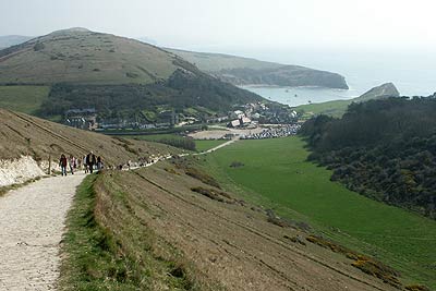
Durdle Door & White Nothe from Lulworth Cove
Jurassic Coast Walk
Region - Jurassic Coast
County/Area - Dorset
Author - Lou Johnson
Length - 7.0 miles / 11.4 km Ascent - 1600 feet / 485 metres
Time - 5 hours 10 minutes Grade - moderate
Maps 

| Ordnance Survey Explorer OL15 | Sheet Map | 1:25k | BUY |
| Anquet OS Explorer OL15 | Digital Map | 1:25k | BUY |
| Ordnance Survey Landranger 194 | Sheet Map | 1:50k | BUY |
| Anquet OS Landranger 194 | Digital Map | 1:50k | BUY |
Walk Route Description
Click image to visit gallery of 9 images.
The white cliffs of the Dorset coast to the west of Lulworth Cove offer some excellent walking. The undulating nature of the path makes any route rather more challenging than one might expect although the effort is always rewarded withe fine coastal views. The first section of this route to Durdle Door can be very busy in fine summer weather and it might be better to visit mid-week out of season.
There is a large pay and display carpark at Lulworth Cove (Grid ref. SY821800). In addition there is a reasonable bus service connecting Lulworth with towns and villages in the immediate area. From the car park take the wide paved path that slants uphill in a westerly direction. This is the first of many ascents although generally the effort is compensated by the views. The wide path continues west to reach Durdle Door where you can drop down to the beach for a closer view. However do remember that you need to reagin height by climbing up from the beach so careful thought is required before making a rash choice. As with all of the outward route you are following the South West Coast Path, which is one of the finest National Trails in the UK.
From Durdle Door you leave behind many of the crowds. The path narrows and the switchback nature of the path soon becomes evident with a couple of fairly steep ascents. The final 460ft ascent up to White Nothe past the beacon seems longer than it is despite the wonderful retrospective view back towards Durdle Door from the highest point (Grid ref. SY 776808). After enjoying the view, retrace your steps for a short way to the fence (Grid ref. SY 778 808) where you turn left and follow the path to a track (Grid ref. SY 780810).
Turn right along the track and begin the return to Lulworth Cove. The track is easily graded and progress is fast passing some concrete fossils in the wall on your left. Keep straight ahead to reach a fence (Grid ref. SY 800811) where you take the path forking right to continue to the road at Newlands Farm (Grid ref. SY 810810). Turn right and follow the road through the caravan site. On reaching the southern boundary of the site cross the stile and turn left to follow a path that crosses the northern flank of Hanbury Tout. Just above Hambury Farm bear right and continue to the start.
Other walks nearby
| Walk 2568 | Egmont Point & Kimmeridge Bay from Tyneham | moderate | 14.0 miles |
| Walk 1533 | Gad Cliff, Povington Hill & Tyneham | easy/mod | 4.5 miles |
| Walk 2575 | Durdle Door & Lulworth Cove | moderate | 10.0 miles |
| Walk 1889 | White Nothe from Ringstead Bay | easy/mod | 5.8 miles |
| Walk 1331 | Kimmeridge & Tyneham | easy/mod | 6.8 miles |
| Walk 1534 | Swyre Head & Tyneham Cap from Kimmeridge | moderate | 11.8 miles |
| Walk 1995 | Houns-tout & Swyre Head from Kimmeridge | moderate | 8.7 miles |
| Walk 1597 | The White Horse & Sutton Poyntz from Osmington | easy/mod | 4.0 miles |
| Walk 2440 | White Nothe & Moigns Down from Osmington | moderate | 10.5 miles |
| Walk 2145 | Houns-tout Cliff from Kingston | easy | 3.5 miles |
Recommended Books & eBooks
Walking the Jurassic Coast
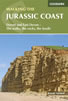 This guidebook includes 30 walks on the Jurassic Coast of Devon and Dorset. Covering the coast between Exmouth and Bournemouth, these delightful routes range from 3 to 16 miles (5 to 24km), exploring and explaining the spectacular geology of this World Heritage area with clear, easily understood descriptions, cross-sections and timelines.
More information
The South West Coast Path
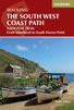 Guidebook to walking the entire South West Coast Path National Trail. The route runs for 630 miles from Minehead to Poole along the north Devon, Cornish, south Devon and Dorset coastline. Divided into 45 stages, this long-distance coastal trek could be completed within 4 weeks, or walked in sections. Guide includes maps and essential information.
More information
Messaging & Social Media
Message Walking Britain and follow the latest news.

Mountain Weather
Stay safe on the mountains with detailed weather forecasts - for iOS devices or for Android devices.