Ripley & Knox circular
North Yorkshire Walk
County/Area - North Yorkshire - Vale of York
Author - Allan Friswell
Length - 5.5 miles / 8.9 km Ascent - 300 feet / 91 metres
Time - 3 hours 0 minutes Grade - easy
Maps 

| Ordnance Survey Explorer 298 | Sheet Map | 1:25k | BUY |
| Anquet OS Explorer 298 | Digital Map | 1:25k | BUY |
| Ordnance Survey Landranger 99 | Sheet Map | 1:50k | BUY |
| Anquet OS Landranger 99 | Digital Map | 1:50k | BUY |
Walk Route Description
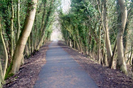
Click image to visit gallery of 5 images.
From the main car park at Ripley turn right and at the roundabout cross the main road with care and continue down the B6165. After a third of a mile take the path on the right which brings you to the old North Eastern Railway track, now a Sustrans funded cycleway. Turn left and walk along this path, the river Nidd peacefully rolling below on your right. After 1 ½ miles you reach the seven-arch Nidd viaduct. Cross it, turn right along the unsigned path, taking the left path when it shortly forks. Reaching the power lines, turn right and soon bear right again at a crosspaths, the path taking you behind the houses. Cross the tarmac lane, and keep ahead past the allotments. Fork left, following the power lines and shortly after take the right fork! This path soon brings you to an estate where you turn right along Old Trough Way. Turn right at the T junction and drop down gently to the delightful hamlet of Knox.
Cross the restored packhorse bridge over Oak Beck and climb the steps opposite, turning left at the top over the expanse of lawn and then turning round the corner to find a narrow alley between houses. After the stile at its end, make for the field's top left corner, and then for the farmhouse and paddock. Exit on to the lane, turn left then immediately right via a kissing gate. Cross the field and after a couple of stiles turn right along a tarmacked lane.
This soon divides and you take the left fork marked "farm vehicles". Go through the farmyard, exit at the second green gate and the kissing gate immediately on the left. Keep left initially but move out slightly right to find the three plank bridge and kissing gate about 50 yards from the corner. After the stile at the top of the next field bear right to the kissing gate by the corner. Turn left then right at this crosspaths, and make for the step stile in the left corner of the field. Make your way down to the exit by the white house, turn right along the lane, climb to the main road, cross, and follow the cycleway back to Ripley.
Other walks nearby
| Walk 1078 | Hampsthwaite & Ripley Park | easy | 7.5 miles |
| Walk 2404 | Ripon Rowel Walk Leg 2 - South Stainley to Sawley | easy/mod | 8.5 miles |
| Walk 1800 | West of Harrogate without a car | easy/mod | 9.0 miles |
| Walk 2405 | Ripon Rowel Walk Leg 3 - Sawley to Ilton | moderate | 11.0 miles |
| Walk 3528 | Fountains Abbey & Markenfield Hall | moderate | 8.7 miles |
| Walk 3726 | Brimham Rocks Circular | easy | 4.7 miles |
| Walk 3507 | Dacre Banks Circular | easy/mod | 6.5 miles |
| Walk 2403 | Ripon Rowel Walk Leg 1 - Ripon to South Stainley | easy/mod | 10.0 miles |
| Walk 1572 | Swinsty Reservoir | easy | 3.0 miles |
| Walk 1405 | Thruscross Reservoir & Kex Gill Moor | easy/mod | 8.5 miles |
Recommended Books & eBooks
Trail and Fell Running in the Yorkshire Dales
 Guidebook to 40 of the best trail and fell runs in the Yorkshire Dales National Park. Ranging from 5 to 24 miles, the graded runs start from bases such as Ribblehead, Dent, Sedbergh, Malham and Grassington and take in the region's diverse delights, from castles and waterfalls to iconic mountains such as Whernside, Ingleborough and Pen Y Ghent.
More information
Messaging & Social Media
Message Walking Britain and follow the latest news.

Mountain Weather
Stay safe on the mountains with detailed weather forecasts - for iOS devices or for Android devices.