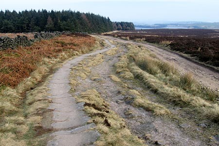
Burbage Moor & Redmires from near Ringinglow
Peak District Walk
Nat Park - Peak District - Derwent Edge Sheffield
County/Area - Derbyshire & South Yorkshire
Author - Andy Chaplin
Length - 9.8 miles / 15.8 km Ascent - 900 feet / 273 metres
Time - 5 hours 50 minutes Grade - easy/mod
Maps 

| Ordnance Survey Explorer OL1 | Sheet Map | 1:25k | BUY |
| Anquet OS Explorer OL1 | Digital Map | 1:25k | BUY |
| Ordnance Survey Explorer OL24 | Sheet Map | 1:25k | BUY |
| Anquet OS Explorer OL24 | Digital Map | 1:25k | BUY |
| Ordnance Survey Landranger 110 | Sheet Map | 1:50k | BUY |
| Anquet OS Landranger 110 | Digital Map | 1:50k | BUY |
| Ordnance Survey Landranger 119 | Sheet Map | 1:50k | BUY |
| Anquet OS Landranger 119 | Digital Map | 1:50k | BUY |
Walk Route Description
Click image to see photo description.
This walk reminds you how close the Peak District is to Sheffield and how easy it is to get out of the city and into some beautiful countryside. As you follow the walk around Burbage Moor you have views into the countryside towards and away from Sheffield. It takes in, arguably, the best part of the Sheffield Country Walk along Stanage Edge - certainly better than the part near Meadowhall. For those that choose to travel by bus you can start at the Fox House. For those that are driving you can start at Lady Canning's Plantation on Ringinglow Road - where there are a dozen parking places - or if that is full then carry on to Upper Burbage Bridge.
From the off-road parking (grid ref. SK277834), take the Public Byway that leads south-eastwards alongside Lady Canning's Plantation. Should you choose to walk up there, there are paths up on the right to the trig point and the Ox Stones on top of the hill. Shortly after passing the wood turn right onto the Houndkirk Road. This is another public byway which leads almost all the way down to the Fox House. The walking is easy - unless you have to keep moving out of the way of horses, mountain bikes, motor scramblers and four-by-fours. The views are great - initially the south west suburbs of Sheffield are just visible over Houndkirk Hill then the Peak District towards Hathersage comes into view.
Passing the Fox House on the main road, turn right then left on the road to Grindleford, before turning off right into the National Trust Longshaw Estate. All of this, and the next 5 km, are part of the Sheffield Country Walk. When the paths in the wood diverge take the right hand one to cross the main road and head towards Burbage Rocks. Until 2015 there is a weekday diversion of the SCW off its lower route and onto a higher path so that trees felled in the Burbage Plantation can be moved out along the SCW track. You rejoin at grid ref. SK268816 and continue up to Upper Burbage Bridge.
Continue along the SCW until you turn off right to Stanedge Pole. The views along the way into the Derwent Valley are superb. The track from the Stanedge Pole to Redmires Reservoirs is another public byway and at weekends can be another route for various off-roaders. Just before you get to Redmires Road turn off to the right on the Yorkshire Water circular walk that goes around the reservoirs. When you cross the second stream, Fairthorn Clough, turn off right over the stile on the well defined path that leads uphill to White Stones.
As you get towards the top of Rud Hill it can be boggy in places. Head towards the stile that is visible on the skyline and cross the fence at that point. Then cross a further stile to put the wall and the Yorkshire Water installation on your right. Come out on Fulwood Lane. Take the path off to the right to and through Brown Edge Farm. After the farm you follow the green lane to the gate then turn left along the wall. You will, sooner or later, come to the path that angles off right and then picks up the path that goes through the disused Brown Edge quarries and comes out, after a dog-leg on top of the hill, back at Ringinglow Road.
Other walks nearby
| Walk 1580 | Redmires Reservoir | easy | 2.5 miles |
| Walk 1541 | Redmire, Stanage & Ughill Moor circular | moderate | 13.0 miles |
| Walk 1093 | Higger Tor & Burbage Rocks | easy/mod | 5.3 miles |
| Walk 2548 | Stanage Edge from Hathersage | moderate | 8.5 miles |
| Walk 1090 | Stanage Edge | moderate | 7.0 miles |
| Walk 3440 | Sheffield Round | moderate | 15.2 miles |
| Walk 2235 | Bamford & Stanage Edges | moderate | 9.9 miles |
| Walk 2516 | Moscar, Dale Dike & Shrines Reservoirs | easy/mod | 7.0 miles |
| Walk 2629 | Stanage Edge, Redmires & Hallam Moors | easy/mod | 8.5 miles |
| Walk 1273 | Burbage Rocks & Padley Gorge from Hay Wood | moderate | 11.0 miles |
Recommended Books & eBooks
Walking in the Peak District - White Peak East
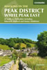 Guidebook describing 42 half-day and day walks in the limestone landscapes of Derbyshire's White Peak, part of the Peak District National Park. One of two volumes, this book covers the east of the region, with potential bases including Bakewell, Eyam, Castleton, Birchover, Matlock and Wirksworth.
More information
Great Mountain Days in the Pennines
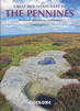 An inspirational guidebook to 50 classic walks on the rolling Pennine landscape. The graded routes, between 6 and 13 miles in length, cover classic Pennine fells and moorland such as Whernside, Ilkley Moor and Pendle Hill; exploring the North and South Pennines, Yorkshire Dales, Howgills and Dark Peak. Many routes are also suited to fell running.
More information
Messaging & Social Media
Message Walking Britain and follow the latest news.

Mountain Weather
Stay safe on the mountains with detailed weather forecasts - for iOS devices or for Android devices.