Nanpantan Reservoir, Wood Brook and Buck Hill
Leicestershire Walk
County/Area - Leicestershire
Author - David McMahon
Length - 2.5 miles / 4.1 km Ascent - 250 feet / 76 metres
Time - 1 hours 30 minutes Grade - easy
Maps 

| Ordnance Survey Explorer 246 | Sheet Map | 1:25k | BUY |
| Anquet OS Explorer 246 | Digital Map | 1:25k | BUY |
Walk Route Description
Click image to see photo description.
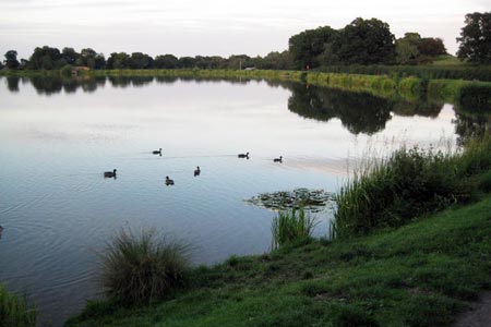
This walk uses a series of permissive paths in the Charnwood Forest area just south of Loughborough. The starting point is Nanpantan Reservoir (grid ref. SK507169) where there are both parking and toilet facilities. This walk could also be added onto Walk 1487, as its starting point is opposite where you come onto Nanpantan Road.
To start the walk leave the car park and turn right onto Woodhouse Lane and then turn left at the crossroads onto Nanpantan Road. Carry on this road until you see a ?Permissive Path? sign on the left-hand side. Go through a gate, along a closed in footpath and then right through another gate into a narrow wood. Out the other side and go slightly right diagonal through the field until you reach another wood. Follow the path as it eventually goes left and when you reach a clearing take the path which goes sharp right. Pass through into the field; turn sharp left and follow the stone wall. Follow it around to the left until you reach a farm gate. Turn right as indicated by the arrow and walk parallel to the stone wall. You then have another gate to negotiate.
After that gate you aim slightly diagonal to the left toward the side of a wood. Follow the stone wall to the right enclosing the wood as the path swings to the right and downhill to Wood Brook. Turn left to follow the brook and then over a bridge. Carry on along this path as it swings to the right and then straightens to go uphill. Near the top of the slope look for a gap, to the left, in a stone wall and take this path which carries on rising until you're on the summit of Buck Hill where there is a very good view of the surrounding countryside.
You then carry on along the ridge until the path drops down and swings to the right into a field. Cross the field to the wood facing you; go through the gate and follow the enclosed footpath you then come out onto Woodhouse Lane; go to your left and walk back to the car.??
Other walks nearby
| Walk 2941 | Out Wood & Beacon Hill from Loughborough | easy/mod | 6.8 miles |
| Walk 1487 | Blackbrook Reservoir & Nanpantan | moderate | 12.0 miles |
| Walk 2187 | Bradgate Country Park from Hallgates | easy | 3.4 miles |
| Walk 2315 | Old John & Beacon Hill | easy/mod | 8.8 miles |
| Walk 2175 | Bradgate Park from Newtown Linford | easy | 4.8 miles |
| Walk 2234 | Belton, Osgathorpe, Worthington & Wilson | moderate | 13.8 miles |
| Walk 2080 | Belton, Osgathorpe, & Worthington | easy/mod | 10.3 miles |
| Walk 1592 | Thornton Reservoir | easy | 2.5 miles |
| Walk 1465 | Sileby, Barrow on Soar and Walton from Seagrave | easy/mod | 12.5 miles |
| Walk 1543 | Desford, Botcheston and Thornton Reservoir from Ratby | moderate | 11.0 miles |
Recommended Books & eBooks
No suggestions for this area.Messaging & Social Media
Message Walking Britain and follow the latest news.

Mountain Weather
Stay safe on the mountains with detailed weather forecasts - for iOS devices or for Android devices.