Walk 1586 - printer friendly version
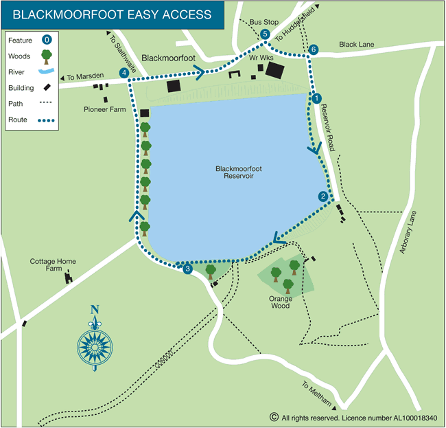
Blackmoorfoot Reservoir Walk
Author - Yorkshire Water
Length - 1.5 miles / 2.4 km
Ascent - 100 feet / 30 metres
Grade - easy
Start - OS grid reference SE102130
Lat 53.613453 + Long -1.8472954
Postcode HD7 5GY (approx. location only)
Located south-west of Huddesfield this easy walk follows the shores of Blackmoorfoot Reservoir. It is an easy walk and should be completed in less than an hour. The walk should provide evidence of the local wildlife and during certain times of the year you should also see plenty of evidence of migrating birds.
This is one of the free reservoir walks produced by Yorkshire Water who are one of the county's largest landowners, with around 72,000 acres of land spanning National Parks, Areas of Outstanding Natural Beauty, the North York Moors and the Yorkshire Wolds. There is a wide range of walks on offer from gentle strolls around one of their picturesque reservoirs to more adventurous routes. Yorkshire Water have selected some of their top walks for you and split them into three regional packs. Just print them out and off you go.
Each site has its own walk pack that you can easily print out and take along with you. Each pack includes directions to the site, a summary of the walk, a list of facilities available, a detailed route map and route instructions. To download walk descriptions go to Yorkshire Water Walks.
Messaging & Social Media
Message Walking Britain and follow the latest news.

Mountain Weather
Stay safe on the mountains with detailed weather forecasts - for iOS devices or for Android devices.