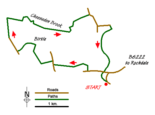
Cheeseden Brook & Pooley Bridge from Heywood Walk
Walk 1619 - Route Maps
Sketch Map
Suggested Maps 

| Ordnance Survey Explorer OL21 | Sheet Map | 1:25k | BUY |
| Anquet OS Explorer OL21 | Digital Map | 1:25k | BUY |
It is recommended you take a map. The preferred scale is 1:25k.
Start Point Details
Ordnance Survey Grid Ref SD852117
Latitude 53.601653 Longitude -2.22512
Postcode OL10 4AQ
what3words start treat.dimes.square
Walk description may contain detailed information on the start point for this walk.
Further Information
Walk grading - Learn how each walk is assessed and select a walk to suit your ability and experience by going to Walk Grading Details.
Messaging & Social Media
Message Walking Britain and follow the latest news.

Mountain Weather
Stay safe on the mountains with detailed weather forecasts - for iOS devices or for Android devices.