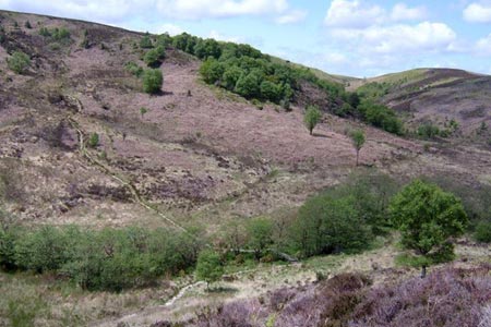
Burn Howe Rigg from Jugger Howes
North York Moors Walk
Nat Park - North York Moors - North York Moors East
County/Area - North Yorkshire
Author - Andy Chaplin
Length - 10.0 miles / 16.3 km Ascent - 920 feet / 279 metres
Time - 6 hours 0 minutes Grade - moderate
Maps 

| Ordnance Survey Explorer OL27 | Sheet Map | 1:25k | BUY |
| Anquet OS Explorer OL27 | Digital Map | 1:25k | BUY |
Walk Route Description
Click image to visit gallery of 3 images.
The end of this North York Moors walk involves a little bit of open walking but has the advantage that you will know the layout of the surrounding countryside by the time you come back to it and you will be walking on the top of the valley side. From the lay-by at grid ref. NZ944002 cross over the stile into the site of the old Jugger Howe military area. This now consists of an old concrete road which heads south west towards Jugger Howe Beck. The first 3 miles is actually part of the Lyke Wake Walk - see http://www.lykewake.org/index.php for those that fancy a 40 mile cross-moors walk.
Where the road ends there is a post with a red-painted band. Continue straight on, rather than going left where the main base buildings must have been situated, then before you descend down to the beck try to take note of the moors track that goes off on the left - this is where you will be coming back to at the end. As you go down to the beck the path is set out as stone steps and you will pass another couple of posts with orange and green bands before crossing the bridge and ascending up onto High Moor. The path is easy to follow as you head gently up towards Burn Howe duck pond.
After 2 miles from Jugger Howe beck, and before the duck pond, there is a moors track that leads back south east towards Brown Hill. As you look back from this junction the path you have been on is marked as a footpath and no motorbikes and the track you want is marked simply as "no motorbikes". Keep going along this track for 1.5 miles until you reach a gate that marks the end of open country.
From here the bridleway goes across the field next to the fence until it picks up the farm track that heads towards Riverhead Farm. Before the farm turn off left on the bridleway, through the next gate, then right on the track towards the farm road, then take the track down to Park Hill. Off to your right are views all the way to Scarborough Castle. At Park Hill house go right before the house then left over the stile and through the field below the house to Castlebeck Wood. There is a path that descends down to Lownorth Beck - but it is not well used. When you get to the bottom there is a better path that you take to the left, following the beck upstream. Oddly, in this rather remote wood, there are several remembrance benches - good for lunch.
Cross on the footbridge before Bloody Beck joins Jugger Howe Beck and continue north along the beck, then cross the bridge over the Helwath Beck and take any path that leads you up the bank side onto the moor on the north of, and above, Jugger Howe beck. There is a path (or is it a sheep trail?) at the start - and there is a moors track at the end - but the plan is to stay on the edge of the moor until one meets the other.
There is a new wooden bridge on a moors track that crosses a gulley to the south east of the 500 metre ditch near the top of the moor. Both the bridge and the ditch should be visible as you head north west. You should come close to the end of the ditch, but don't walk along it as it is water-logged, and contour round westwards on the moors track to meet your initial outbound route. At this point you will see the Grouse Hill caravan park in front of you and it is a short stroll back to the parking lay-by.
Other walks nearby
| Walk 3471 | Robin Hood's Bay from Ravenscar | moderate | 8.5 miles |
| Walk 1744 | Hayburn Wyke & Ravenscar along the Cleveland Way | moderate | 8.5 miles |
| Walk 2130 | Robin Hood's Bay & Hawkser from Fylingthorpe | moderate | 10.0 miles |
| Walk 1743 | Sneaton Thorpe & Littlebeck from May Beck | moderate | 8.9 miles |
| Walk 1395 | Broxa & Broxa Forest | easy/mod | 8.3 miles |
| Walk 2583 | Iburndale and the Esk Valley from Stainsacre | moderate | 10.3 miles |
| Walk 1922 | Goathland & Howl Moors | moderate | 11.2 miles |
| Walk 1464 | Sleights Moor | easy/mod | 7.8 miles |
| Walk 1758 | Newton House Plantation & Stony Leas | moderate | 10.3 miles |
| Walk 1602 | Saltergate, Fylingdales & Allerston High Moor | moderate | 11.5 miles |
Recommended Books & eBooks
Trail and Fell Running in the Yorkshire Dales
 Guidebook to 40 of the best trail and fell runs in the Yorkshire Dales National Park. Ranging from 5 to 24 miles, the graded runs start from bases such as Ribblehead, Dent, Sedbergh, Malham and Grassington and take in the region's diverse delights, from castles and waterfalls to iconic mountains such as Whernside, Ingleborough and Pen Y Ghent.
More information
Messaging & Social Media
Message Walking Britain and follow the latest news.

Mountain Weather
Stay safe on the mountains with detailed weather forecasts - for iOS devices or for Android devices.