Buttercrambe & Youlthorpe from Stamford Bridge
Yorkshire Wolds Walk
Region - Yorkshire Wolds
County/Area - East Yorkshire & North Yorkshire - Yorkshire Wolds
Author - Andy Chaplin
Length - 11.8 miles / 19.2 km Ascent - 500 feet / 152 metres
Time - 6 hours 20 minutes Grade - moderate
Maps 

| Ordnance Survey Explorer 190 | Sheet Map | 1:25k | BUY |
| Anquet OS Explorer 190 | Digital Map | 1:25k | BUY |
| Ordnance Survey Explorer 294 | Sheet Map | 1:25k | BUY |
| Anquet OS Explorer 294 | Digital Map | 1:25k | BUY |
Walk Route Description
Click image to visit gallery of 3 images.
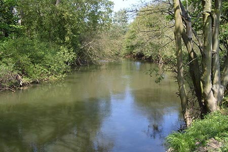
This East Yorkshire walk from Stamford Bridge includes a short section across the "border" in North Yorkshire. Walks in East Yorkshire are never going to be dramatic but the river Derwent is very pleasant and the parts of the walk on the Minster way around Youlthorpe allow broad views over the surrounding agricultural countryside.
The walk starts at the free car park off Viking Road in Stamford Bridge (grid ref. SE711554). Take Main Street to your right past the New Inn and the Coop to the 1066 battle memorial plaque. To the left of the memorial is a footpath that goes down to the river. For the next 3 miles you follow the east bank of the river Derwent to Buttercrambe until you come out on the Dolegate Road. All of this section is part of the White Rose Way and is periodically signed as such. Go north on Dolegate Road to the crossroads then take Lowfield Lane off on the right then turn right again onto Bleaberry Lane at the next junction.
After nearly 2 miles on the roads, which are generally pretty quiet, take the footpath off southwards through Bugthorpe Grange and turn left just before Grange Plantation and pick up the Chalkland Way which heads past Bugthorpe, crosses the A166 (Roman Road) and meets the Minster Way at grid ref. SE773560.
From here you follow the Minster Way through Youlthorpe, into the village of Full Sutton, past the prison and then onto Stamford Bridge. From Full Sutton it is another two and a half miles of walking on roads which may not be to everyone's liking but again the roads were relatively quiet. Initially it is Moor Lane then as you approach Stamford Bridge it becomes Moor Road. For those who are bored by road walking you may wish to know that current (2017) inmates of Full Sutton include Dennis Nilson (the Muswell Hill Murderer) and Jeremy Bamber (the White House Farm murders).
When you come into Stamford Bridge a short detour down White Rose Drive will take you to a memorial stone and information board about the Battle on 25th September 1066. Continue back along Moor Lane to the car park off Viking Road.
Other walks nearby
| Walk 2727 | Pocklington Canal from Allerthorpe Wood | moderate | 11.0 miles |
| Walk 3127 | Bishop Wilton & Millington | moderate | 13.4 miles |
| Walk 1760 | Pocklington Canal, Melbourne & East Cottingwith | easy/mod | 11.0 miles |
| Walk 3121 | Castle Howard & Coneysthorpe | moderate | 11.4 miles |
| Walk 2655 | Wayram To Fridaythorpe Circular | easy/mod | 7.5 miles |
| Walk 2906 | Circular from Wayrham Through Painsthorpe | moderate | 8.5 miles |
| Walk 3733 | Coneysthorpe & Castle Howard from Welburn | easy/mod | 9.0 miles |
| Walk 3126 | Kirkham Priory & Pretty Wood from Low Hutton | moderate | 11.0 miles |
| Walk 2703 | Thixendale & Kirby Underdale | easy/mod | 8.5 miles |
| Walk 1757 | River Ouse & Moor Monkton FROM Nether Poppleton | moderate | 10.0 miles |
Recommended Books & eBooks
No suggestions for this area.Messaging & Social Media
Message Walking Britain and follow the latest news.

Mountain Weather
Stay safe on the mountains with detailed weather forecasts - for iOS devices or for Android devices.