Moel Famau and the Clwydian Hills Walk
Walk 1912 - Route Maps & Profile
Route Map
Digital Maps - Copyright © 2011-2024. All rights reserved.
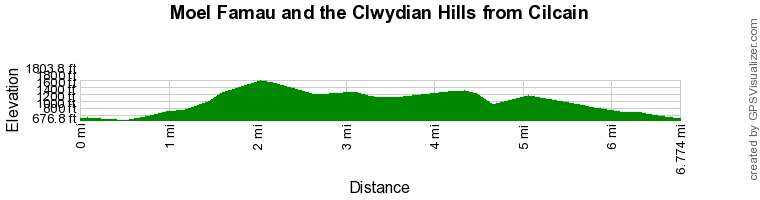
Route Profile
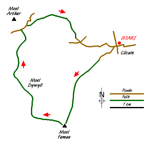
Sketch Map
Suggested Maps 

| Ordnance Survey Explorer 265 | Sheet Map | 1:25k | BUY |
| Anquet OS Explorer 265 | Digital Map | 1:25k | BUY |
| Ordnance Survey Landranger 116 | Sheet Map | 1:50k | BUY |
| Anquet OS Landranger 116 | Digital Map | 1:50k | BUY |
It is recommended you take a map. The preferred scale is 1:25k.
Start Point Details
Ordnance Survey Grid Ref SJ176651
Latitude 53.176601 Longitude -3.234311
Postcode CH7 5NN
what3words start throwaway.insisting.guarded
Walk description may contain detailed information on the start point for this walk.
Further Information
Clwydian Hills
The Clwydian Hills stretch for about 20 miles, rising between the Vale of Clwyd to the west and the Dee Estuary to the east. This line of undulating hills have steep slopes to their west providing excellent views as far as Snowdonia. In contrast to the moorland character of the summits the surrounding valleys are lush and green. Clwydian Hills Walking Guide
Walk grading - Learn how each walk is assessed and select a walk to suit your ability and experience by going to Walk Grading Details.
Messaging & Social Media
Message Walking Britain and follow the latest news.

Mountain Weather
Stay safe on the mountains with detailed weather forecasts - for iOS devices or for Android devices.