Cown Edge & Whiteley Nab from Chunal
Peak District Walk
Nat Park - Peak District - Kinder Scout Edale
County/Area - Derbyshire
Author - Lou Johnson
Length - 6.5 miles / 10.6 km Ascent - 1150 feet / 348 metres
Time - 4 hours 20 minutes Grade - easy/mod
Maps 

| Ordnance Survey Explorer OL1 | Sheet Map | 1:25k | BUY |
| Anquet OS Explorer OL1 | Digital Map | 1:25k | BUY |
| Ordnance Survey Landranger 110 | Sheet Map | 1:50k | BUY |
| Anquet OS Landranger 110 | Digital Map | 1:50k | BUY |
Walk Route Description
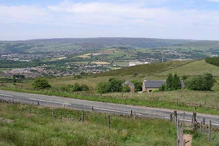
Click image to see photo description.
This Peak District walk explores the often rugged countryside to the east of Cown Edge. The start is a small parking area on the west side of the A624 Hayfield to Glossop road just past the lay-by at grid ref. SK034913. After parking walk back towards Hayfield for about 200 metres to a track on the right side of the road. Go through gate and bear right down into Long Clough. Cross a stile and head uphill to reach a walled track leading to Plainsteads Farm and a road (grid ref. SK024910). Turn left and almost immediately right down a no through road. Just before the road turns sharp right, take the footpath on the right, cross field to far corner and go over a stile.
Turn left along the access track and continue past Higher Plainstead Farm to Rock Farm. Take the stile at side of the farm and bear right along a track heading northeast. Where the tracks divide (grid ref. SK020918), bear left and continue to the next junction. Here go right, joining the Cown Edge Way. Where the track bends to the left, take the footpath on the right and cross a field to a road (grid ref. SK018924). Turn right along the road and then take the first path on your left. This path follows Slack Edge before descending to High Lane (grid ref. SK012931).
Turn right along the lane towards Simmondley. After a short downhill section and you enter the village. At grid ref. SK020932, take the footpath on the right. The path climbs steadily to reach a junction of paths and tracks at grid ref. SK021926. Here bear half left following an indistinct track towards the western edge of a plantation at Whiteley Nab. Continue on this track as it heads south eventually reaching Monk's Lane (grid ref. SK022913). Turn left along the lane, and at the junction with the access road to Rock Farm take the footpath almost straight ahead (grid ref. SK022912). Cross the field on the path used for the outward route to reach another lane (grid ref. SK023909).
Head south along the lane ahead. When the lane runs right (grid ref. SK021904) take the footpath on the left (not the path going straight ahead). Continue along this path with the wall to your immediate right. The path climbs gently to Knarrs, where you join their access drive which is followed down to a road (grid ref. SK028904). Cross this road and follow the footpath opposite which leads back to the start.
Other walks nearby
| Walk 1486 | Harry Hut, Mill Hill & Doctor's Gate from Glossop | moderate | 11.3 miles |
| Walk 2546 | Lantern Pike & Cown Edge from Rowarth | easy/mod | 8.0 miles |
| Walk 1759 | Torside Clough & Longendale from Old Glossop | moderate | 7.4 miles |
| Walk 1168 | Old Glossop & Bleaklow | moderate | 9.5 miles |
| Walk 2507 | South Head & Edale Cross from Hayfield | moderate | 8.0 miles |
| Walk 2637 | Coombs Ridge, Cown Edge from Broadbottom | easy/mod | 7.0 miles |
| Walk 1686 | Cown Edge | easy/mod | 7.3 miles |
| Walk 1174 | Kinder Low & Mount Famine | moderate | 7.5 miles |
| Walk 1182 | Kinder Downfall | moderate | 8.0 miles |
| Walk 1703 | Longdendale from Hadfield Station | easy/mod | 9.0 miles |
Recommended Books & eBooks
Dark Peak Walks
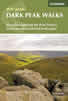 Guidebook to 40 walks in the Dark Peak area of the Peak District National Park. 35 circular routes for most abilities, from 8km to 19km, around Edale, Marsden, Fairholmes, Baslow and Castleton, including Kinder Scout and Mam Tor, and 5 longer (25km to 45km) routes highlighting the best of the Gritstone Edges, High Moorland and Deep Valleys.
More information
Walking in the Peak District - White Peak East
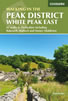 Guidebook describing 42 half-day and day walks in the limestone landscapes of Derbyshire's White Peak, part of the Peak District National Park. One of two volumes, this book covers the east of the region, with potential bases including Bakewell, Eyam, Castleton, Birchover, Matlock and Wirksworth.
More information
Messaging & Social Media
Message Walking Britain and follow the latest news.

Mountain Weather
Stay safe on the mountains with detailed weather forecasts - for iOS devices or for Android devices.