Oldbury-on-Severn & Littleton-upon-Severn
Gloucestershire Walk
County/Area - Gloucestershire
Author - Lou Johnson
Length - 5.2 miles / 8.5 km Ascent - 100 feet / 30 metres
Time - 2 hours 40 minutes Grade - easy
Maps 

| Ordnance Survey Explorer 167 | Sheet Map | 1:25k | BUY |
| Anquet OS Explorer 167 | Digital Map | 1:25k | BUY |
| Ordnance Survey Landranger 162 | Sheet Map | 1:50k | BUY |
| Anquet OS Landranger 162 | Digital Map | 1:50k | BUY |
Walk Route Description
Click image to see photo description.
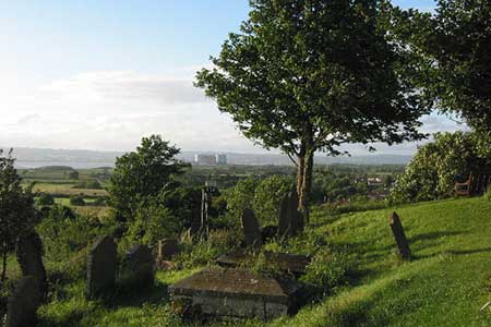
This walk includes sections of the Jubilee Way and the Severn Way long distance footpaths. The route starts from the village of Oldbury-on-Severn and continues to the shoreline of the River Severn estuary where it turns downstream. The walk then visits Littleton-upon-Severn before returning to the start using field paths and country lanes to pass St Arilda's church which stands on a solitary hill.
Limited on street parking is available in Oldbury-on-Severn (grid ref. ST608923). Please be careful not to block residents' access and park in a courteous manner. After parking locate the road bridge at the eastern end of Oldbury Pill and follow the Severn Way as it heads west to the Severn Estuary. The path is easy to follow and turns southwest with the river to your right. Continue along the Severn Way for just over one and a half miles to the junction of the Severn Way with the Jubilee Way (grid ref. ST582907) at Littleton Warth. Here turn left walking inland initially following a path but soon joining a track marked as Rushden Lane on maps.
Rushden Lane leads you to the road through Littleton-upon-Severn. On reaching the road through the village (grid ref. ST594899), turn left and in 400 metres reach a T-junction (grid ref. ST597902). Take the footpath almost opposite and in a short distance bear half right across the field to the corner of a small wood (grid ref. ST601905). Continue across fields to reach a road at Cowhill (grid ref. ST606914). Bear left along the road and continue, passing St Arilda's church on your left, back to the start.
Other walks nearby
| Walk 3437 | The Severn Estuary from Thornbury | easy/mod | 9.3 miles |
| Walk 1272 | Tintern, Devil's Pulpit & Brockweir | moderate | 7.5 miles |
| Walk 2832 | The Wye Valley | easy/mod | 5.8 miles |
| Walk 1258 | The Tyndale Monument | easy/mod | 5.5 miles |
| Walk 2212 | Bristol Curiosities Trail | easy | 1.5 miles |
| Walk 2213 | Bristol Maritime Trail | easy | 1.5 miles |
| Walk 2214 | Bristol Literary Trail | easy | 1.5 miles |
| Walk 2215 | Bristol Religious Trail | easy | 1.5 miles |
| Walk 1877 | Uley Bury & Cam Long Down | easy/mod | 5.5 miles |
| Walk 3278 | Hinton & Dryham Circular | easy | 3.0 miles |
Recommended Books & eBooks
No suggestions for this area.Messaging & Social Media
Message Walking Britain and follow the latest news.

Mountain Weather
Stay safe on the mountains with detailed weather forecasts - for iOS devices or for Android devices.