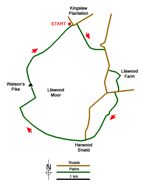
Watson's Pike & Hexhamshire Common Walk
Walk 1942 - Route Maps
Route Map
Digital Maps - Copyright © 2011-2024. All rights reserved.
Sketch Map

Suggested Maps 

| Ordnance Survey Explorer OL43 | Sheet Map | 1:25k | BUY |
| Anquet OS Explorer OL43 | Digital Map | 1:25k | BUY |
It is recommended you take a map. The preferred scale is 1:25k.
Start Point Details
Ordnance Survey Grid Ref NY902543
Latitude 54.883354 Longitude -2.154281
Postcode NE47 0HR
what3words start flip.tonic.apparatus
Walk description may contain detailed information on the start point for this walk.
Further Information
Northumberland County
Northumberland is a county of contrasts. The North Sea coast offers some excellent walking and includes the island of Lindisfarne. Inland, there is some glorious countryside with the hills and moors of the Cheviots as an ever present backdrop. Historic houses, castles and villages provide added interest to many walks.
Walk grading - Learn how each walk is assessed and select a walk to suit your ability and experience by going to Walk Grading Details.
Mountain Weather
Stay safe on the mountains with detailed weather forecasts - for iOS devices or for Android devices.

