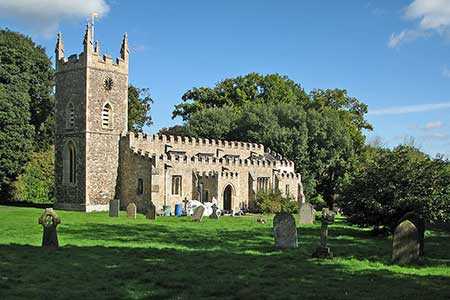
Elsworth & Conington from Boxworth
Cambridgeshire Walk
County/Area - Cambridgeshire
Author - Lou Johnson
Length - 10.1 miles / 16.4 km Ascent - 300 feet / 91 metres
Time - 5 hours 20 minutes Grade - moderate
Maps 

| Ordnance Survey Explorer 225 | Sheet Map | 1:25k | BUY |
| Anquet OS Explorer 225 | Digital Map | 1:25k | BUY |
Walk Route Description
Click image to see photo description.
This Cambridgeshire walk starts from Boxworth and explores the countryside to the south and west of the village. The route passes through the villages of Lolworth, Knapwell, Elsworth and Conington using tracks and field paths plus a few sections of lanes. The walk also includes a section of the Pathfinder Long Distance Walk.
The start is the complex road junction just north of St. Peter's Church in Boxworth where parking is available on the grass verge (grid ref. TL349646). After parking take the bridleway signed to Lolworth. Follow Manor Lane past Manor House Farm on your left. At the end of the tarmac take the track ahead to the right of a small pond. The bridleway initially follows a hedge on your left before veering right across a field to reach Yarmouth Farm. Continue through the farmyard to join the farm's access drive. Follow this as it becomes a tarmac lane to a crossroads.
Turn right and follow the lane to reach the end of the tarmac at Broadway Farm (grid ref. TL364637) where you continue ahead on a track heading south. After two kilometres of easy walking, you enter Black Park. The path runs beside trees on your right. Turn right into the farmyard at Childerley joining the Pathfinder Long Distance Walk. Keep the large farm buildings on your left following the track as it bends left and shortly after right into a large field. After 200 metres turn left and follow the path with hedge on your left. Pass through a gap in the hedge and continue across two more fields with the hedge now on your right to reach Battle Gate Road (grid ref. TL345623).
Go straight across and follow Thorofare Lane to the road at Knapwell. Turn right and after 250 metres take the signed footpath to Elsworth. Follow the waymarked Pathfinder Long Distance Walk over fields and latterly a tarmac lane to reach Boxworth Road in Elsworth. Turn left to the first crossroads (grid ref. TL317637). Turn right along Paddock Road, keeping right where the road forks. Turn left onto a narrow path between houses. Cross a bridge with stiles at either end and turn right. The onward path follows the edge of the field with hedge on your right. Continue past a small reservoir on your left and stay on the path north to join School Lane in Conington.
Turn right along School Lane and continue to a T-junction. Turn right on to Conington Road. After 250 metres take the signed bridleway on the left through a metal gate. After two kilometres the bridleway turns left and shortly after right before reaching the start in Boxworth.
Other walks nearby
| Walk 3444 | Fen Drayton Nature Reserve Walk | easy | 4.6 miles |
| Walk 3721 | Oakington and Longstanton round via Rampton Drift | easy | 6.0 miles |
| Walk 3741 | St. Ives, Houghton & the Hemingfords | easy | 5.6 miles |
| Walk 3103 | Wimpole Park and Whaddon | easy/mod | 8.3 miles |
| Walk 2243 | Mare Way & Wimpole Estate from Orwell | easy | 5.2 miles |
| Walk 1798 | Little Paxton & River Ouse Circular | easy/mod | 6.4 miles |
| Walk 2352 | Lode Mill, Quy Water & Quy Fen | easy | 4.2 miles |
| Walk 3271 | Grafham Water Circular | easy/mod | 8.7 miles |
| Walk 2305 | Gamlingay, Tetworth & Everton from Potton | easy/mod | 9.5 miles |
| Walk 3623 | Wood Walton Circular | easy | 4.1 miles |
Recommended Books & eBooks
No suggestions for this area.Messaging & Social Media
Message Walking Britain and follow the latest news.

Mountain Weather
Stay safe on the mountains with detailed weather forecasts - for iOS devices or for Android devices.