Blackdown Hills & Castle Neroche from Staple Fitzpaine
Somerset Walk
County/Area - Somerset
Author - Lou Johnson
Length - 6.8 miles / 11.1 km Ascent - 850 feet / 258 metres
Time - 4 hours 20 minutes Grade - easy/mod
Maps 

| Ordnance Survey Explorer 128 | Sheet Map | 1:25k | BUY |
| Anquet OS Explorer 128 | Digital Map | 1:25k | BUY |
Walk Route Description
Click image to see photo description.
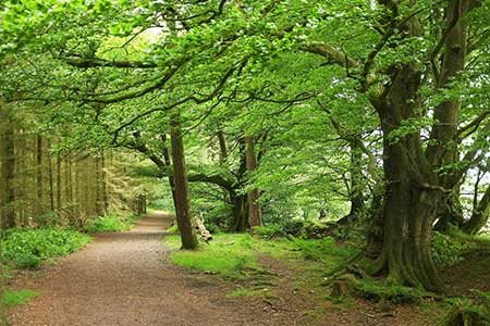
A circular walk exploring the Blackdown Hills in Somerset. The route follows a section of the East Deane Way and uses field paths across the undulating countryside. The walk starts from Staple Fitzpaine to the south of Taunton and visits the Norman motte and bailey Castle Neroche which occupies a strategic position high in the hills. The relevant OS 1:25k map is useful for sections of the walk.
The start is the village of Staple Fitzpaine where limited parking is available by the phone box on New Road (grid ref. ST264183). Parking is also available at the nearby Greyhound Inn. After parking walk west along New Road passing the phone box on your right. Reaching a fork, keep right and continue past Staple Park Farm. Continue ahead along a clear track which runs along the left-hand edge of a field. Near the end of the field the East Deane Way comes in from the right (grid ref. ST251184). Entering the next field, the path soon bears right through the hedge and continues with the hedge on your right. Continue to the end of the field and follow the path as it bends left. The path then bends right and enters woodland. Reaching a cross track, turn left following the East Deane Way (grid ref. ST245184).
The path continues south for a kilometre to reach a junction (grid ref. ST244174). Turn left and follow the track through woodland to Underhill Lane. Turn right and after 300 metres turn left into trees. The route is waymarked, but a map is useful. Continue into a more open area and bear south-east soon joining a track which leads to a track just south of Mount Fancy Farm (grid ref. ST251163). Turn right along the track and soon after left to regain the East Deane Way which is followed via Britty Common and Staple Common to a road (grid ref. ST267159).
Cross the road and take the track opposite. Follow the track as it bends left to reach a junction of tracks after 400 metres (grid ref. ST271161). Turn right and make the short ascent up to Castle Neroche. After exploring the site of the castle and Iron Age Hill Fort, return downhill to the junction of paths recently passed. Go straight across at this junction and follow Green Lane to a road. Turn right, keep ahead at the junction, and take the first track on the right (grid ref. ST270168).
Approaching a house, bear right off the track, keep to the left of the field, enter the next field, and turn right and continue with hedge on your right. Maintain direction across the next two fields to reach a lane. Go straight across and follow a track to Crosses Farm. Walk through the farmyard and take the footpath north to Perry Hall. The path passes in front of the Hall and continues north across three fields initially with a hedge on your right. The path swaps sides of the hedge halfway along and continues to a large field (grid ref. ST270183). The path veers slightly left across this large field aiming for a gap in the hedge opposite Staple Farm and a road. Turn left and the starting point is about 500 metres along the road.
Other walks nearby
| Walk 3570 | River Tone from Stoke St Gregory | easy | 5.2 miles |
| Walk 1924 | Lydeard Hill to Wills Neck | easy | 2.6 miles |
| Walk 1925 | Plainfield to Wills Neck | easy | 5.0 miles |
| Walk 3211 | Crowcombe & Wills Neck | moderate | 7.3 miles |
| Walk 2330 | Quantock Hills from Dead Woman's Ditch | moderate | 9.2 miles |
| Walk 1973 | River Parrett from Pawlett | easy/mod | 7.1 miles |
| Walk 1822 | Hodder's Combe, Bicknoller Post & Higher Hare Knap | easy/mod | 5.8 miles |
| Walk 3412 | Dowsborough Fort from Holford | easy/mod | 6.0 miles |
| Walk 1696 | Weacombe Combe, Bicknoller Post, Kilve & Longstone Hill | easy/mod | 7.5 miles |
| Walk 1551 | Seatown and Charmouth via Golden Cap | easy/mod | 5.0 miles |
Recommended Books & eBooks
No suggestions for this area.Messaging & Social Media
Message Walking Britain and follow the latest news.

Mountain Weather
Stay safe on the mountains with detailed weather forecasts - for iOS devices or for Android devices.