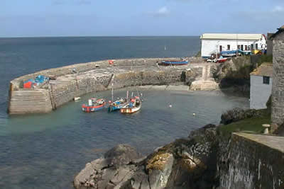
Coverack & Lowland Point
Cornwall AONB Walk
Region - Cornwall AONB
County/Area - Cornwall
Author - Parc an Grouse Bed & Breakfast
Length - 4.2 miles / 6.8 km Ascent - 500 feet / 152 metres
Time - 2 hours 40 minutes Grade - easy/mod
Maps 

| Ordnance Survey Explorer 103 | Sheet Map | 1:25k | BUY |
| Anquet OS Explorer 103 | Digital Map | 1:25k | BUY |
| Ordnance Survey Landranger 204 | Sheet Map | 1:50k | BUY |
| Anquet OS Landranger 204 | Digital Map | 1:50k | BUY |
Walk Route Description
Click image to see photo description.
This pleasant walk is an ideal half day excursion, which includes a pleasant stretch of the coastal path and the historic village of Coverack known for both its fishing and smuggling activities. Parking is available in Coverack (grid ref. SW781185).
From the car park in Coverack follow the road down to the sea and turn left along the residential road that runs north parallel with the coast. Shortly after the tarmac ends, take the left fork. This leads to a stile and the path continues into woodland. Continue with this path, passing some rocky outcrops, to reach a lane. This leads to Boscarnon Farm. The way ahead lies through a small wood to reach a lane that passes Trevalsoe Farm.
Care is needed here to pick up the correct path leading to Trevean where a lane is reached. Turn left and follow the lane north in the direction of St Keverne. After about 600 yards turn right down another lane and continue towards the sea. The track becomes rougher as you descend with some quarry buildings and a pier becoming visible as you lose height.
Offshore can be seen the notorious Mannacles Rocks that have claimed many ships. Go through a kissing gate and follow a descending path alongside a metal rail towards Lowland Point which is part of the extensive National Trust inventory in Cornwall. Shortly after entering Lowland Point the village of Coverack can be seen in the distance. All that remains is a very pleasant section of coastal path back to the starting point.
Other walks nearby
| Walk 1778 | Maenporth and Helford Passage Circular | easy/mod | 8.0 miles |
| Walk 2009 | Gillan & Nare Point from Porthallow | easy | 4.7 miles |
| Walk 2088 | Rosemullion Head & Mawnan | easy | 4.0 miles |
| Walk 2007 | Helford Passage & Frenchman's Creek | easy/mod | 7.0 miles |
| Walk 2010 | Housel Bay & Bass Point from the Lizard | easy | 3.5 miles |
| Walk 1032 | Kynance Cove, Cadgwith & The Lizard | moderate | 8.0 miles |
| Walk 2392 | The Lizard Circular | easy/mod | 5.9 miles |
| Walk 1878 | Poldhu Cove to Lizard Point | moderate | 9.5 miles |
| Walk 2003 | Cowlands, Coombe & Roundwood Quay from Trelissick | easy/mod | 9.0 miles |
| Walk 1027 | Nare Head & Portloe | moderate | 7.0 miles |
Recommended Books & eBooks
The South West Coast Path
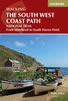 Guidebook to walking the entire South West Coast Path National Trail. The route runs for 630 miles from Minehead to Poole along the north Devon, Cornish, south Devon and Dorset coastline. Divided into 45 stages, this long-distance coastal trek could be completed within 4 weeks, or walked in sections. Guide includes maps and essential information.
More information
South West Coast Path Map Booklet - Minehead to St Ives
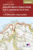 Map of the northern section of the 630 mile (1014km) South West Coast Path National Trail. Covers the trail from Minehead to St Ives along the north Devon and Cornish coastline. This convenient and compact booklet of Ordnance Survey 1:25,000 maps shows the route, providing all of the mapping you need to walk the trail in either direction.
More information
Messaging & Social Media
Message Walking Britain and follow the latest news.

Mountain Weather
Stay safe on the mountains with detailed weather forecasts - for iOS devices or for Android devices.