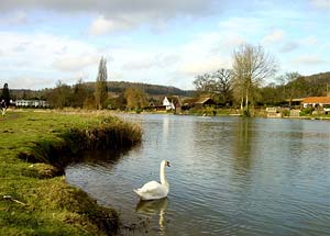
River Thames & Hambleden from Henley-on-Thames
Chilterns Walk
Region - Chilterns
County/Area - Oxfordshire
Author - Chilterns AONB
Length - 7.0 miles / 11.4 km Ascent - 200 feet / 61 metres
Time - 3 hours 40 minutes Grade - easy/mod
Maps 

| Ordnance Survey Explorer 171 | Sheet Map | 1:25k | BUY |
| Anquet OS Explorer 171 | Digital Map | 1:25k | BUY |
| Ordnance Survey Landranger 175 | Sheet Map | 1:50k | BUY |
| Anquet OS Landranger 175 | Digital Map | 1:50k | BUY |
Walk Route Description
Click image to see photo description.
The walk offers fantastic views of the Thames Valley and Chilterns Area of Outstanding Natural Beauty with wonderful countryside and picturesque villages. Along the way you may see birds such as red kites, buzzards, herons, kingfishers and pheasants and animals such as deer.
Historical features along the walk include Henley town , Fawley Court, Hambleden Mill & Lock, Temple Island and Hambleden village. You can also watch boats and rowers on the River Thames or people canoeing in the weir at Hambleden Lock.
The start is Hart Street, Henley-on-Thames. From Henley to Hambleden Lock the route is flat with gentle hills involved for the Hambleden and Aston sections.
Seasonal : During wet periods some paths can be muddy and slippery, during winter the Thames Path may not be passable due to flooding, call Floodline 0845 988 1188 to check.
Henley Regatta/Festival : Please note that it is not possible to do this walk during Henley Regatta and Festival - which generally take place during the first 2 weeks in July . For more information about these events call 01491 578034.
The Route : From Hart Street in Henley (grid ref SU760826) cross the bridge over the River Thames on the left hand side. Once over the bridge turn left, following the signs for the Thames Path to Hambleden Lock, the path between the buildings will take you onto the side of the River. Follow the path for 2 1/2 miles until you reach Hambleden Lock.
You can divert to Remenham village to see the traditional brick and flint Church of St Nicholas Remenham.
At Hambleden Lock cross over the river Thames on a series of bridges and then follow the driveway to the main road. Take care crossing the road, then turn right and follow the path/road to the left towards Hambleden.
At the T-junction with the road to Rotten Row enter the field through the kissing gate (NB There are toilets in the car park 50m further along the Hambleden road). Follow the path towards the village, crossing a bridlepath half way.
Rejoin the road, turn right over the stream and walk into the village. Turn right into the private road past the pub and up the hill.
Hambleden has a village store and the Stag & Huntsman pub serves meals 12-2 and evenings and offers B&B. Call 01491 571227. Turn right into the unsurfaced farm track before the buildings. You are now walking back along the valley towards the River Thames.
After 1/4 mile the track forms a T-junction with another track. Turn left here following public footpath signs uphill. Follow the footpath which turns right along the hedge. Enter the wood over the stile and then follow the footpath to the right, through the kissing gate and across the field, parallel to the wood. Follow this path until you reach the road. Turn right and follow the road down the hill to the junction. Turn left and walk back to Hambleden Lock.
From Hambleden Lock continue along the Thames Path downriver towards Hurley following the tarmac road. Follow the road away from the River to the village of Aston. Turn left to go to The Flower Pot pub which serves meals 12-2pm and evenings and offers B&B. Call 01491 574721. Otherwise turn right and follow the road for 50 metres, then turn left and follow the track up the slope (The Copas Partnership has kindly given permission to use this section of path which is not a public right of way). Then turn right and follow the public footpath for ½ mile.
At the road turn left and walk for about 200m, then turn right and follow the footpath across the field. Follow the footpath through Remenham Wood. Leave the wood over the stile and cross the field downhill towards the trees to the signpost. Follow the path through the trees, continue over the stiles and fields until you reach Henley. Turn left and follow the road past the cricket pitch until you reach the main road and the Little Angel pub. Turn right along the main road and cross the River Thames back into Henley.
Further information - including how to get to Henley, parking, visitor information and features of the walk is available in the form of a downloadable leaflet from www.chilternsaonb.org
Other walks nearby
| Walk 1720 | Henley-on-Thames to Marlow along the Thames Path | easy/mod | 9.0 miles |
| Walk 3128 | Henley-on-Thames, Aston and Hambleden | easy/mod | 8.0 miles |
| Walk 3248 | Henley-on-Thames, Rotherfield Greys & Shiplake | easy/mod | 8.3 miles |
| Walk 1919 | Henley-on-Thames, Middle Assendon and Stonor | moderate | 14.5 miles |
| Walk 1954 | Fingest & Turville from Hambleden | moderate | 11.4 miles |
| Walk 1966 | Turville & Hambleden circular | moderate | 9.6 miles |
| Walk 3082 | Sonning Eye & Shiplake circular | easy | 5.7 miles |
| Walk 1982 | Hurley Circular | easy | 5.1 miles |
| Walk 2398 | Turville Circular | easy | 4.1 miles |
| Walk 3359 | Christmas Common, Ibstone Common & Turville Heath | easy/mod | 8.5 miles |
Recommended Books & eBooks
The Thames Path Map Booklet
 Map of the 180 mile (288km) Thames Path National Trail, from London's Thames Barrier to the river's source near Cirencester in Gloucestershire. This booklet is included with the Cicerone guidebook to the trail, and shows the full route on OS 1:25,000 maps. The easy riverside route takes around two weeks to walk.
More information
Messaging & Social Media
Message Walking Britain and follow the latest news.

Mountain Weather
Stay safe on the mountains with detailed weather forecasts - for iOS devices or for Android devices.