Warsett Hill from Saltburn-by-the-Sea
Redcar and Cleveland Walk
County/Area - Redcar and Cleveland
Author - Lou Johnson
Length - 4.3 miles / 7 km Ascent - 800 feet / 242 metres
Time - 3 hours 0 minutes Grade - easy
Maps 

| Ordnance Survey Explorer OL26 | Sheet Map | 1:25k | BUY |
| Anquet OS Explorer OL26 | Digital Map | 1:25k | BUY |
Walk Route Description
Click image to see photo description.
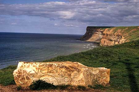
Starting from Saltburn-by-the Sea this circular walk follows a section of the Cleveland Way south along the North Sea coast. The route turns inland and crosses Warsett Hill before descending back to the start. Along the way there are a number of points of interest including a Roman signal station, Guibal Fanhouse and many excellent coastal views including those from Warsell Hill.
The start is the main pay and display Cat Nab car park at Saltburn-by-the-Sea (grid ref. NZ668216). After parking, exit to the sea front and turn right immediately joining the Cleveland Way. Leave the sea front and pass to the right of the Ship Inn and the take the first footpath on the left. Ignore the path going right and follow the stepped path ahead (signed Cleveland Way). The path soon reaches the cliff top. Continue along the clear path passing Saltburn Scar below on the left. The next landmark is the Huntcliff Roman Signal Station with an information board.
Continue along the coast path to pass a sculpture on the left, which is reached by taking a loop off the main path. Soon after you reach the Circle Sculpture (also known as the Charm Bracelet). Stay on the main path and at the next information board for the Guibal Fanhouse (grid ref. NZ699213). Turn right over the stile and continue up across the railway to reach this interesting building. Continue on a grassy path which runs at right angles to the railway. The path climbs up to the OS trig column on Warsett Hill (166 m.) from where there is an extensive view along the coast.
Start the descent by the crossing the stile just inland from the trig column, After crossing the stile bear right and follow the hedge on your right to a gap in the hedge. From here turn left down a grassy path to cross the railway (grid ref. NZ688215). Once across the railway follow the grassy track along the left-hand side of a field. Reaching a house on the left with Brough House Farm also on the left, keep straight ahead. Pass the barns at Ladgates on your right and continue the descent along the track. Just before reaching the Coastguard Cottage, bear left off the track and descend to the Ship inn. Retrace your steps along the seafront back to Cat Nab car park.
Other walks nearby
| Walk 1841 | Saltburn and Skelton from Skinningrove | moderate | 10.4 miles |
| Walk 1050 | Highcliff Nab & Roseberry Topping from Slapewath | moderate | 10.5 miles |
| Walk 2090 | Easington Beck & Staithes from Loftus | moderate | 11.5 miles |
| Walk 1476 | Boulby Mine to Whitby by the Cleveland Way | moderate | 12.5 miles |
| Walk 2685 | Highcliff Nab and Guisborough Moor | moderate | 11.1 miles |
| Walk 1452 | Leaholm Moor & Scaling Dam | moderate | 9.8 miles |
| Walk 3165 | Roseberry Topping & Highcliff Nab from Eston | moderate | 14.3 miles |
| Walk 3319 | Eston Moor from Flatts Lane | easy | 3.0 miles |
| Walk 1467 | Cleveland Way - Roseberry Common to Tidy Brown Hill | moderate | 15.0 miles |
| Walk 3160 | Roseberry Topping and Captain Cook's Monument | easy/mod | 6.3 miles |
Recommended Books & eBooks
The Cleveland Way Map Booklet
 Map booklet of the Cleveland Way National Trail, a 177km (110 mile) walk around the North York Moors National Park. This booklet is included with the Cicerone guidebook to the Cleveland Way and the Yorkshire Wolds Way, and shows the full route of the Cleveland Way on Ordnance Survey 1:25,000 maps.
More information
Messaging & Social Media
Message Walking Britain and follow the latest news.

Mountain Weather
Stay safe on the mountains with detailed weather forecasts - for iOS devices or for Android devices.